Elevation: 7,027 ft
Prominence: 47
This peak is not in the book. Published November 2019
Timber Butte is a small, easy-to-miss, butte that sits just to the west of Deadline Ridge Road near a minor ridge saddle. It has a short patch of thick pine/aspen forest on its east side, hiding the rocky outcrop that is its summit. Its south and west sides are a thicket of boulders and unpleasant brush and willows. There was a shepherd’s portable shack parked at the base of the east face (just off Deadline Ridge Road) when I climbed the peak. Thankfully, the shepherd and his guard dog(s) were not home. USGS Timber Butte
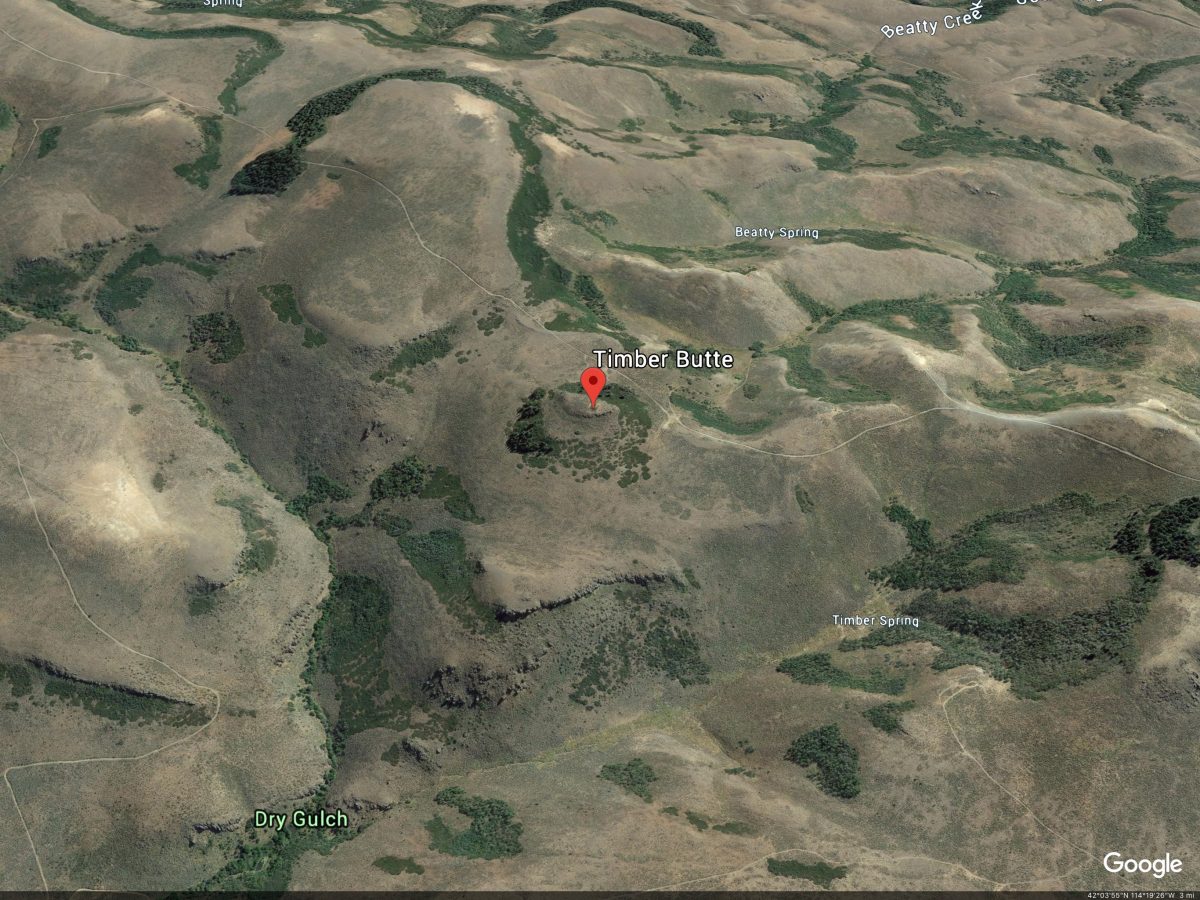
Google Earth Image
South Face, Class 2
Access
From the junction of FSR-500 and FSR-541/Deadline Ridge Road (about 1.3 miles south of the Magic Mountain Ski Area), go right/west onto FSR-541. At 0.2 miles, turn left/south at an unsigned “T” junction. At 5.8 miles, go straight/south at a junction with FSR-542/Winecup Creek Road. Continue south on FSR-541. At 7.5 miles, park in a pullout on a hilltop just south of the road junction with FSR-543. The elevation here is 7,090 feet. The road becomes rougher after this point.
The Climb
This is mostly a road hike with a short, somewhat-punishing scramble up through an unpleasant combination of willows, brush, and boulders. From the parking spot, hike about a mile south on Deadline Ridge Road to reach the base of the peak. Continue past the butte in order to climb the [more open] south face. While you avoid the short section of thick pine forest on the east face by doing this route, you will suffer equally as much. The summit of Timber Butte is a rocky buttress with a tall, 5-foot cairn on top. It is a rather unimpressive, hidden chunk of rock.
East Face, Class 2
Access
Same as for the south face
The Descent
From the rocky summit, descend directly eastward through thick willows then through a short section of thick pine forest to reach a flat, open area of scrub. Continue eastward a short distance to reach Deadline Ridge Road. You may find a portable shepherd’s shack here. Hopefully, the shepherd and his guard dog(s) won’t be home.
Additional Resources
Regions: South Hills->SOUTHERN IDAHO
Mountain Range: South Hills
Longitude: -114.3001 Latitude: 42.07209