Elevation: 6,852 ft
Prominence: 352
This peak is not in the book. Published November 2019
Walker Benchmark is a ranked bump on the east ridge of Indian Mountain (7,298 feet). It makes for a fun scramble from Walker Creek Road to the south. It is also free of snow when many other ranked summits are not. Consequently, it makes for a good early- or late-season climb. It is seldom visited. USGS Scout Mountain
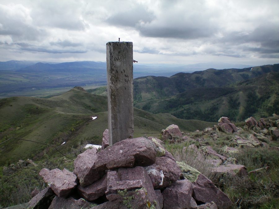
The summit cairn and post atop Walker Benchmark with rocky Point 6586 in the distance (just left of the cairn post). Livingston Douglas Photo
Southeast Ridge, Class 2
Access
From Exit 47 on I-15 at McCammon, drive west on Merrill Road across I-15 to reach its “T” junction with [signed] Marsh Creek Road. Turn right/north and drive 4.6 miles to reach the [signed] junction with Walker Creek Road. Turn left/west onto Walker Creek Road and drive 2.7 miles to the National Forest boundary (unsigned) at a cattle guard. Park here (5,250 feet). Please note that the National Forest boundary is about 0.2 miles farther east than the USGS topo map shows. The boundary line runs straight north up a shoulder that bends to the left/northwest higher up. This “shoulder” is actually the southeast ridge.
The Climb
The National Forest boundary is marked by a cattle fence. Be sure to stay to the left/west of the cattle fence to remain on public land. From the parking pullout on Walker Creek Road at the National Forest boundary, follow the left/west side of the cattle fence northward on a cattle/use trail. Leave the trail fairly soon, as the trail leaves the ridge crest to continue northward.
Scramble northwest up the ridge from this departure point. The terrain here is steep, but relatively easy, scrub with some trees/bushes early on. Higher up, the ridge becomes short scrub and goes quickly. You will eventually reach Point 6586. This ridge point is a rocky outcrop with mountain mahogany mixed in. It is quite distinct from its barren surroundings. The slope eases here. Continue following the ridge crest as it crosses two minor ridge humps on its way northwest to the summit of Walker Benchmark. The summit has a large cairn and a USGS benchmark in a nearby ground boulder. I stuck a post in the cairn to dress it up.
Southeast Ridge/South Spur, Class 2+
Access
Same as for the southeast ridge
The Descent
From the summit, follow the ridge southeast to Point 6586. Leave the southeast ridge here to descend straight south down the south spur. Lower down, the spur turns into a face with multiple minor ridges and gullies. Follow one of these ridges directly down to Walker Creek Road. Once you reach the road, hike east down the road for about 0.7 mile to the National Forest boundary and your parked vehicle. Hopefully, when you reach the road, Walker Creek will be on the other side of the road and you won’t have to ford it (or jump it).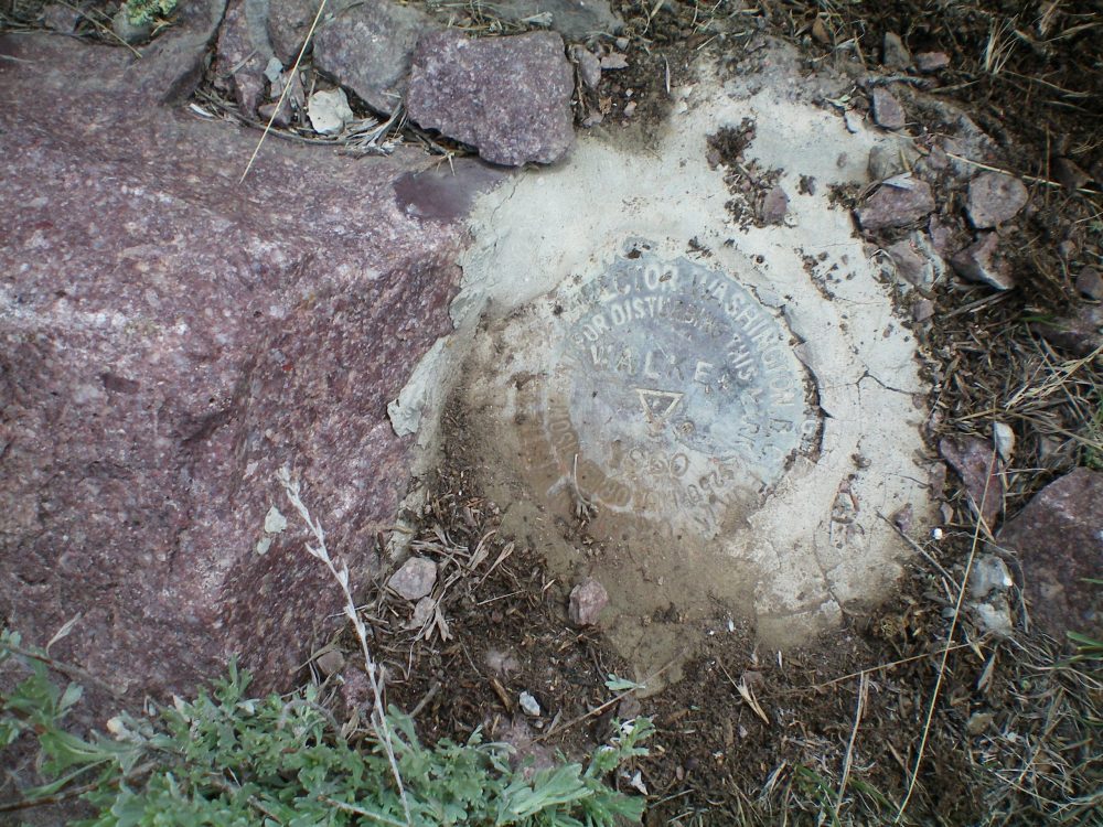
Additional Resources
Regions: Bannock Range->SOUTHERN IDAHO
Mountain Range: Bannock Range
Longitude: -112.30919 Latitude: 42.74179