Elevation: 11,102 ft
Prominence: 362
Climbing and access information for this peak is on Page 221 of the book. One route is suggested in the write-up and one is listed as possible. See below for a description of the suggested route (which has now been climbed) on this rugged peak. USGS Boulder Chain Lakes
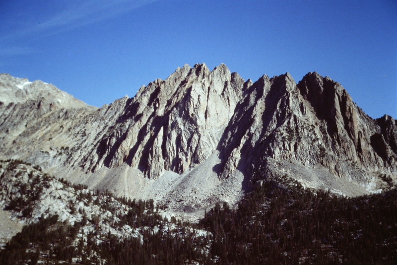
WCP-10
This route is not in the book. Judi Steciak and Carl Hamke provided the following route information. See their article on the Missing Eleveners in the Climbing History Section of this site.
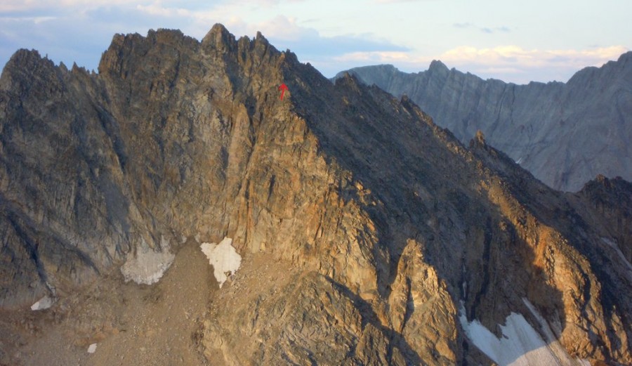
East Face via the Northwest Face, Class 4
From Tin Cup Lake [(B)(2.1)(a) see below], walk up towards the saddle west of the summit. Do a rising traverse above cliffs onto the Northwest Face. A series of ledges, ribs, and gullies (Class 3) crisscross the face. Stay well below the crest, ~100 feet or so, to avoid ridge towers. Just west of the summit, cross a prominent rib at a notch. Ascend the dirty Class 4 gully to the east of the summit. Then climb the East Face to the knife-edged summit. To descend, scramble down the West Face to a notch and rappel the Class 5 gully just west of the summit. A 60M rope is adequate.
The notch in the rib just west of summit of WCP-10. Steciak/Hamke Photo
(B) East Fork Salmon River Approach (on Page 230)
(2) FS-667, Big Boulder Creek Road (on Page 230)
(2.1) Railroad Ridge Road
Instead of turning off FS-667 to the parking area, continue towards the Livingston Mine on the Railroad Ridge Road which, at 10,000 feet, is the highest road accessible to full-sized vehicles in Idaho. The road follows switchbacks up to the crest of the ridge. On the ridge crest, bear left/west and then left/south again to reach the saddle north of Point 10617. A high-clearance 4WD vehicle is recommended.
(a) Cross-country route into Tin Cup Lake Basin. From the saddle, climb south to Point 10617 and follow its East Ridge down until you can descend to the south and still remain east of the cliffs that break up the South Face. At the base of the face, traverse west into the Tin Cup Lake basin.
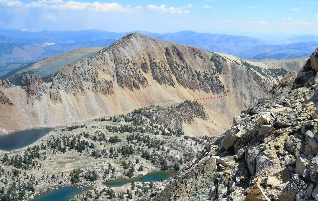
The least-steep route into the Tin Cup Lake basin from Railroad Ridge. Steciak/Hamke Photo
Additional Resources
Regions: EASTERN IDAHO->White Cloud Mountains
Mountain Range: White Cloud Mountains
Longitude: -114.61 Latitude: 44.1177