Elevation: 7,396 ft
Prominence: 416
This peak is not in the book. Published December 2020
West Farnes Mountain is the higher of two summits atop Farnes Mountain in the Big Hole Mountains northeast of Idaho Falls. It sits at the head of Garner Creek and Sawmill Gulch. Contrary to its ornery cohort, West Farnes Mountain is an easy ascent up an old 2-track road. USGS Temple Peak
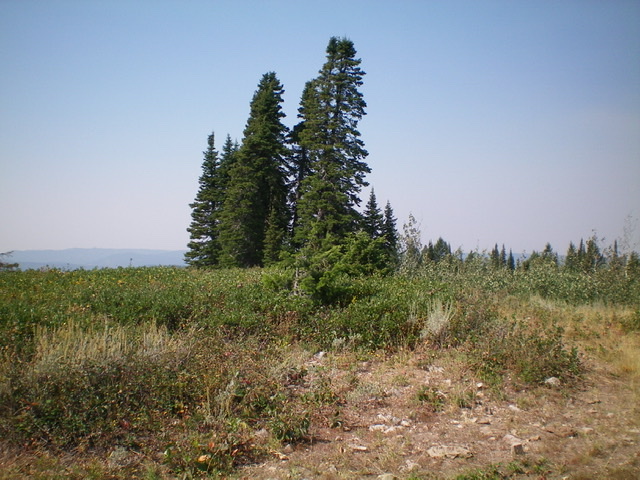
The summit area of West Farnes Mountain. Livingston Douglas Photo
Access
From the Caribou-Targhee National Forest office on US-26 at the north end of Idaho Falls, drive 13.6 miles east on US-26 to a [signed] junction for the Kelly Canyon ski area. Turn left/north onto a paved road. Reset your odometer here. At 1.9 miles, go right at an unsigned junction. At 3.1 miles, cross the Snake River on a bridge then immediately reach a “T” junction. Go right/east here onto [signed] Heise Road.
At 5.4 miles, go left at a signed fork in the road. At 7.9 miles, enter the Caribou-Targhee National Forest. You are now on FSR-218. At 8.9 miles, reach a [signed] junction with FSR-217 (the “Y” junction). Go straight here to stay on FSR-218. At 17.4 miles, reach an unsigned junction with a 2-track road on the left/northwest side of the road. Park at this road junction (6,650 feet).
South Gully, Class 1
The Climb
From the road junction, follow the 2-track road through a cattle gate (only foot traffic is allowed from here) up a dry gully all the way to the summit. The old road gets a bit overgrown but is still good for hiking and sure beats bushwhacking in this area. The road heads northwest initially then bends right-ish/north. After reaching the summit ridge, the road bends right-ish again (northeast) and brings you to the summit shortly after that. The summit is mostly open but is quite brushy. There is no summit cairn on top.
Additional Resources
Mountain Range: Big Hole and Snake River Mountains
Longitude: -111.49839 Latitude: 43.66849