Elevation: 9,870 ft
Prominence: 250
This peak is not in the book. Published November 2021
The east summit of White Mountain is labeled as “White Mountain” on the USGS topo map even though it is not the high point of White Mountain. The Board of Geographic Names corrected this error in 2021. Nevertheless, the name will still be on older maps for many years to come. The east summit is merely a rocky bump on the long east ridge of White Mountain. The true summit is at 10,442 feet, a whopping 572 feet higher! The north face of White Mountain East is rugged (see photo). The easiest ascent route is probably via its long east ridge.
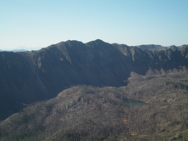
White Mountain East is the minor ridge hump in dead center on the ridgeline. This view is from South Twin Peak. Livingston Douglas Photo
Access
From US-93 at the north end of Challis, turn left/west onto [signed] Clinic Avenue. Follow Clinic Avenue as it goes west briefly, then jogs north briefly, then heads west to a “T” junction with [unsigned] Challis Creek Road. This junction is 0.4 miles from US-93. Turn right/north onto Challis Creek Road and drive 9.7 miles to a signed junction. Go left for Mosquito Flat Reservoir (7 miles) and go straight/northwest for Bear Creek Road and Twin Peaks. Go straight here.
This road heads northwest briefly then turns sharply left/southwest to cross some private property and reach the Bear Creek drainage. The road bends right-ish/west to follow Bear Creek upstream. It is labeled as “Sleeping Deer Road.” From the signed junction on Challis Creek Road, drive 4.6 miles on Sleeping Deer Road/FSR-086 to a signed junction with FSR-537 at a sharp right bend in the road. Park here (7,320 feet). The final 1.9 miles of Sleeping Deer Road is rocky and narrow.
East Ridge, Class 2-3
The Climb
From the road junction, follow FSR-537 west then south as it crosses two creeks (with pipes underneath the road). Leave the road between the two creeks and bushwhack west up through a thick pine forest. The ridge soon gains definition and steepens. You enter an area of extensive burn. Follow the ridge crest west-southwest to the rocky false summit. Continue west to reach the true summit. I have not climbed this route but my comments are based on observations from nearby peaks and photos from several different angles, as well as the contour lines of the USGS topo map.
White Mountain East can also be climbed via its connecting ridge with White Mountain’s true summit to the west. It can also be climbed via an old road then a bushwhack west up West Fork Creek to two lakes at the head of the basin. From the lakes, scramble north up to a ridge saddle at 9,620 feet, just west of the summit. Scramble east up the narrow, rocky ridge crest to the top.
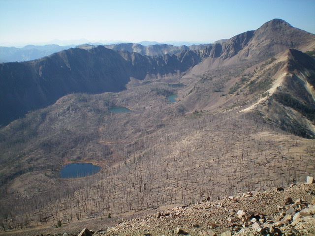
The burnt basin of Twin Lakes that sits below both White Mountain East (left of center) and White Mountain (upper right). Livingston Douglas Photo
Additional Resources
Regions: Eastern Salmon River Mountains->Salmon River Mountains->Southeast Corner Peaks->WESTERN IDAHO
Mountain Range: Eastern Salmon River Mountains
Longitude: -114.48229 Latitude: 44.57149