Elevation: 6,780 ft
Prominence: 218
This peak is not in the book. Published November 2020
Windy Ridge is a horseshoe-shaped ridgeline in the Big Hole Mountains. It sits at the headwaters of Fish Creek and separates South Moody Creek from State Creek. Windy Ridge is overshadowed by Farnes Mountain to its east and Lookout Mountain to its south. An ATV trail leads from FSR-218 (a heavily-traveled Forest Service road) to near the summit. USGS Hawley Gulch
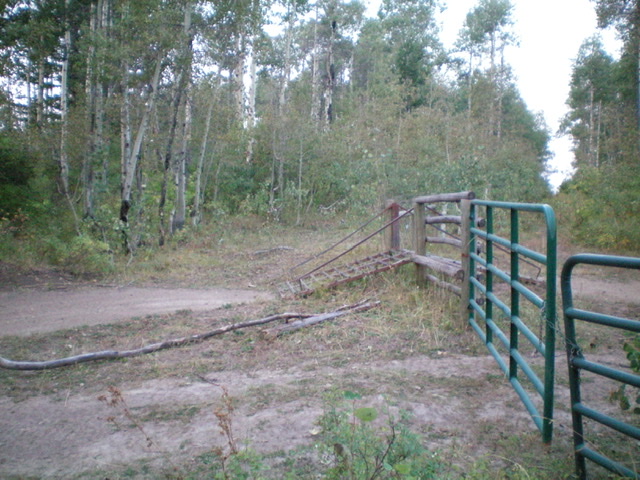
The cattle fence crossing on the summit ridge of Windy Ridge. The summit is in the thick forest in the background. Bring a machete. Livingston Douglas Photo
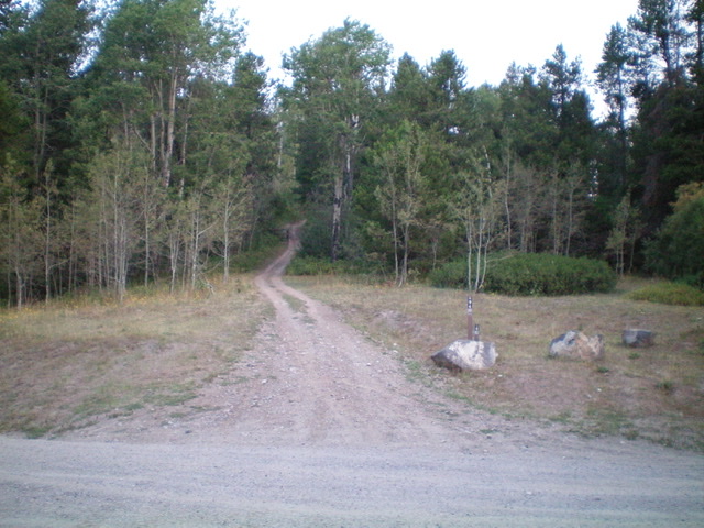
The start of FST-294 (an ATV trail) and the short hike up to the summit area of Windy Ridge. Livingston Douglas Photo
Access
From the Caribou-Targhee National Forest office on US-26 on the north side of Idaho Falls, drive 13.6 miles E on US-26 to a signed junction for the Kelly Canyon ski area. Turn left/north onto a paved road. Reset your odometer here. At 1.9 miles, go right at an unsigned junction. At 3.1 miles, cross the Snake River on a bridge then immediately reach a “T” junction. Go right/east here onto Heise Road.
At 5.4 miles, go left at a signed fork in the road. At 7.9 miles, enter the Caribou-Targhee National Forest. You are now on FSR-218. At 8.9 miles, reach a signed junction with FSR-217(the “Y” junction). Go straight here to stay on FSR-218. At 14.1 miles, reach a signed junction with FSR-342 (right) and FST-294 (left) at a saddle. Park in large pullout area here (6,565 feet).
Southeast Ridge/Northeast Face, Class 2
The Climb
From the road junction, hike northwest up FST-294 (a steep, rutted ATV trail) for 0.2 miles to a cattle gate/fence up on the ridgeline. Leave the trail/road here and follow a cattle trail southwest on the left/southeast side of the cattle fence briefly then bushwhack through chest-high brush and veg a short distance into the forest to reach the summit high point. There is no real “high point” here. It is so thick that it is almost impossible to even move around in this wicked mix of brush, veg, and pines. After you feel that you’ve thrashed around enough, leave and claim the summit. This one was most dissatisfying.
Please note that the USGS map suggests that the summit is a small area that rises 80 vertical feet above the ATV trail. Such is not the case. The area is quite flat and only rises about 20 vertical feet from the ATV trail. I even walked southwest down the fence row to see if there was a “bump” farther down the ridge, but there wasn’t. All in all, I was disgusted. I took a few pics, returned to the ATV trail, and quickly descended back to FSR-218 and drove off to do a few more interesting and reasonable peaks. Good riddance to this nightmarish one.
Additional Resources
Mountain Range: Big Hole and Snake River Mountains
Longitude: -111.54009 Latitude: 43.65801