Elevation: 7,470 ft
Prominence: 540
This peak is not in the book. Published November 2023
Wolf Mountain sits south of Johnson Creek and north of Petterson Canyon in the Aspen Range. It is separated from Schmid Ridge by the wide Slug Creek Valley. Due to extensive private land in this area, Wolf Mountain is only publicly accessible from FSR-895, a poorly-maintained 2-track that comes south up the Johnson Creek drainage from South Trail [Canyon] Road. USGS Johnson Creek
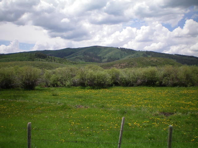
Wolf Mountain (dead center) as viewed from the northwest. Livingston Douglas Photo
Access
FSR-895 (unsigned) is located along South Trail [Canyon] Road exactly 2.5 miles southwest of the [signed] road junction with Slug Creek Road, 0.5 miles east of the [signed] road junction with Wood Canyon Road, and 3.9 miles east of the [signed] road junction with North Trail [Canyon] Road. From ID-34 about 3 miles north of Soda Springs, drive east on Trail Canyon Road for 9.6 miles to reach the unsigned junction with FSR-895. Drive south on FSR-895 for 1.5 miles to the signed Caribou National Forest boundary at an unsigned junction with a spur road at the mouth of Petterson Canyon. This junction is at 6,530 feet and 42⁰40’29”N, 111⁰24’10”W.
Map Errors
South Trail [Canyon] Road in the area on the north side of Wolf Mountain is mislabeled as “Mill Canyon Road” on the USGS topo map. FSR-895 is mislabeled as FSR-200 on the USGS topo map.
West Gully/Southwest Shoulder/West Ridge, Class 2
The Climb
From the road junction, walk about 0.1 miles southeast on FSR-895 to a large pullout on the left/east side of the road at the mouth of a side gully. Leave the road and bushwhack east on a cattle trail up the dry gully. At a fork in the cattle trail, go left to exit the gully and follow another cattle trail to reach a blue cistern and an old 2-track road. The sagebrush is thick in this gully, so staying on these cattle trails is critical. This route avoids aspens in the gully and stays left/north of the gully when heading to the base of the southwest shoulder.
Follow the old road right/southeast to return to the center of the gully. Leave the 2-track road and bushwhack directly northeast at a sagebrush-covered shoulder that heads steeply up to the west ridge. The sagebrush and other brush look a bit thick and ominous but it goes quickly thanks to many grassy paths/gaps in it. Higher up on the shoulder, the thick brush disappears and the veg is easy green foliage with yellow flowers. Farther up, the scrub is short as it is on the west ridge.
Once on the west ridge, scramble east up over gentle Point 7437 then drop 60 vertical feet to a sagebrush saddle. Continue up through more sagebrush to reach the summit of Wolf Mountain. The summit has a modest cairn with a small piece of rebar protruding from the ground. The view of nearby Schmid Ridge (to the east) is superb from the summit.
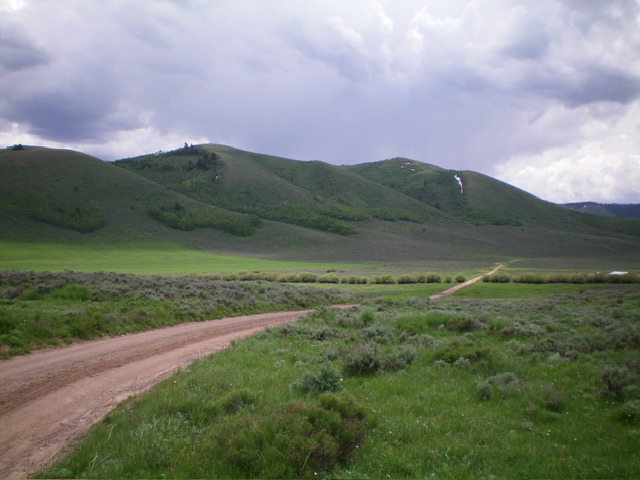
Wolf Mountain as viewed from Slug Creek Road to its east. Livingston Douglas Photo
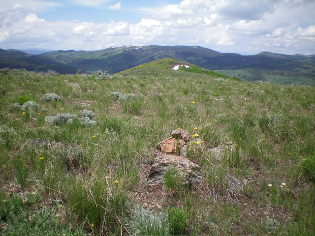
The summit of Wolf Mountain, looking west at Point 7437 on the west ridge. Livingston Douglas Photo
West Ridge, Class 2
The Climb
An alternative, more straightforward route to the summit of Wolf Mountain is via the West Ridge all the way from its base along FSR-895. While this route does cross a small patch of private land, I saw no fencing or signage to prohibit entry. Leave FSR-895 at an unsigned road junction at 6,486 feet (shown on the USGS topo map) on State of Idaho land. The sagebrush is thick-ish initially but is manageable. After that, the scrub is short and the ridge is magnificent and open. The ridge heads east then southeast then east to the summit up over Point 7437. The ridge is obvious from the 6,486-foot road junction.
Additional Resources
Regions: Aspen Range->Peale Mountains->SOUTHERN IDAHO
Mountain Range: Peale Mountains
Longitude: -111.3820 Latitude: 42.6767