Elevation: 8,002 ft
Prominence: 662
This peak is not in the book. Published August 2020
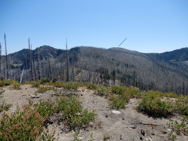
Zena Peak is covered by a fire scar. It is located south of Blue Lake Peak between the Secesh River and the South Fork Salmon River. USGS Williams Peak
Zena Peak as viewed from the west. John Platt Photo
Access
Primary access is via the FH-48, Lick Creek/Yellow Pine Road [(B)(3) on Page 136]. Follow this road to FS-361/Zena Creek Road which leaves FH-48 0.6 miles south of the Ponderosa Campground. Follow FS-361 to its end. From the road’s end, follow FST-294 north to its junction with FST-079.
Northwest Ridge/West Slopes, Class 2
This peak can be climbed via its west slopes from FST-294. See John Platt’s trip report which is linked below. He ascended the peak from the FST-294/FST-079 junction via the northwest ridge and descended its west slopes back to FST-294.
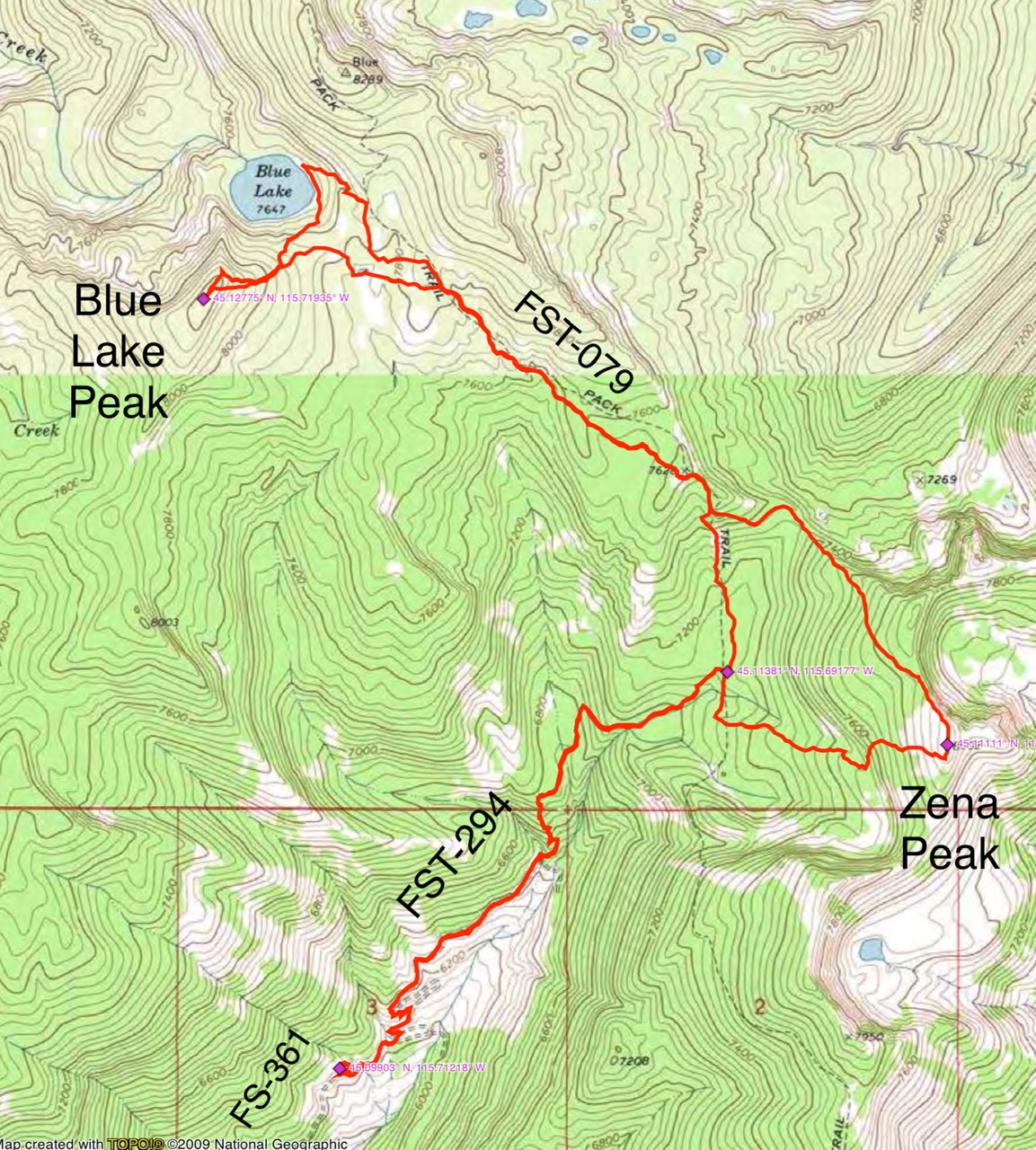
John Platt’s GPS track
Additional Resources
Mountain Range: Western Salmon River Mountains
Longitude: -115.68019 Latitude: 45.11109