Cow Creek Road/FS-058 is accessed from ID-20 just east of Hill City. Google Maps gives excellent directions to Cow Creek Reservoir. Turn north off ID-20 onto Mink Road just east of Hill City. Drive north for 2.3 miles and turn left/west onto Harrison Road. There is a jog along this road but it will bring you to the Cow Creek Reservoir in 5.5 miles.
Cow Creek Road passes by the North Side of the reservoir and then begins its climb up Cow Creek. The road crosses over a pass between Cow Creek and Sulix Creek and then descends Sulix Creek to a junction with Moores Flat Road in just under 5.5 miles. Cow Creek Road is maintained infrequently and has its share of rough spots and mud holes. A 4WD is recommended.
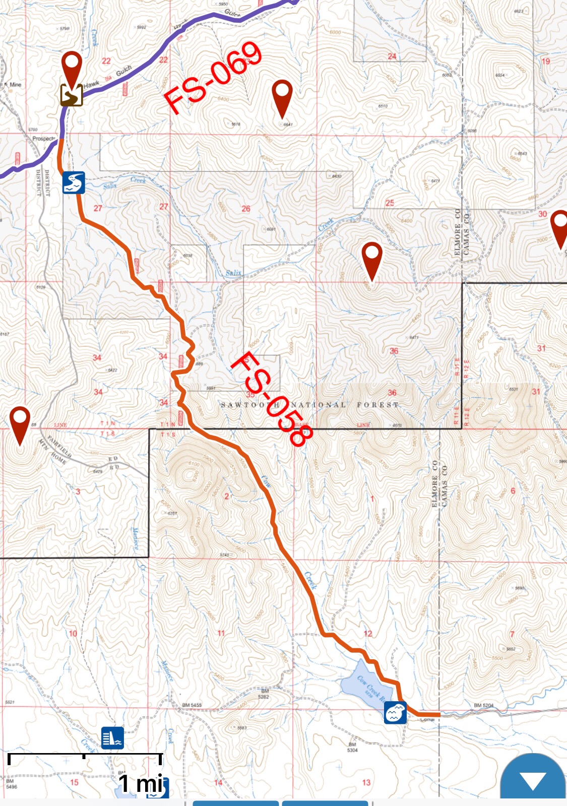
Cow Creek Road is the roughest of the 3 roads accessing the Southern Soldier Mountains.
FS-069/Hawk Gulch Road
Hawk Gulch Road/FS-069 is accessed just north of the Moores Flat Road/Cow Creek Road junction. Hawk Gulch Road was signed in 2019. The road climbs up Hawk Junction, crosses a pass and drops into the Maxfield Creek drainage. The road has some rough spots and there is a ford of Maxfield Creek which can be problematic. A 4WD is recommended.