Reynolds, Idaho is now a ghost town in Owyhee County. It is located 9.8 miles west of Murphy and ID-78. At the townsite, you will find the ruins of a school and a cemetery. The Reynolds Creek Valley is the home of several ranches. Reynolds is an access hub for many destinations in the North Central Owyhee Mountains. Two roads reach Reynolds from ID-78. The Reynolds Creek Road is a long twisting route. The Rabbit Creek Road is the most direct and best maintained route.
Rabbit Creek Road. Rabbit Creek Road leaves ID-78 on the northwest side of tiny Murphy, Idaho. At its start the road is signed as “Old Highway 45.” Follow the road west from the highway. It is paved but soon becomes a wide gravel road. Eventually, the road crosses a pass and drops down into the Reynolds Creek drainage.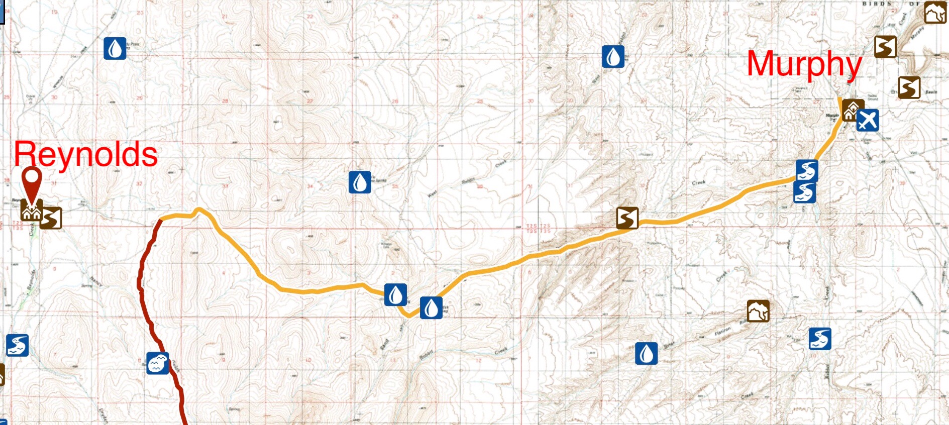
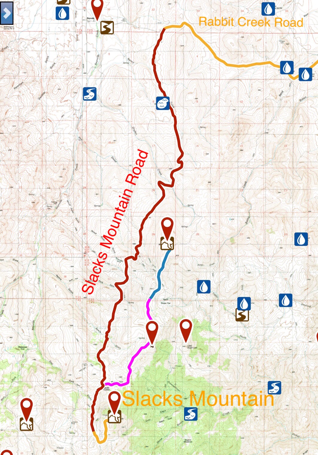
At 9.6 miles, there is a junction for Slacks Mountain Road. Reynolds is reached at 11.0 miles. The road arrives at the Reynolds townsite at a junction with Reynolds Creek Road. Turning right will take to back to ID-78 on Reynolds Creek Road. Turning left will take you on a long journey out of Reynolds Creek and into the upper, remote reaches of Succor Creek.
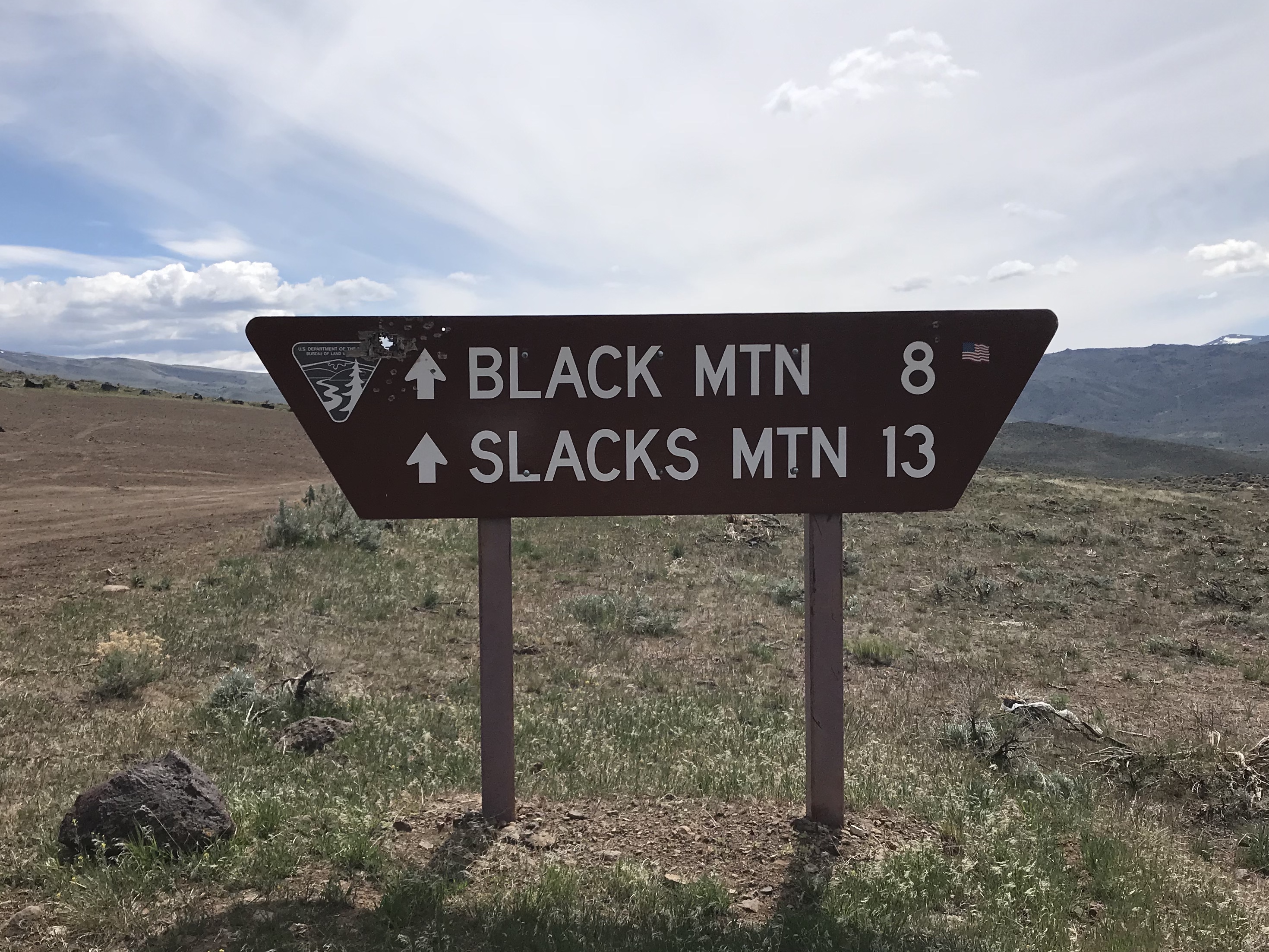 Slacks Mountain Road. Slacks Mountain Road leaves the Rabbit Creek Road east of Reynolds. This road is steep, winding and rough. It opens up earlier in the Spring than the Silver City Road. A 4WD is highly recommended and good all-terrain tires are a necessity. The road leaves Rabbit Creek Road 9.7 miles from Murphy. Its junction is well signed. It is 13.0 miles to the base of Slacks Mountain. Slacks Mountain Road eventually reaches Silver City Road and many other points of interest to climbers.
Slacks Mountain Road is maintained by the BLM. It receives a lot of use. Not surprisingly, ATVs outnumber 4WDs due to the road’s rugged nature.
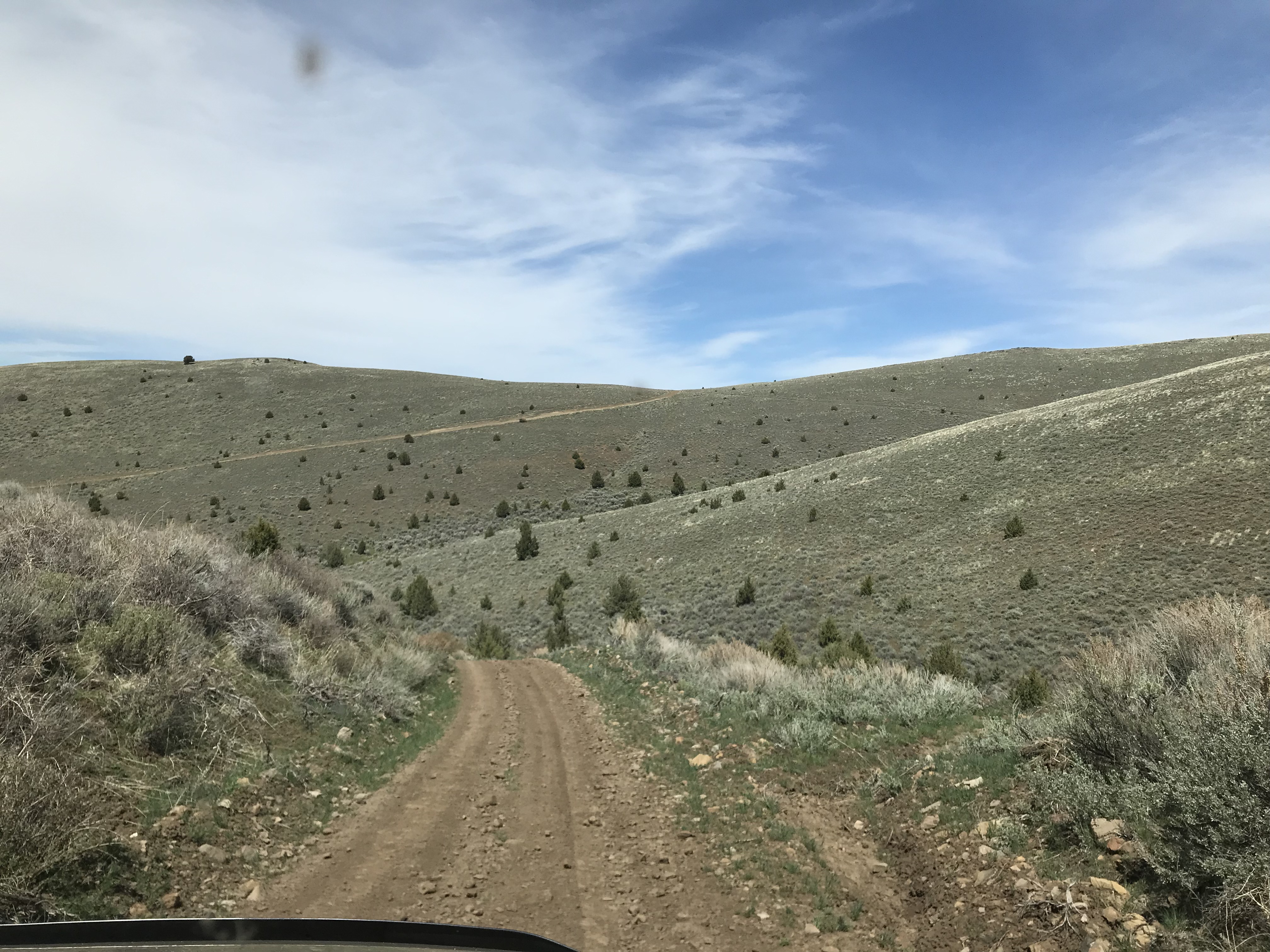
This photo shows the type of terrain crossed by Slacks Mountain Road as it weaves in and out of drainages on its way to Slacks Mountain. The road gains over 3,000 vertical feet along the way. It will be extremely treacherous when wet.
Northern Owyhee Crest Road
This road leaves Slacks Mountain Road just west of Slacks Mountain. The road runs west and then northwest toward Jacks Benchmark for 6.25 miles. The road is a decent 2-track with minimal ups and downs. It passes a USDA facility with 2 buildings early on. Glass Hill, Peak 7114 and Peak 7380 are also accessed from this road. The road continues past Peak 7380 toward Jacks Benchmark but I have not explored it. It is designated as a 4WD road past this point. High clearance and good all-terrain tires are recommended and a 4WD is needed for wet conditions. The road ends above the headwaters of Succor Creek where it becomes the rugged Upper Succor Creek Road which is described below.
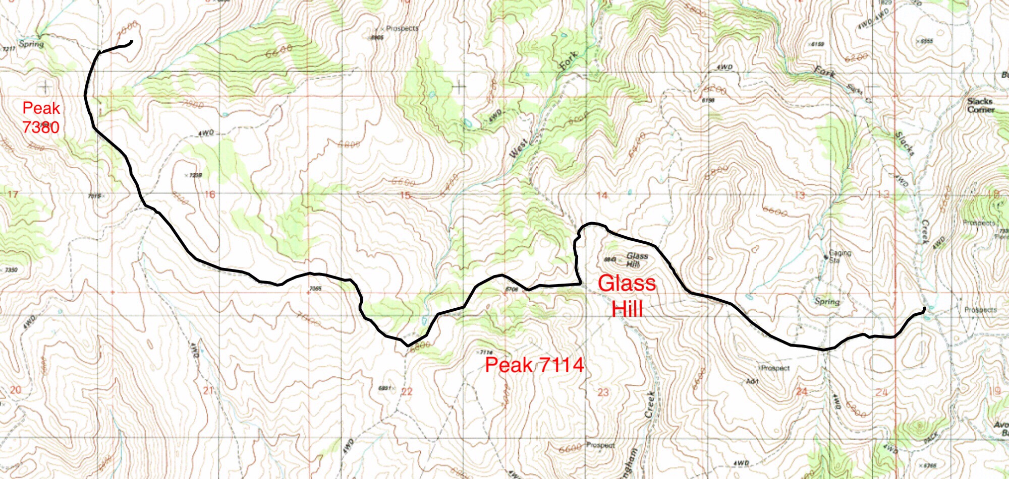
My GPS track for the Northern Owyhee Crest Road from Slacks Mountain Road to Peak 7380.
Whiskey Mountain Road, Chipmunk Road and Upper Succor Creek Roads
Whiskey Mountain Road. The uplands southwest of Reynolds and the headwaters of Succor Creek are accessed by the Whiskey Mountain Road. From the Reynolds Cemetery and the Upper Reynolds Creek Road/Rabbit Creek Road junction continue north on the Upper Reynolds Creek Road for 0.3 miles and turn right on the signed Whiskey Mountain Road. This road is one of the best roads in the Owyhee Mountains. It is well engineered and graded as it makes a steep climb up the north end of Whiskey Mountain. The road then traverses that mountain’s western slopes and drops down into Succor Creek where it ends in 7.0 miles. There is one gate along the way which you will need to open and close. See map below,
Chipmunk Road. This road leaves the Whiskey Mountain Road 3.6 miles from its beginning. This is another well built road that leads to a set of corrals on private property in 1.4 miles. Just before the corrals a two track continues heading west on BLM land. This road curves to the north and reaches the base Peak 6140. This road ends at the gate which delineates the beginning of private property. See map below.
This area was covered in the book see [(A)(1)] on Pages 345-346 of the book.

Upper Succor Creek Road. This road begins where the Whiskey Mountain Road ends and climbs to the south to reach the Northern Owyhee Crest Road described above in 5.4 miles. This in one of the more difficult roads in the range and requires a 4WD. The road fords Succor Creek just south of Rooster Comb Peak. The creek runs deep in the Spring. This road can be used to access Jack Benchmark if you are up to the driving challenge. See map below.
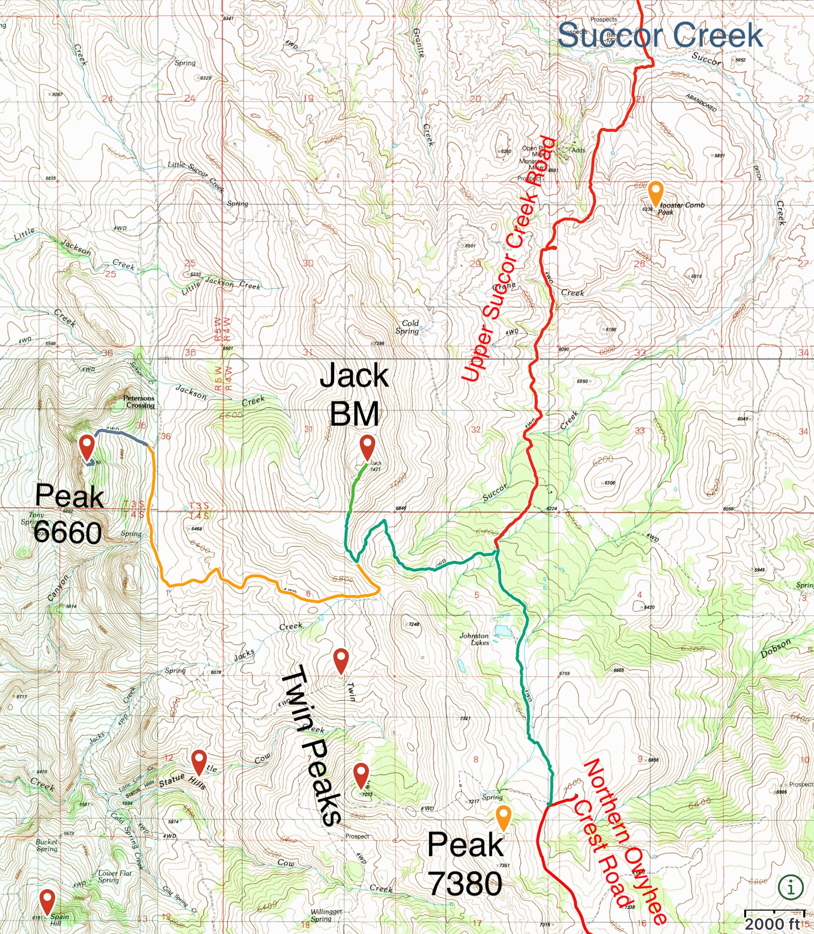
This map shows the roads in the Upper Succor Creek drainage and the road to Peak 6660.
The Wilson Creek Road System.
This road system is also accessible from Reynolds. Use this link to read about it.