Idaho A Climbing Guide divides Idaho into 4 sections: Northern, Western, Eastern and Southern. While the vast majority of information in the book is still valid, this website updates, supplements and expands on the contents in the book. You will find the following information on this website: (1) Updates to historical, access and route information found in the book and (2) Idaho peaks not found in the book. While you do not need the book to use this website, the book has a lot of useful information that is not included on the website. Thus, the book is a valuable resource for planning any exploration of Idaho’s mountains.
Website Organization
There are over 5,000 ranked peaks in Idaho. These mountains fall into 36 major groupings. The following linked headings briefly discuss the contents of the tabs found at the top of each peak page. Each tab is a gateway to the exploring the peaks:
Mountain Ranges —sets forth links to each mountain range and subrange.
Peak Index —creates sortable tables of peaks by elevation or name.
Mount Borah —the everything Borah page.
The 12ers —quick links to each of Idaho’s nine 12,000-foot peaks.
Peak Lists —an assortment of peak lists to ignite your imagination.
Find Nearby Peaks — this link is located at the top of each Peak page. Clicking on the link will generated a list of peaks within a 10-mile radius of the peak you are on.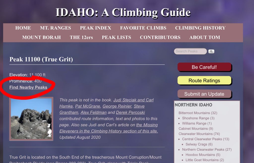
Navigation In the Real World
Maps form the foundation for almost every climb in the book and on the website. You should not consider attempting a climb without hard copy or digital versions of the necessary maps—and the expertise to use them. Idaho is a big state. In some places, getting lost is easier than you might imagine. Additionally, route descriptions often refer to map designations such as contour lines, lakes, drainages and elevation points.
Roads and Trails —protocols used on the website are discussed at this link.
Maps —Livingston Douglas updates the available map resources at this link.
Abbreviations—A list of abbreviations used in the book and the website.
Definitions —A few commonly-used terms used in route descriptions.
Organization of Peaks
The peaks included on the website (like the book) are divided into 4 regions. Each region is then divided into the major mountain ranges found in that region. The following graphic displays these divisions.
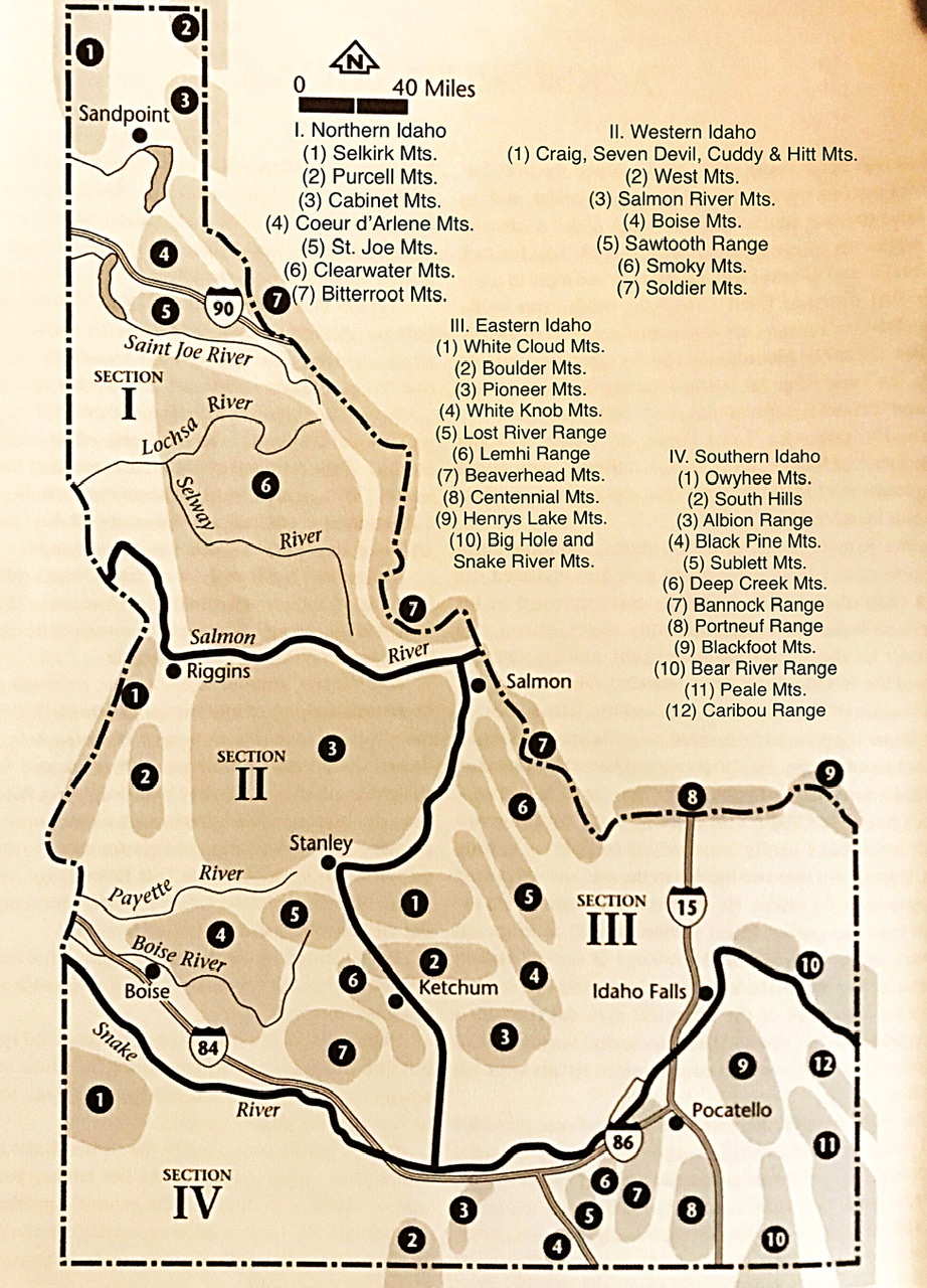
Idaho’s 36 major mountain ranges.
Using the Map Feature
The mapping feature on the website to provide better maps and include a feature that will show public and private land so you can avoid trespassing on your way to a summit. The photos below explain how the maps work.
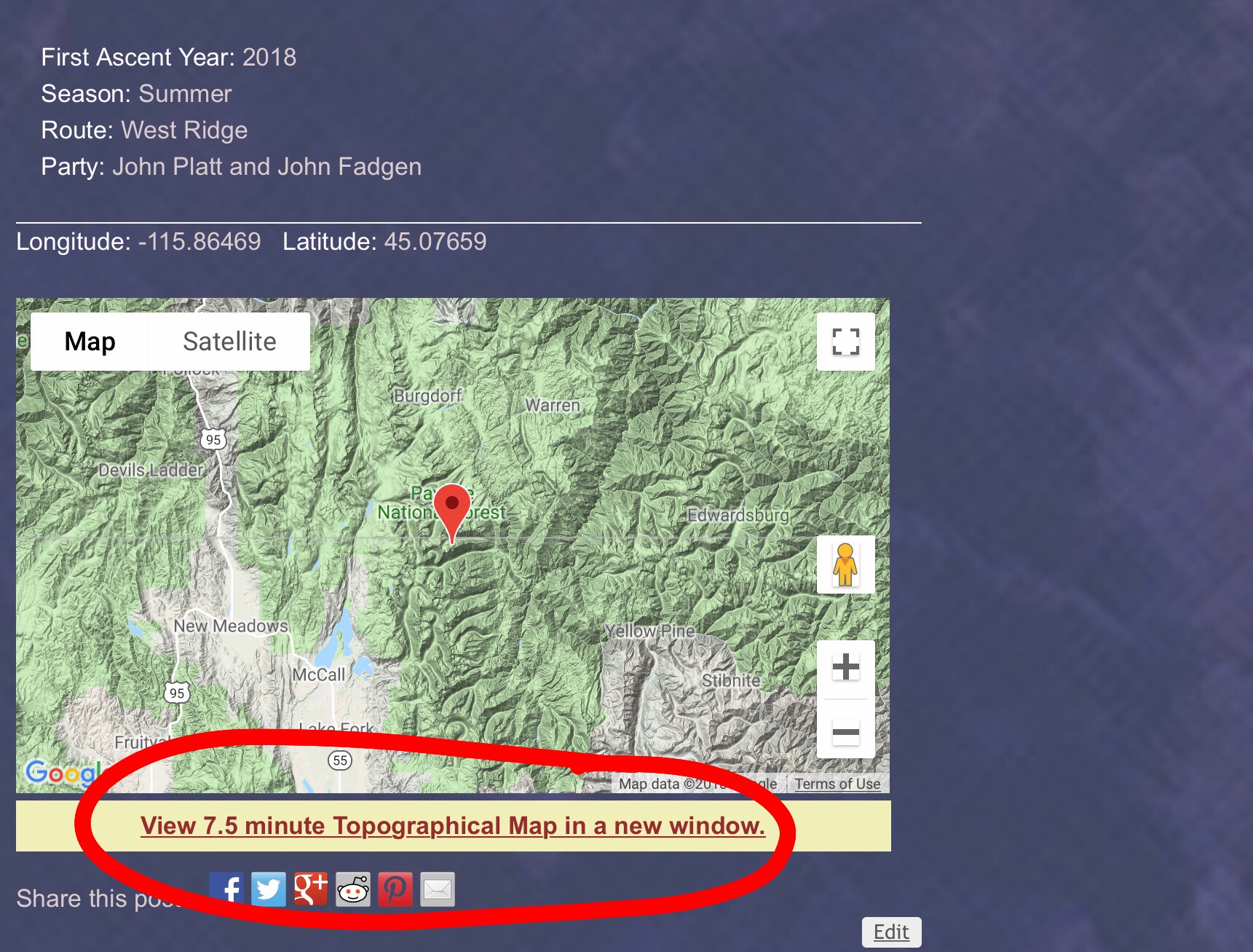
At the bottom of each peak page is an orientation map. Under each orientation map is a link to a Caltop map. Click on the link.
The link will take you to a Caltopo map with peak centered. In the upper right hand corner is the lawyer symbol which will take you to a new page with a drop down box.
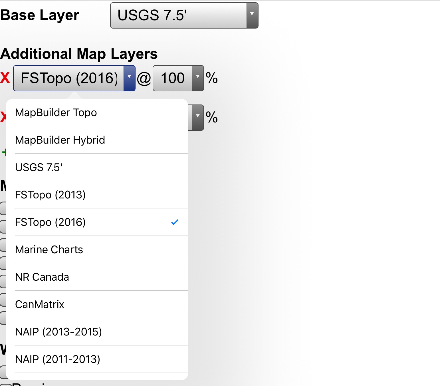
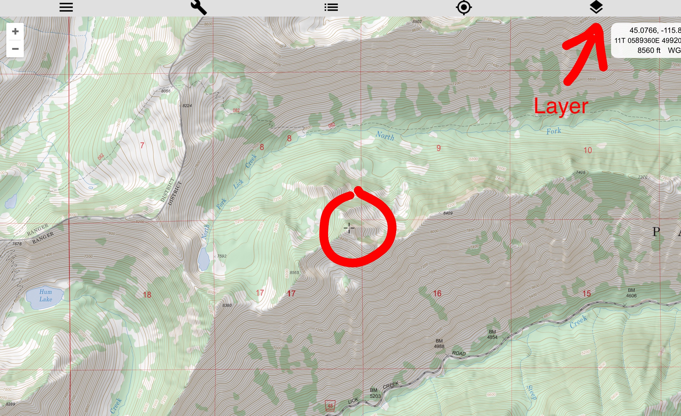
The base layer is a USGS quad but by using the drop down box you can select other maps including Forest Service Topos and satellite photos.
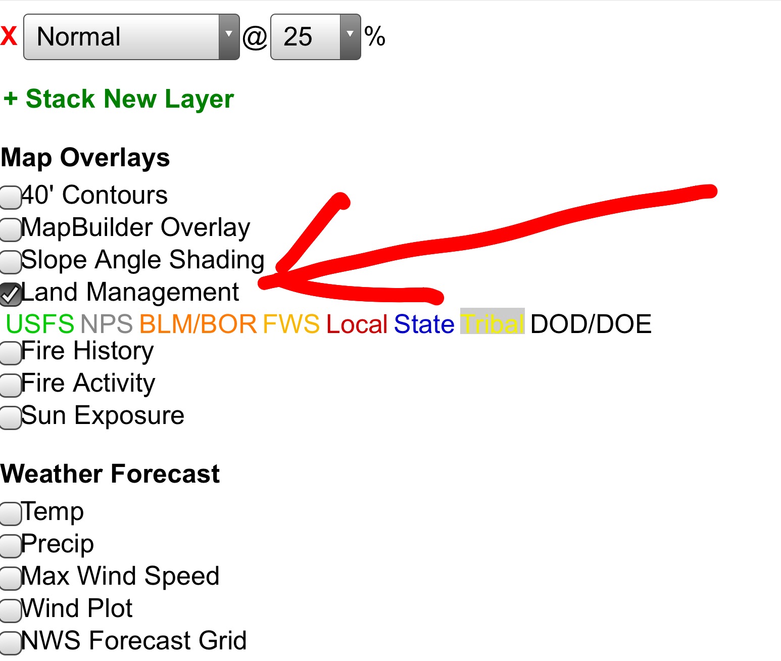
Finally, below the drop box on the layer page there are other options you can add to your map. The land management layer is perhaps the most important as it will add a layer showing you public and private land.