Elevation: 12,228 ft
Prominence: 5,387
Climbing and access information for this peak is on Page 276 of the book. The West Ridge and Southwest Face Routes are discussed in the book. This page includes route information for the Northeast Face/Northeast Ridge. This route is now more popular than the West Ridge. Also, check out the view from Leatherman’s summit through Larry Prescott’s photo essay. Updated November 2022
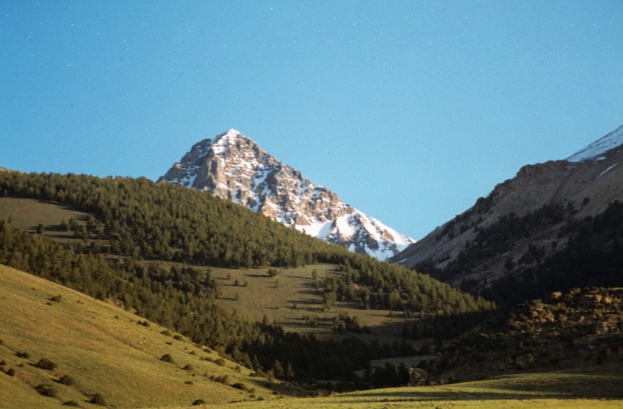
Leatherman Peak is the 2nd-highest peak in the State of Idaho and is located in the Lost River Mountain Range. It is one of the nine Idaho 12ers. Leatherman Peak is a distinctive peak that is easily visible from US-93, yet it is difficult to access. Approaches from both the east and the west require a 4WD, good rough road driving skills and a bit of patience. Scroll down this page to find descriptions of the Northwest Face/Northeast Ridge, the Northeast Ridge and the South Ridge routes, which are not found in the book. USGS Leatherman Peak
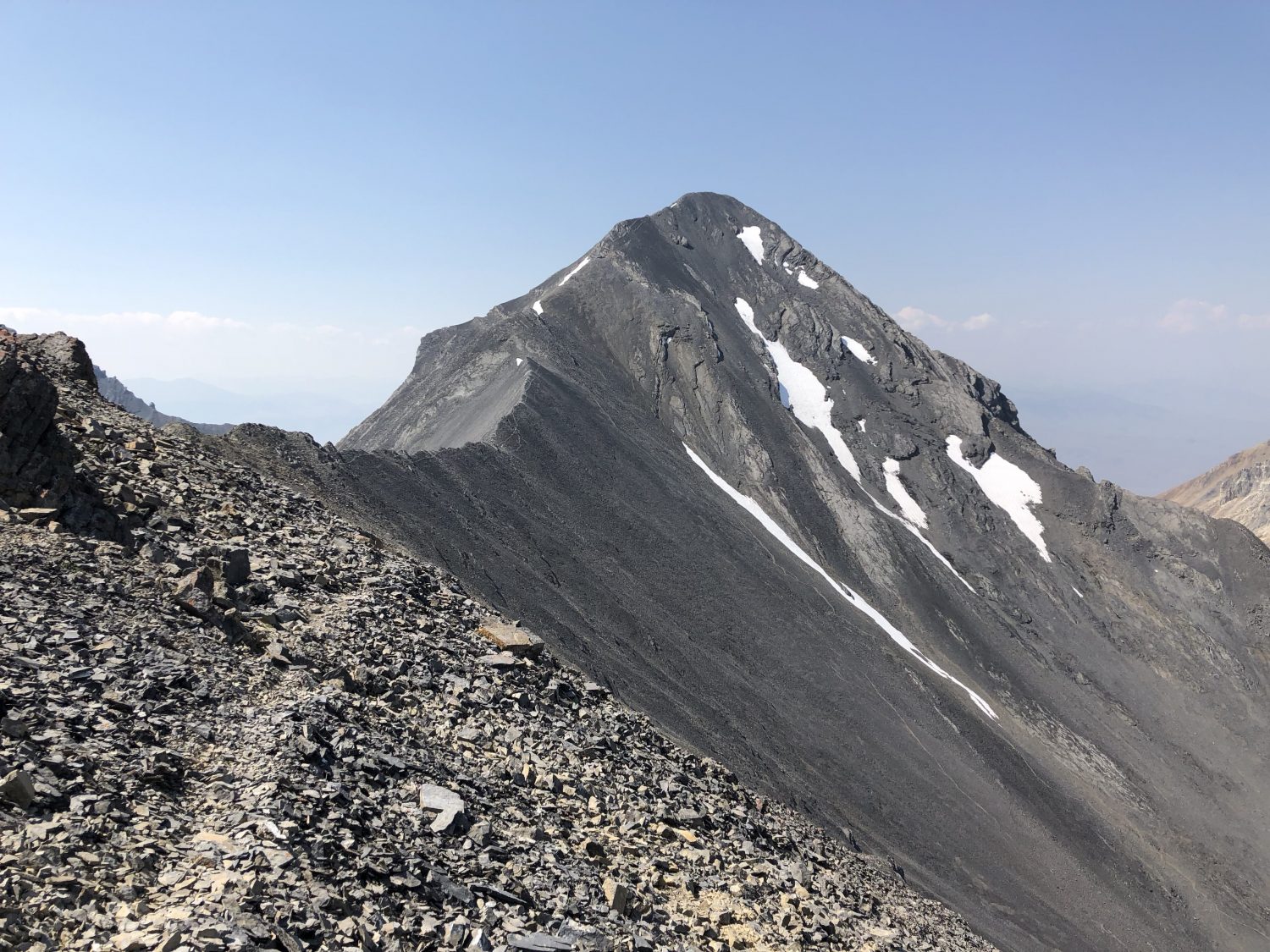
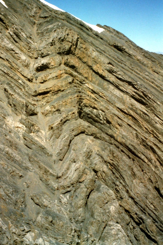
The northeast ridge of Leatherman Peak viewed from Peak 11909 (North Leatherman Peak). Derek Percoski Photo
Access
Leatherman Peak can be accessed from the east [(C)(3.1)(a) Page 293] and the west [(B)(8)(a) Page 292]. West side access has deteriorated since the book was published. Derek Percoski provided the following 2018 update on the west access: “Sawmill Gulch has a well-defined trail with occasional cairns. However, once you get to the flat area at 9,600 feet, you’re on your own to Leatherman Pass. It’s actually not that easy. I remember having to descend some loose garbage to get down near the start of Lone Cedar Creek, without any obvious or easy way to go. From Leatherman Pass, I think there’s a little bit of a visible path in the scree but it fades away as you ascend and the route gets more ambiguous.“
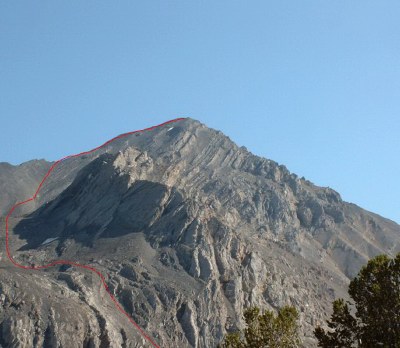
West Ridge, Class 3+
This route was at one time the standard route up the peak. Lately, climbers have gravitated to the North Face/Northeast Ridge route (discussed below). The Class 3 moves on the West Ridge are not difficult but the ridge is steep and broken and care must be taken to avoid rock fall. This is especially true if there is more than one party climbing at the same time.
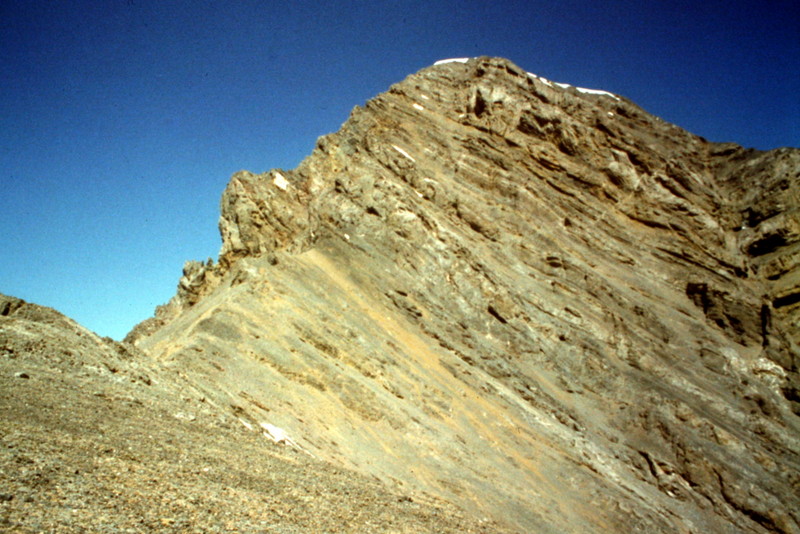
Leatherman Peak as viewed from Sawmill Pass. The West Ridge is the left skyline.
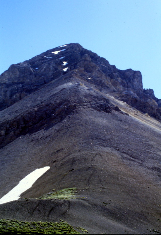
The West Ridge Route viewed from Leatherman Pass. The first half of this route is easy to traverse but when you get to the top half you will find it genuinely steep and loose.
Northeast Face, Upper Northeast Ridge, Class 2-3
Dan Robbins reports the following route on Leatherman Peak, which is not found in the book. Also, check out Dan’s trip report which is linked below.
Come in from the West Fork Pahsimeroi Trail [(B)(8)(a)] hiking due west toward Leatherman Pass. Between Peak 11909 and Leatherman Peak, follow the gully up to a cirque at 10,800 feet. From here, either climb the Northeast Face, or continue up the gully to the ridge at 11,800 feet and follow the ridge to the top.
All the rock on this route is tight and it is a very pleasant route. There is only one short 20-30 foot section of Class 3 climbing, which could be bypassed by dropping down off the ridge a little (I’m too lazy to do that though). The face looked doable in several spots too, and probably would have been just as easy. 8 miles, 4,100 feet of elevation gain, took us 8 hours, but my friend bonked. If I had soloed this peak, I probably would have finished it in 6 1/2 to 7 hours.
Derek Percoski opines that this route should be rated Class 2 because the Class 3 section can be bypassed.
The northeast ridge of Leatherman Peak viewed from Peak 11909 (North Leatherman Peak). Derek Percoski Photo

The Northeast Ridge route. Dan Robbins Track
South Ridge, Class 4-5
The South Ridge has been climbed and descended by a number of climbers over the years. The following two narratives describe descents down the ridge.
- Pat McGrane’s article covering his 2007 traverse from Borah to No Regret Peak is an excellent read, The High Route to No Regret Peak.
- Wes Collins’ 2014 account of his Borah to Lost River Peak, The Lost River Traverse.
The south ridge of Leatherman Peak viewed from the saddle between it and Bad Rock Peak.
Leatherman Peak as viewed from Sawmill Gulch.
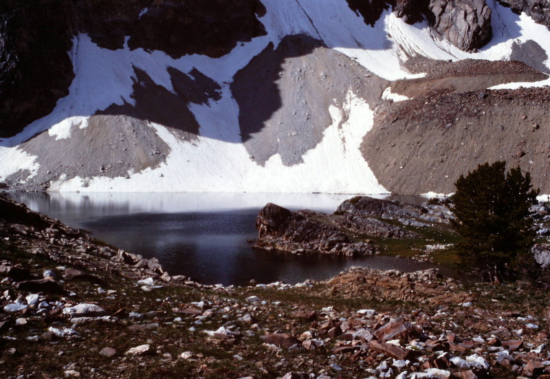
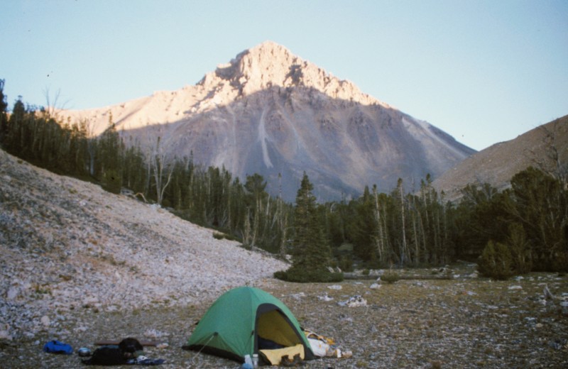
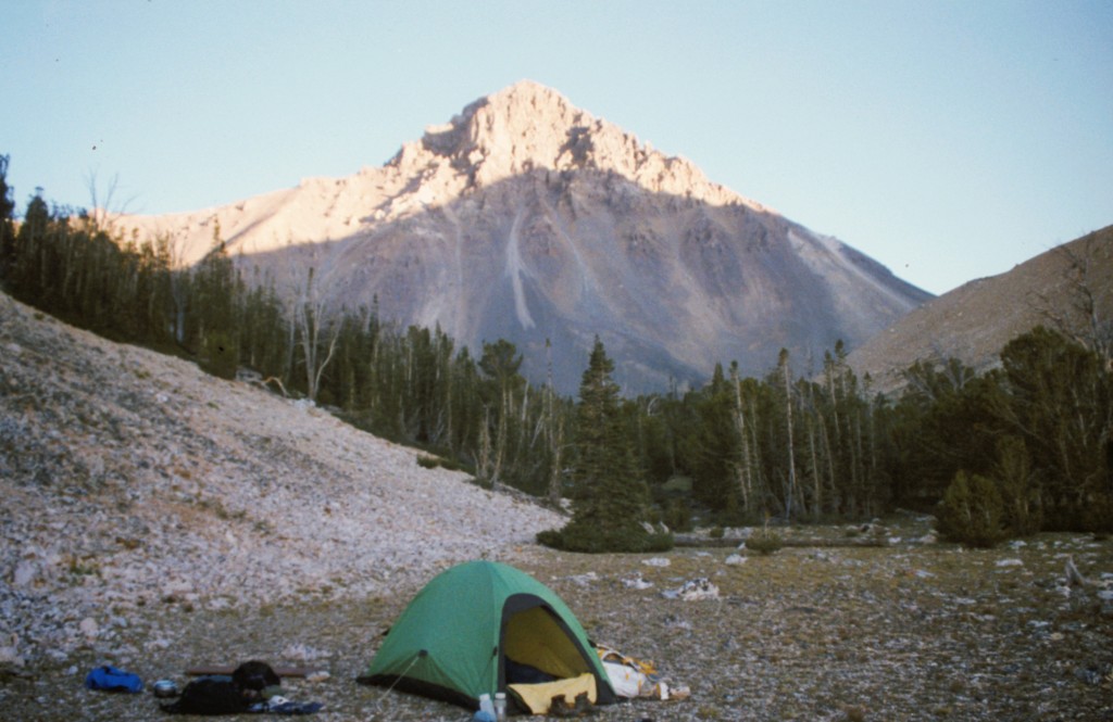
Pass Lake is a good, but fragile place to camp when approaching Leatherman Peak from the east.
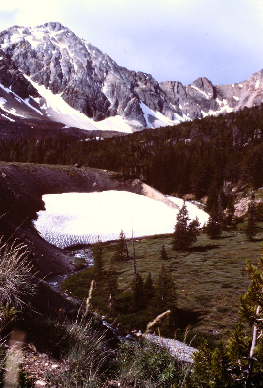
The East Side Approach to the peak is scenic and more alpine in nature than most Lost River Range drainages.
For fans of twisted, broken rock, there are a lot of interesting unclimbed lines on Leatherman Peak.
Return to the Idaho 12ers Page.
Additional Resources
Regions: EASTERN IDAHO->Lost River Range
Mountain Range: Lost River Range
Year Climbed: 1982
First Ascent Information:
- First Ascent Year: 1910
- Season: Summer
- Route: Unknown
- Party: T.M. Bannon
- Other First Ascent: First Winter via West Ridge
- Year: 1973
- Season: Winter
- Party: W. March and R. Albano
Pingback: From Diamond Peak to Hyndman Peak: Kelly Lance’s 12er Traverse by Tom Lopez - IDAHO: A Climbing Guide