Article Index
Gary Quigley, Dana Hanson and I took off a few extra days in conjunction the 4th of July holiday and set out to climb Mount Jefferson and Mount Saint Helens. Jefferson was first on our list. We planned to ascend the peak’s south ridge. This route would cover 23 miles with just under 8,000 feet of elevation gain round trip.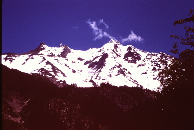
Mount Jefferson is one of the Cascade Mountains’ most impressive volcanoes. It is also the second highest peak in Oregon. The volcano has been constructed by many eruptive episodes, the first of which occurred roughly 300,000 years. The last eruption was around a thousand years ago.
It is located in the Mount Jefferson Wilderness which means there is no short, high altitude access. Nevertheless, it is a popular destination for climbers. The indigenous inhabitants called the peak Seekseekqua. However, Lewis and Clark reportedly named the Volcano after their benefactor, Thomas Jefferson. The earliest know ascent was by E. C. Cross and R. L. Farmer in 1888.
We left Boise on June 29th and made the long drive to the west side of Mount Jefferson. We picked up a wilderness permit at the Forest Service office in Detroit, Oregon and then found a campsite nearby. The next day we started our climb at the Pamelia Lake Trailhead (elevation 3,100 feet). The large parking lot was disappointedly nearly full when we arrived on Saturday, June 30th.
We hiked a mile or so to Pamelia Lake and found it crowded with campers. From there we followed a connecting trail to the Pacific Crest Trail. We followed the PCT to the mostly snow covered Coyote Lake/Shale Lake basin. A third larger lake designated as Mud Lake in a guidebook looked like suitable for camping. After a short discussion, we left the trail and found a snow free camping spot. The elevation was roughly 5,900 feet. This left us with 4,600 foot climb the next day.
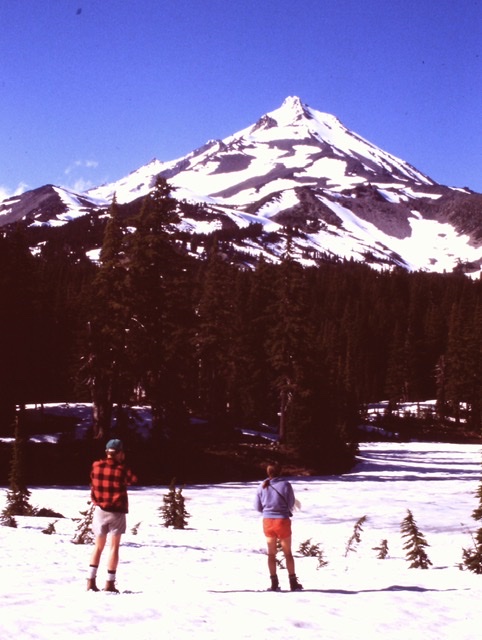
Gary and Dana scoping out the route from our camp.
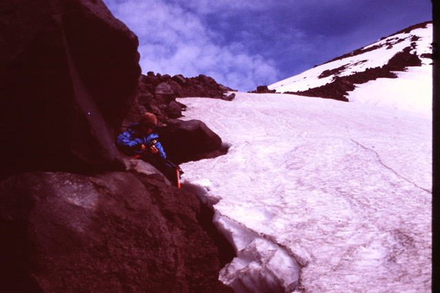
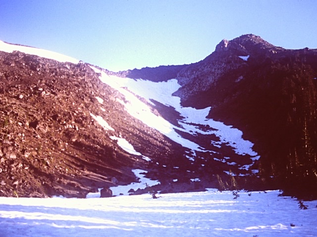
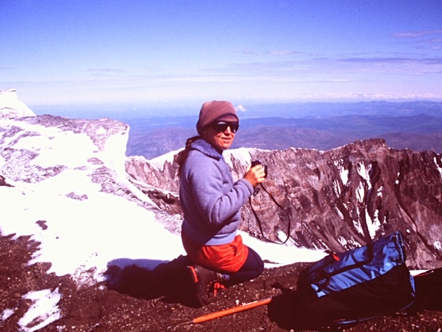
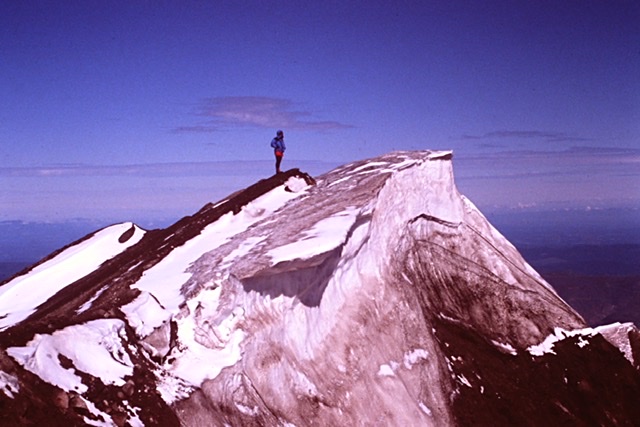
Sunday, we started our climb by quickly ascending Goat Peak which is located on the main Cascade crest. We dropped off Goat Peak and descended to the saddle connecting it with Jefferson. From the saddle we climbed up Jefferson’s south ridge to roughly 9,800 feet. From here we made a scrambling traverse on the east side of the ridge to avoid an obstacle. This brought us to the Red Saddle. The climbing was easy to this point. The summit pinnacles loomed above us. We roped up at this point. From the Red Saddle we down climbed a short distance and then traversed north across a steep snow slope below the south pinnacle. I placed snow pickets for protection as we crossed this 200 foot traverse. The north pinnacle (which is the high point) was covered with fluted rime ice which was sticking out horizontally. It sort of looked like a giant porcupine.
Crossing over Goat Peak.
Looking up the south ridge.
Mount Jefferson’s western slopes.
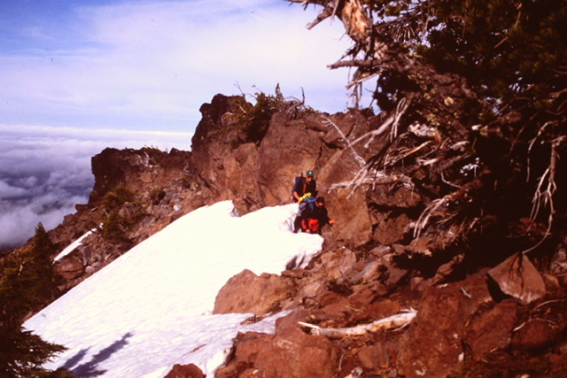
Getting ready for the traverse under the summit towers.
At this point all three of us had second thoughts. In dry conditions the last few vertical feet to the summit, primarily due to exposure, is rated Class 4 to easy Class 5 depending on the line climbed. Now, we were not looking at a rock climb but instead a vertical climb up steep rime ice. We had two pickets and one ice screw to use for protection. After setting up a belay position I would basically have one picket to protect the route as I climbed or to set up a belay on the summit. I doubted the ice screw would be of any use with the conditions we observed.
Ever the optimist, I said “maybe it’s not as hairy as it looks.” Dana and Gary didn’t agree and were adamant that it was time to turn around. I offered to “check it out.” They both refused to belay me. Relieved, I agreed to call it quits. We retreated to our camp.
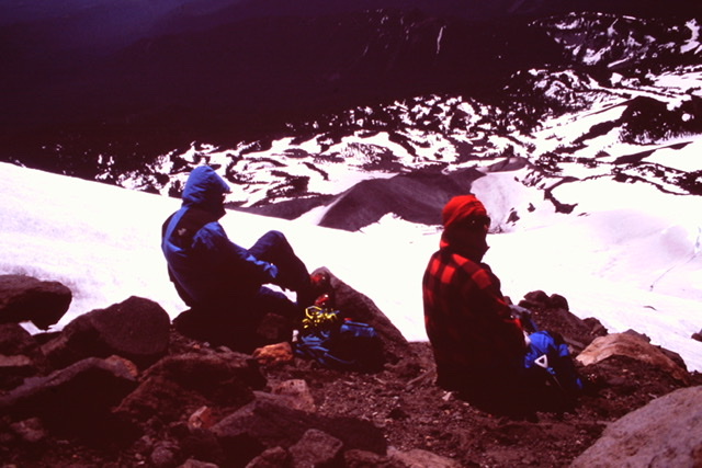
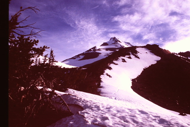
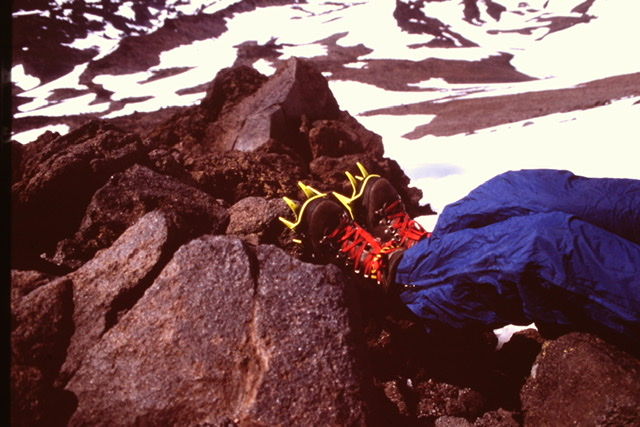
Taking a break to enjoy the view on our descent.
It started to rain about dinner time and continued through the night. We ate a cold breakfast the next morning and packed up our soaked tents and started the long hike to the trailhead. The rain stopped about and hour into our walk. When we reached Pamelia Lake we once again. This time the mass of weekend campers were gone evidently driven away by the rain. Garbage was spread out everywhere. One camper had even left a paper grocery bag full of trash. It was time to head to Mount Saint Helens.
Lawetlat’la to the Indigenous Cowlitz people or as it is now known, Mount Saint Helens is an impressive an active volcano located 50 miles northeast of Portland of and 100 miles south of Seattle. The British explorer George Vancouver named it after his buddy Lord Saint Helen. I wanted to climb this peak in 1973 when I was working as a seasonal ranger at Crater Lake National Park. Unfortunately, I could not find a climbing partner and I felt it’s glaciated slopes of the then nearly ten thousand foot mountain were beyond my skill level at the time.
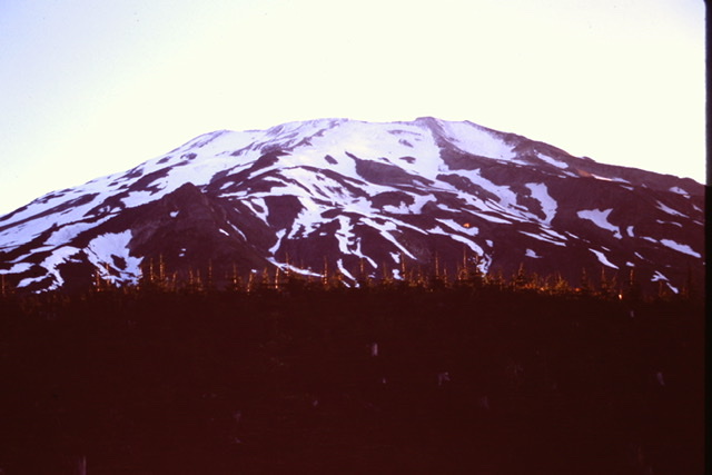
The south side of Mount Saint Helens from a point near the trailhead.
Seven years later Mount St. Helens erupted and was changed almost beyond recognition. It was not only lost its upper 1,300 feet but it also now had a massive crater on its northern side. The mountain was off limits for years but it’s southern slopes had recently been reopened to climbers. From Mount Jefferson we drove to Portland and spent the night with one of my sisters. The next morning, July 3rd we were on the road early heading for the trailhead.
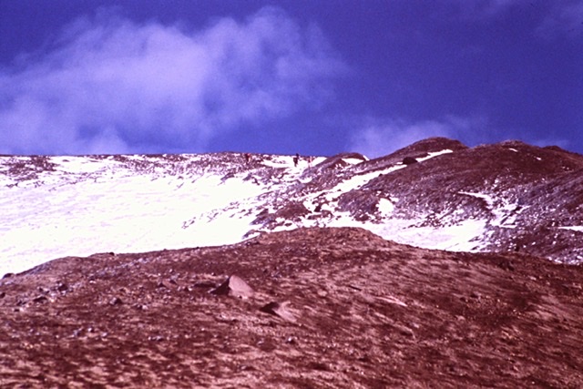
After picking up a permit we arrived at the trailhead at an elevation of 3,700 feet. We followed the Monitor Ridge Route to the summit gaining 4,600 feet in around 5 miles. At the crater rim we worked our way along the rim to the high point.
The trail was easy to follow but crossed a lot of snow higher up.
Getting near the rim.
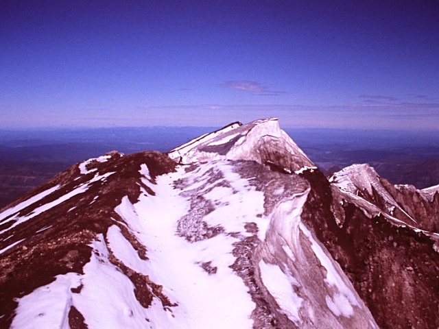
Looking toward the high point from the end of the trail.
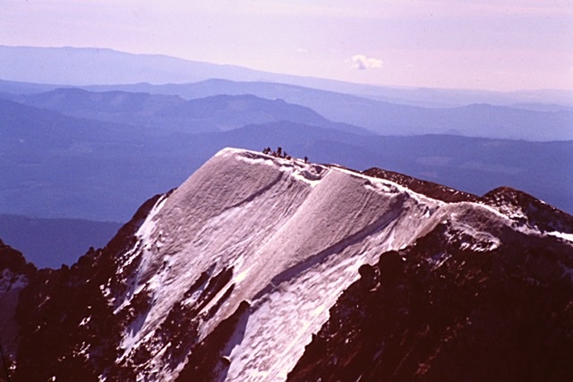
Looking back down the rim from the summit. The trail ends where a group of climbers is standing.
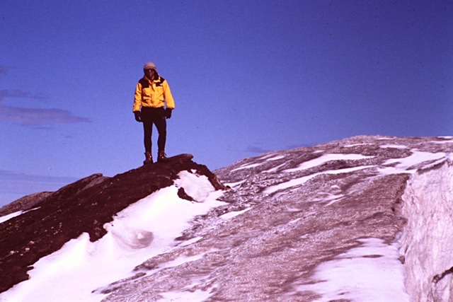
Dana.
Dana on the summit.
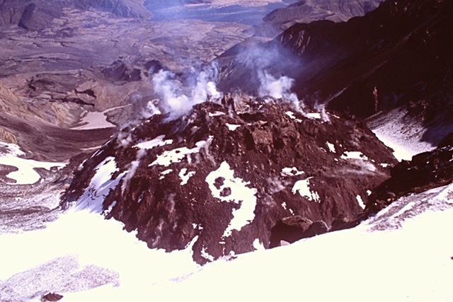
The Lava Dome.
Next: A Sawtooth Traverse