This page updates the access information on Page 290 of the book. You still need the book to get to the start of this road. Published September 2018
Use this road to access the North Face of USGS Peak, The Moat, Ferguson Peak and Peak 10297. This road requires a 4WD vehicle with high clearance and all-terrain tires. On the map below, I have marked the 3 most difficult spots which will not only test your vehicle but will also test your driving skills. There is a campsite at the end of the road and another one roughly a half-mile past the Swauger Lake trailhead.
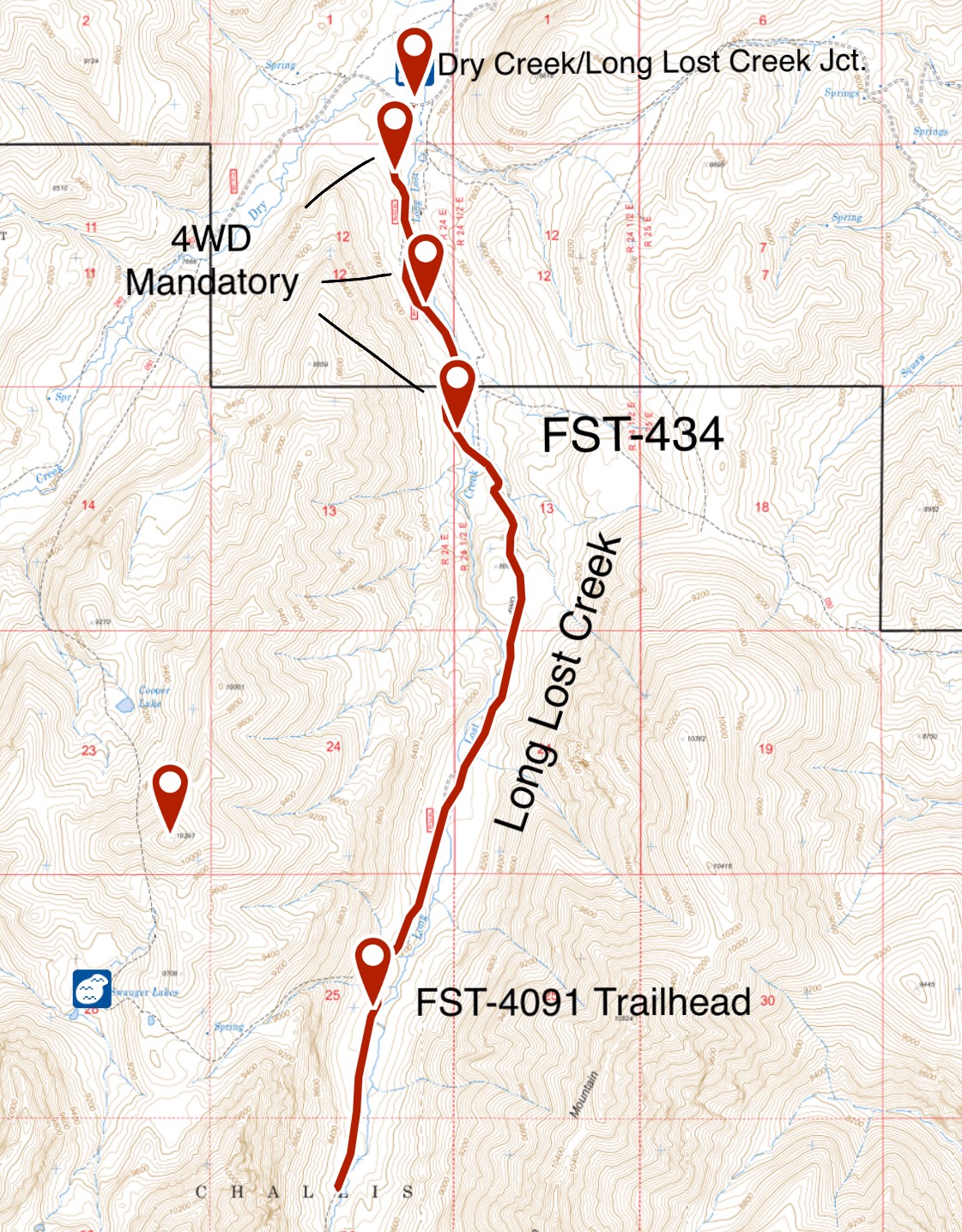
From the junction of Dry Creek Road and Long Lost Road, FS-434 wanders 4.9 miles up Long Lost Creek.
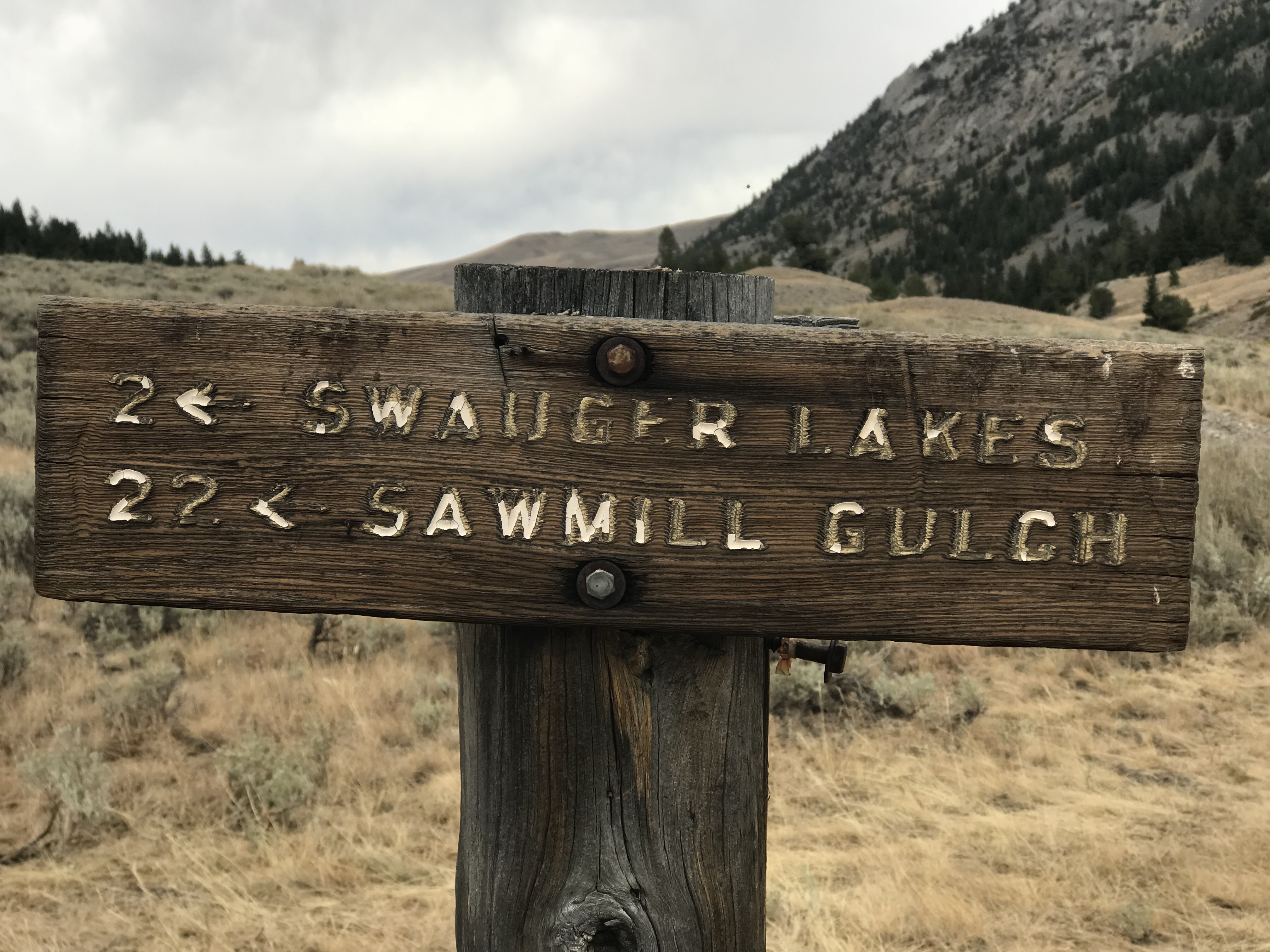
FST-041/Swauger Lake Trail. The information in the book is correct. The well-constructed trail was in excellent condition in 2018.
The trailhead in Long Lost Creek is marked. There is good camping farther up the drainage.