Elevation: 6,491 ft
Prominence: 511
This peak is not in the book. Livingston Douglas provided new route information for ascending the peak’s southeast ridge. Updated November 2019
Peak 6491 is located on the main Bennett Mountains Crest between East Twin Peak and Fir Grove Mountain. USGS Fir Grove Mountain
Access and Route, Class 1+
A 4WD road leaves the Davis Mountain Road southeast of the peak at an elevation of 5,629 feet (see Livingston Douglas’ access section below). This road is the quickest route to the summit. This road leads to the summit. The last bit of the route is located on private property. In 2019, the private property was not posted.
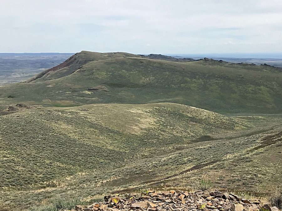
Peak 6491 as viewed from East Twin Peak
Southeast Ridge, Class 3 by Livingston Douglas*
* Note that this route crosses private property that was not posted in 2019.
Access
From its junction with ID-46, drive west on City of Rocks Road. At 4.9 miles, go left to stay on City of Rocks Road. At 5.8 miles, go right onto Davis Mountain Road. At 7.5 miles, go right at an unsigned junction onto a rougher jeep road. At 7.6 miles, park/camp in a grassy area alongside the road. The elevation here is 5,700 feet. This climb begins on the ridge saddle at the base of the west ridge of Fir Grove Mountain. You can reach this saddle directly from the grassy parking pullout area by hiking up the ATV road/trail all the way to the saddle.
The Climb
This climb is a long ridge traverse from Fir Grove Mountain and only joins an old jeep road as you near the summit of Peak 6491. There are numerous ups-and-downs on this ridge so be prepared to pile up the elevation statistics. If you maintain a true line on the ridge crest proper, you must climb over Class 3 buttresses and rocky outcrops. If you skirt these rocky obstructions, you will still have a Class 2+ endeavor. The summit area is on private land but I saw no signs or orange paint indicating such. There is private fenced land to the south of the ridge crest (directly south of the final ridge saddle) that is well posted and is easy to avoid.
From the saddle at the base of the west ridge of Fir Grove Mountain, follow the ridge crest west then northwest over numerous points and several saddles to reach an old road that leads to the summit area. The ridge crest is mostly short scrub and ground talus but there are a couple of rocky points to either climb over or skirt around. In some sections, you can follow the side of a ridgeline cattle fence using a footpath to move more quickly through the sagebrush/scrub and field grass.
The first ridge point/hump is the rockiest and the most challenging. Climbing up over it is Class 3 with some exposure so care must be taken here. The remaining ridge points/humps are either easy grass/scrub or an easy mix of rock and scrub/grass. You must cross a well-maintained, stiff cattle fence about a mile from the summit. I suspect that this is probably the boundary between BLM land and private land but there were no signage or orange paint to indicate such.
Once you reach the final saddle, pick up an old, weak 2-track jeep road. It leads to the summit area but, not sure of such, I soon left it to climb left/south up onto the ridge proper and the summit plateau. Doing such requires scrambling up over a Class 2+ cliff band. I also did this to investigate a large rectangular cairn (four feet high and six feet long) that is sitting atop a summit plateau point directly south of the true summit. This cairn is truly an unusual sight, given its shape. From the “box cairn,” continue northward on the summit plateau to reach the high point. The summit of Peak 6491 had a torn-down cairn so I rebuilt it. The summit offers an outstanding view of Mormon Reservoir to the north.
Additional Resources
Regions: Bennett Mountain Hills->WESTERN IDAHO
Mountain Range: Bennett Mountain Hills
First Ascent Information:
- Other First Ascent: Southeast Ridge
- Year: 2019
- Season: Fall
- Party: Livingston Douglas
Longitude: -114.83379 Latitude: 43.21169