Elevation: 9,660 ft
Prominence: 680
This peak is not in the book. Published November 2022
Peak 9660 sits on a high ridgeline that overlooks the Baker Creek drainage. It is at the head of both Boyer Gulch and Badger Gulch. Peak 9660 is most easily reached from the Osberg Ridgeline Trail/FST-147. But it is a long hike on that trail from the nearest trailhead, so a direct, off-trail climb from Baker Creek Road to the north is the shortest, most-feasible route to the top. USGS Boyle Mountain
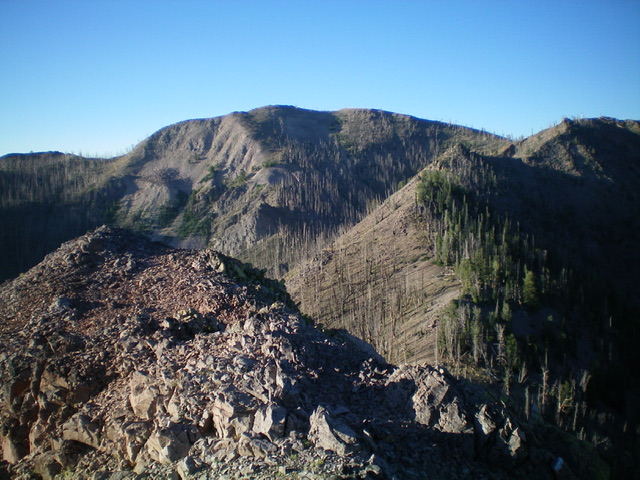
Peak 9660 (dead center in distance) as viewed from high on the rocky north ridge. Livingston Douglas Photo
Access
Drive 4.5 miles up Baker Creek Road/FSR-162 from ID-75 to a campsite located just before a bridge crossing of Baker Creek. This location is just east of Boyer Gulch. Park here (7,100 feet). GPS coordinates: 43⁰43’45”N, 114⁰35’11”W.
North Ridge, Class 3
The Climb
From the campsite, cross to the south side of Baker Creek Road and scramble southwest up a steep talus field to reach a burnt forest with modest veg and some blowdown. The burnt forest is quite steep, more so than the USGS map indicates. Head due south uphill in the burn area and use a gully to make better progress (no snags, less blowdown, more stable scree/gravel). Higher up, move right/west onto a steep shoulder on the east side of Boyer Gulch. This is the north ridge of Peak 9660.
At 8,400 feet, reach a key ridge point that is rocky and is at the head of the aforementioned gully. The slope finally eases and the ridge is better defined. Grind up through the relatively easy veg and snags to reach rockier terrain above. Scramble up a short section of Class 3 ridge rock/outcrops and reach the top of Point 9197. Descend from Point 9197 on easy, loose gravel and scrub to a saddle. From the saddle, scramble up over three narrow, rocky ridge points and continue along the narrow rock-and-pine crest in a flat area. Climb south up over another ridge outcrop then drop a short distance to another saddle.
At this saddle, you face the crux of this ridge climb: a steep section of massive ridge boulders that, thankfully, are stable, solid rock. The final rocky outcrop is the toughest but can be skirted. After a minor drop, scramble up easy veg and skirt the left/east side of Point 9505 and drop to a final saddle. From the saddle, scramble southeast then east up to the open, gravel-and-rock summit (west summit). The summit had nothing on it, so I built a decent summit cairn.
From the west summit (the official high point), scramble northeast then east along the rocky ridge to reach the rocky east summit. The east summit is a ridgeline summit and had a small cairn. The east summit appears to be slightly lower, though it shares the same final contour line as the west summit. You can also reach the east summit via the ridgeline trail then scramble about 100 horizontal feet right/south (with about a 30 vertical foot rise) to the east summit. According to my altimeter, both summits are of equal height.
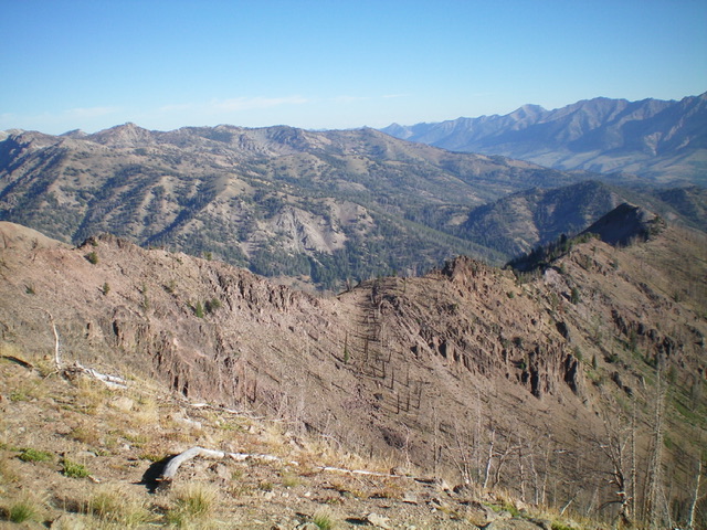
The choppy upper section of the north ridge (in mid-ground), my ascent route. Livingston Douglas Photo
Northeast Ridge, Class 1
The Descent
From the rocky east summit, return to the nearby trail (Osberg Ridgeline Trail/FST-147) to its north and follow the narrow hiking/biking trail as it meanders and switchbacks its way east then northeast then east to a saddle at the base of the west ridge of Peak 9474. This is the connecting saddle between Peak 9660 and Peak 9474. It concludes the first leg of today’s 2-peak adventure. Peak 9474 is up next.
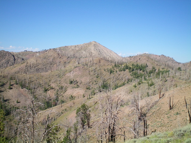
Peak 9660 (dead center) as viewed from the east. Livingston Douglas Photo
Additional Resources
Regions: Smoky Mountains->WESTERN IDAHO
Mountain Range: Smoky Mountains
Longitude: -114.58401 Latitude: 43.70249