Elevation: 6,330 ft
Prominence: 350
This peak is not in the book. Published January 2023
Peak 6330 is a rather inconspicuous hump located at the south end of the Cotterel Mountains west of Malta. This is the first leg of a 2-peak journey that climbs Peak 6330 and nearby Peak 6562 from ID-77 to the west. This adventure covers 6.0 miles with 2,100 feet of elevation gain round trip. The easier, but longer, ascent route comes up the Rice Creek jeep road and then climbs the northeast ridge. USGS Nibbs Creek
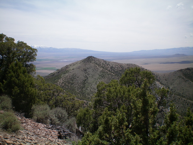
Peak 6330 (center) as viewed from the northwest. Livingston Douglas Photo
Access
From the “T” junction of ID-77 at Connor, drive north on ID-77 for 0.7 miles to an unsigned 2-track road on the right/east side of the highway. Park here alongside a fence row at the base of the 2-track road (5,075 feet). Be very careful to avoid private ranch land on the south side of the fence row and another private ranch about ½ mile farther north on ID-77. Consult a land management map to remain on BLM land for the entire hike. The 2-track road is shown on the USGS topo map and the location is at 42⁰17’33” N.
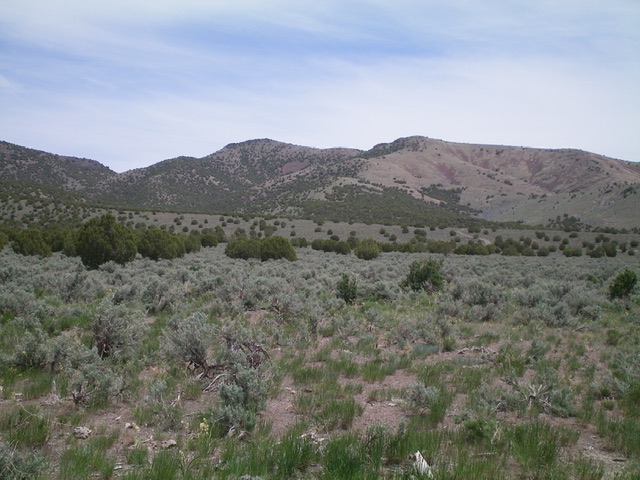
Peak 6330 (in distance just left of center) as viewed from the base of the 2-track road to its southwest. Livingston Douglas Photo
West Slopes/West Ridge, Class 2+
The Climb
This is a confusing area of multiple gullies and ridges with limited visibility. To make matters worse, there are multiple 2-track roads in this area (not shown on any maps) to confuse you even more. Ideally, follow a forested gully that heads northeast to reach the west ridge and then follow the west ridge to the summit. That was my plan, but things didn’t exactly work out that way. Read on.
From the parking spot, jump the cattle fence and follow the 2-track road east then north up a ridge to a “T” junction. I should have dropped right from this ridge into a forested gully earlier in order to follow the most prominent gully up to intercept the west ridge. But I didn’t because I thought that I was on the ridge/shoulder on the right/east side of the aforementioned gully when I was actually on a ridge/shoulder on the gully’s west side. Realizing that I was too far north on this ridge (at about 42⁰18’00”N), I left the ridge and headed east across three dry gullies in forested terrain to reach the west ridge of Peak 6330.
Once on the west ridge, scramble up the ridge in a juniper forest (weaving required) with some rocky ridge outcrops to reach the summit ridge just north of the high point. Turn right/south and climb up some Class 2+ ridge rock/boulders to reach the rocky summit of Peak 6330. There is a modest cairn on top with magnificent views of the surrounding Albion Mountains and ranch lands.
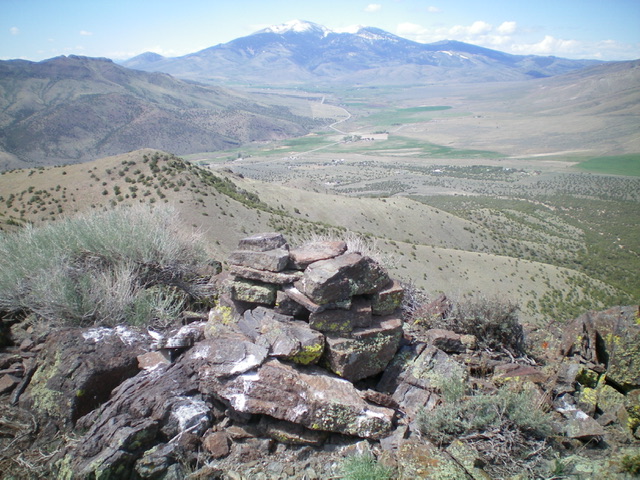
The summit cairn atop Peak 6330 with the snow-dusted Albion Mountains in the distance to the west. Livingston Douglas Photo
North Ridge, Class 2+
The Descent
From the summit, descend the rocky north ridge crest to the juniper-clogged connecting saddle with Peak 6562 (5,980 feet). The rock becomes easier (and there is less of it) as you descend to the saddle. This descent takes less than 15 minutes to complete. This concludes the first leg of today’s journey. Peak 6562 is up next.
Additional Resources
Regions: Albion Range->Cotterel Mountains->SOUTHERN IDAHO
Mountain Range: Albion Range
Longitude: -113.46979 Latitude: 42.30009