Elevation: 9,745 ft
Prominence: 334
This peak is not in the book. Published November 2022
Peak 9745 sits directly north of Baker Lake. It is on a long, north-south ridgeline that separates Blaine County from Camas County. Peak 9745 is most easily climbed from Baker Lake via either its southeast ridge or southwest ridge. Surprisingly, there is no climber’s trail from Baker Lake up to the prominent north-south ridge crest. USGS Baker Peak
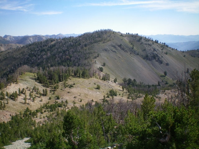
Peak 9745 and its north ridge (center) as viewed from the north. Livingston Douglas Photo
Access
From ID-75 north of Ketchum, turn left/south onto [signed] Baker Creek Road/FSR-162. Drive 9.2 miles up Baker Creek Road to its end at the trailhead parking area for the Baker Lake Trail/FST-138 [(A)(4)(a) on Page 213] and the Osberg Ridgeline Trail/FST-147 (not mentioned in the Book). Park here (7,935 feet).
Map Errors
The USGS map shows no switchbacks on the Baker Creek Trail. In fact, there are two LONG switchbacks on it. The USGS map shows the Baker Lake Trail entirely on the south side of Baker Creek. In fact, the trail crosses to the north side of Baker Creek (at the first LONG switchback) at about 8,410 feet and stays well above Baker Creek all the way to Baker Lake. The USGS map fails to show the Osberg Ridgeline Trail section from the Baker Lake trailhead parking lot to the area of Point 8905.
South Face/Southeast Ridge, Class 3
The Climb
From the Baker Lake Trailhead, hike up Baker Lake Trail for 1.6 miles to the outlet of beautiful Baker Lake. Leave the trail and bushwhack right/north through easy scrub across a minor dry drainage and up a knoll to reach the base of the steep south face of Peak 9745. Scramble straight up the steep mix of gravel/scree, using scattered veg to gain any traction. Get on all fours at times due to the steepness and looseness of the terrain (Class 3). Reach a high section of scattered pines and rock ribs/outcrops to gain traction. Soon after, the slope finally eases and veg takes over. Follow the semi-open forest and veg to reach the forested summit hump. The high point has a small cairn.
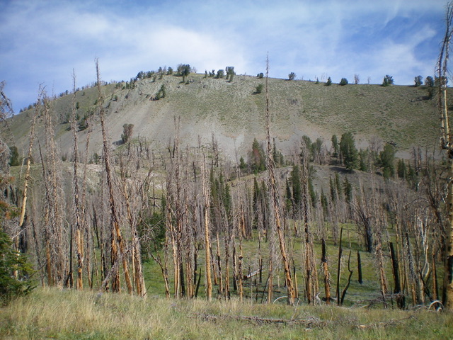
The steep, loose south face of Peak 9745 as viewed from the outlet of Baker Lake. The summit is well left of center. Livingston Douglas Photo
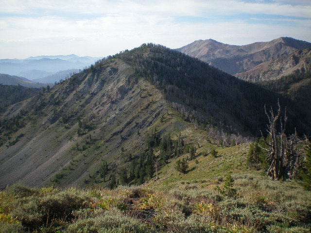
Peak 9745 and its southwest ridge (center), my descent route. Livingston Douglas Photo
North Ridge, Class 2
The Descent (then Ascent)
From the summit, descend north along the ridgeline in a combination of ridge pines, scrub, and loose shale. Scramble 30 feet up over a rocky ridge hump then down to a Saddle 9411, mostly staying right/east of the ridge pines on angled, loose shale with some help from a weak game trail. This is the connecting saddle with Peak 9780 and concludes the first leg of today’s 3-peak adventure. Peak 9780 is up next.
Southwest Ridge, Class 2
The Descent
After returning from Peak 9780 and re-climbing Peak 9745, descend southwest through an easy pine forest to reach mostly open scrub terrain. Continue southwest down through the scrub to reach the semi-forested connecting saddle with Backdrop Peak at 9,300 feet. This concludes the second leg of today’s 3-peak adventure. Backdrop Peak is up next.
Additional Resources
Regions: Smoky Mountains->WESTERN IDAHO
Mountain Range: Smoky Mountains
Longitude: -114.67619 Latitude: 43.69819