Elevation: 8,523 ft
Prominence: 1,903
This peak is not in the book. Published June 2019
Appendicitis Hill is located northwest of Arco, Idaho in the easternmost lobe of the Pioneer Mountains. The origin of the name is based on famed USGS surveyor T.M. Bannon who suffered an attack of appendicitis while surveying the peak. USGS Appendicitis Hill
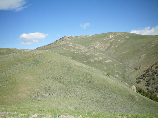
Appendicitis Hill as viewed from the south. The summit is rocky and is left of center. Livingston Douglas Photo
Access
From US-93 in Moore, ID, drive west to [signed] 3400W. Turn left/south onto 3400W and drive south just over a mile to [signed] 3000N. Turn right/west onto 3000N. This road leads west up into Rocky Canyon. Drive 1.4 miles west on 3000N to a cattle guard/fence and unsigned road junction. There is a sign for “Appendicitis Hill Wilderness Study Area” and a large parking area here. You can park here (5,693 feet) or drive another 0.3 miles up 3000N to three blue cattle cisterns and park there if you wish. The road gets rougher after that point, becomes a 2-track road and eventually just a cattle trail.
This is the only public access point from which to climb Appendicitis Hill. All approaches from the north and west sides are closed to the public due to private property. Please note that Rick Baugher’s route is no longer open to the public. The route described here is the second leg of a two-peak journey that begins with a climb of Peak 8319. Please refer to that posting for background on how to get close to Appendicitis Hill from the aforementioned parking area.
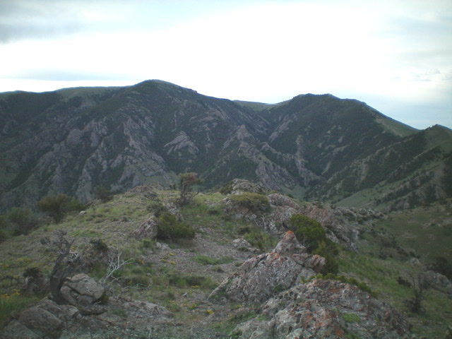
Appendicitis Hill (left) and Peak 8319 (right) as viewed from the west. The west side of Appendicitis Hill is rugged, quite a contrast to its gentle east side. Livingston Douglas Photo
South Ridge, Class 1
The Climb
From the 7,940-foot connecting saddle with Peak 8319, follow a 2-track jeep road north then northwest then north up the south ridge to the wide, open summit of Appendicitis Hill. There are two USGS benchmarks atop the peak along with lots of triangulation posts and wiring. There was no summit cairn so I built one and stuck a triangulation post in it.
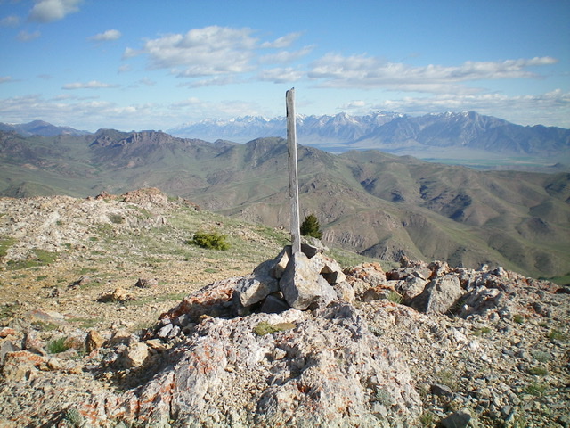
The newly-built summit cairn atop Appendicitis Hill. Livingston Douglas Photo
South Ridge/East Spur, Class 3
The Descent
Follow the 2-track jeep road back to the 7,940-foot connecting saddle with Peak 8319 at the base of the south ridge. Leave the road here and scramble east along the magnificent [and obvious] east spur to return to Rocky Canyon. The east spur is a combination of sagebrush and a few rocky areas as you descend it to a saddle at 7,620 feet. Continue east up over a ridge hump (85 feet of uphill). The ridge bends left/northeast then bends right/east to reach a minor saddle just under, and west of, Point 7158. This ridge section is rocky, choppy, and includes the dreaded mountain mahogany. The terrain between the small saddle and Rocky Canyon gets VERY ROUGH. The easiest way down into the canyon is via a gully that heads southeast from this saddle and then bends left/east to reach Rocky Canyon.
This gully includes some sections of Class 3 face rock to downclimb plus plenty of brush to tie up your legs and mountain mahogany to make your life even more miserable. In retrospect, I should have stayed on the ridge and descended southeast on the forested ridge from Point 7158 to reach the canyon more directly and easily. Once back down to the fork in the canyon, descend the center of the canyon via a cattle trail then a 2-track jeep road then a more established jeep road to return to the unsigned road junction at the mouth of the canyon and your parked vehicle.
Additional Resources
Regions: EASTERN IDAHO->Pioneer Mountains
Mountain Range: Pioneer Mountains
Longitude: -113.47329 Latitude: 43.72329