Elevation: 9,006 ft
Prominence: 466
Climbing and access information for this peak is on Page 310 of the book. Livingston Douglas climbed a new route on this peak which is set out below. Updated November 2019
Yet another Bald Mountain. This lesser Lemhi Range summit sits east of the main Lemhi Ridge Crest. Although the peak just barely tops 9,000 feet, getting to its summit requires over 3,600 feet of elevation gain. USGS Eightmile Canyon
Southeast Ridge, Class 2
Larry Prescott climbed this route in May 2016 with his son Ben. They took the Eightmile Canyon Road in from ID-28. Larry reports: “The road was in great condition all the way to the southeast ridge of Bald Mountain. This ridge extends northwest from the road to an upper gentle slope leading west to the summit. This line undulates up and down until meeting the westward slope. In retrospect, this route was surely not the fastest or easiest. Yet it was a pleasant hike with no real difficulty.”
Use the link below to read Larry’s trip report and to view his outstanding photo collection which includes some great wildlife photos.
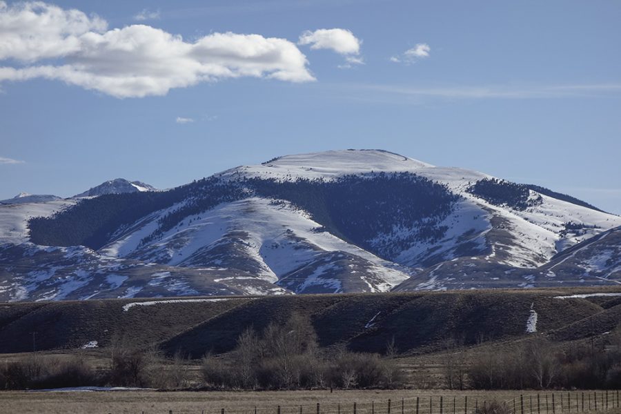
Bald Mountain as viewed from ID-28. Larry Prescott Photo
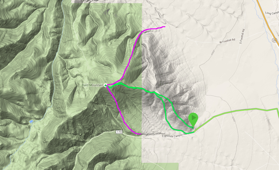
Larry’s GPS track in green. The magenta routes are other possible lines of ascent suggested by Larry.
South Ridge, Class 2 by Livingston Douglas
Access
Drive up Eightmile Canyon Road/FSR-173 and park at the Targhee National Forest Boundary. Walk 0.3 mile farther up Eightmile Canyon Road to a prominent gully and old jeep road. This is the departure point and the beginning of the off-trail climb of Bald Mountain.
The Climb
Leave FSR-173 at a prominent dry gully on the right/north side of the road. This gully has a faint 2-track jeep road in its center with a split-rail fence blocking entry to it by motor vehicles. Follow the overgrown jeep road briefly then leave it to scramble right/northeast up a good, mostly grassy slope to reach the gentle south ridge of Bald Mountain. You can see all the way up the open slope to a prominent rocky buttress at the head of the easy grass/sage slope. This buttress is at about 8,150 feet.
At this point, skirt the right/east side of the buttress and continue up the [better-defined] ridge. Scattered pines join the mix now but it’s certainly NOT a forest as the USGS topo map suggests. The scrub isn’t too bad and the blowdown is pretty minimal. Higher up, the trees disappear and it’s a windy, open grind on broken rock and scrub to the rocky finger that is the summit “cap.” Crumbly rock fins protrude from the ground along this finger. Triangulation posts and wiring are scattered about the summit. There is no summit cairn. The actual USGS benchmark (Clark benchmark) is located about 30 feet northwest of the high point in a ground boulder.
Southwest Ridge, Class 2
Access
Same as for the south ridge
The Descent
From the summit, follow the open, easy scrub and broken rock down the rounded southwest ridge to a wide, gentle saddle. This saddle connects Bald Mountain to Peak 9125, another ranked summit.
Additional Resources
Regions: EASTERN IDAHO->Lemhi Range
Mountain Range: Lemhi Range
Longitude: -112.972589 Latitude: 44.09109