Elevation: 7,988 ft
Prominence: 1,528
This peak is not in the book. Livingston Douglas hiked to the summit of this peak from a Peak 7921 as set out below. His routes are set out below. However, you can drive to the summit or, if you are really strong, ride a mountain bike to the top. Updated September 2020
Bell Mountain is a former fire lookout sits that sits at the head of Sharps Canyon. It is adorned with several antenna installations. Bell Mountain has a road to the top. This area is a patchwork of BLM land, State of Idaho land, and private land. Consult the BLM Fairfield map to stay out of trouble. USGS Little Wood River Reservoir
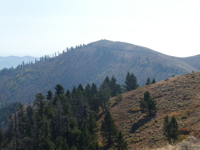
Bell Mountain as viewed from Peak 7921
Access and Route, Class 1
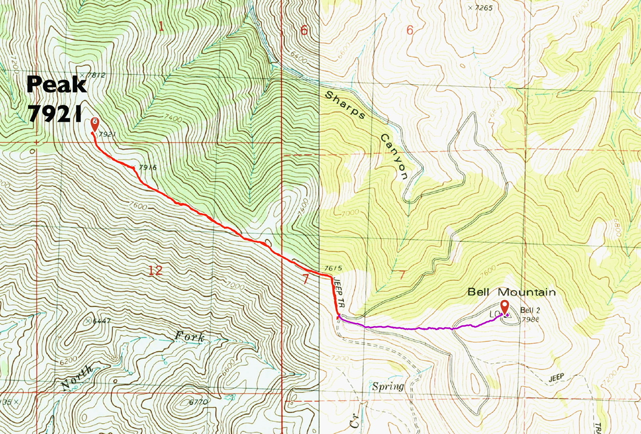
From ID-75 in Bellevue, turn east onto Pine Street and follow it to a junction with Sharps Canyon Road in 5.9 miles. Turn right onto this road, which leads to the top in another 4.1 miles. A 4WD is recommended.
Alternatively, you can park where the road reaches the 7,400-foot pass due west of the summit and hike the peak’s west ridge or walk the road to the summit. There is a poorly-maintained range fence on the west ridge to contend with during the ascent. The footing is best on the south side of the fence but you will need to cross over the fence at some point.
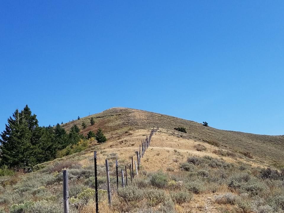
Looking up the west ridge
West Ridge, Class 2 by Livingston Douglas
Access
From the junction of ID-75 and Pine Street in Bellevue, drive east on Pine Street (which becomes Muldoon Canyon Road) for 5.9 miles to an unsigned junction with Sharps Canyon Road, a BLM road. Park near this junction in a pullout area (5,800 feet).
The Climb
This climb is the final leg of a ridge traverse from Peak 7921 to Bell Mountain. From the road junction (and ridge saddle) at the head of Sharps Canyon, hike briefly up the Bell Mountain jeep road east-southeast to reach the crest of the west ridge and a cattle guard/fence. Scramble east up the ridge, following the fence row initially. The terrain here is angled, thick scrub. The cattle fence ends at a crossing of the Bell Mountain jeep road at 7,800 feet. Cross the road and continue climbing east up the ridge to near the summit. Hike up the jeep road briefly to reach the summit. The summit of Bell Mountain has two repeater antennas on top. There is no summit cairn.
North Ridge, Class 2+ by Livingston Douglas
Access
Same as for the west ridge. This is the first leg of a ridge traverse from Bell Mountain to Peak 7374.
The Descent
From the summit, descend the ridge northward, crossing the Bell Mountain jeep road early on. The open scrub terrain soon gives way to a charred forest. This forest is a mess of downed, burnt logs with thick brush mixed in and is difficult to bushwhack through. It is best to stay on the ridge crest or on its right/east side for easiest going through this menagerie of mayhem.
Eventually, you reach an open saddle at 6,940 feet. The Sharps Canyon BLM Road skirts the left/west side of the ridge here. Follow the road briefly northward to another saddle where the road makes a very sharp left/west turn. This saddle is at 6,860 feet and is the low point between Bell Mountain and Peak 7374. It is the base of the north ridge of Bell Mountain.
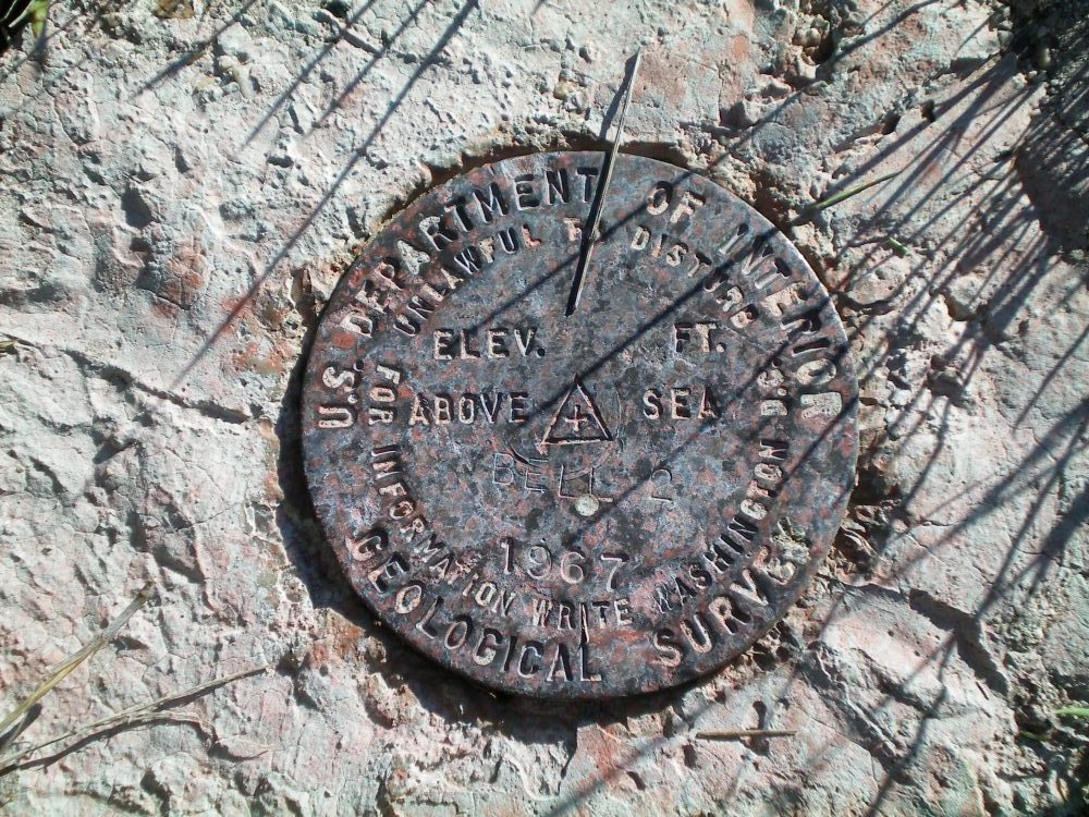
The USGS benchmark atop Bell Mountain. Livingston Douglas Photo
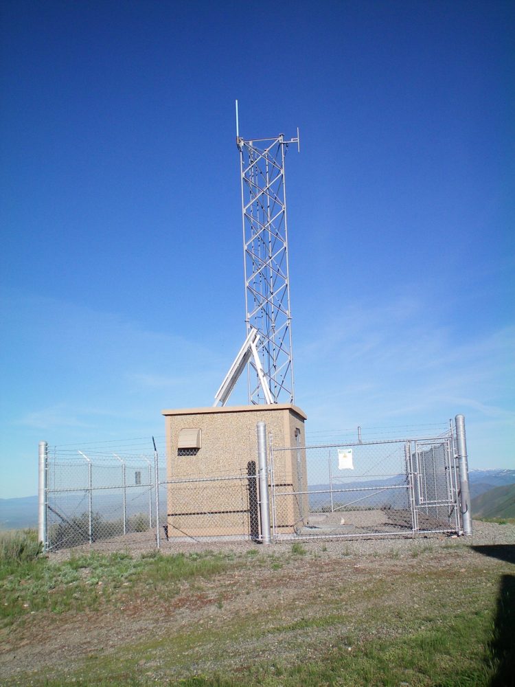
One of the two repeaters atop Bell Mountain. Livingston Douglas Photo
Additional Resources
Regions: EASTERN IDAHO->Pioneer Mountains
Mountain Range: Pioneer Mountains
Year Climbed: 1978, 2020
Longitude: -114.11101 Latitude: 43.43089