Elevation: 6,515 ft
Prominence: 645
Livingston Douglas has provided the additional route information and photos found below. Updated December 2019
Big Cinder Butte is Peak #9 of the Craters 10-Pack
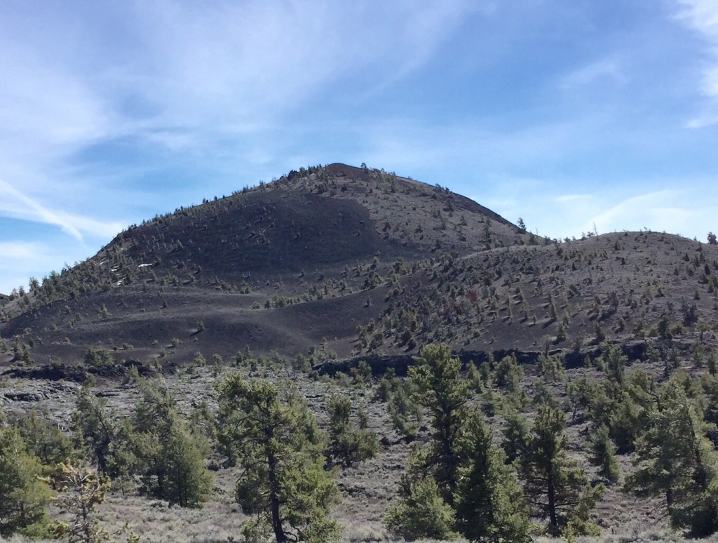
This volcanic cone is located in Craters of the Moon National Monument and Preserve. As Livingston Douglas points out: “Big Cinder Butte is the highest peak in Craters of the Moon National Monument. In the context of this National Monument, Big Cinder is a big mountain. It stands out from almost any vantage point. The easiest ascent route is via the Wilderness Trail and the southeast face.“ USGS Inferno Cone
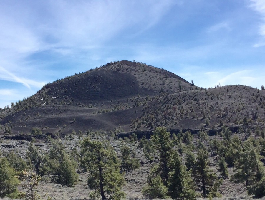
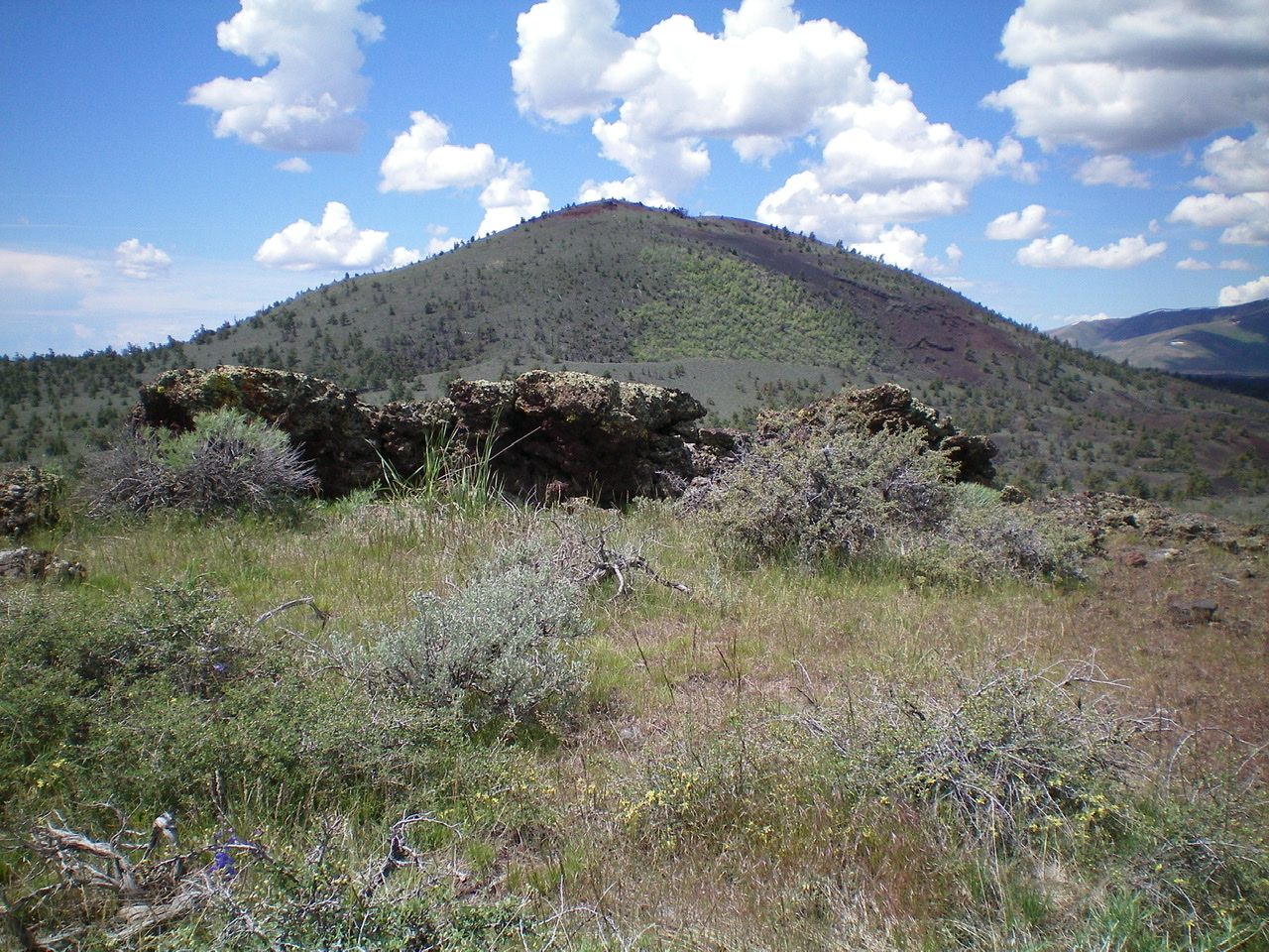
Big Cinder Butte as viewed from the Tree Molds parking lot.
There are numerous lines that will lead you from the parking lot to the peak’s northwest slopes. The area away from the lava flow is covered by sagebrush, pine and juniper trees and is open in nature and easy to traverse. Please take care of this pristine environment and watch out for rattlesnakes.
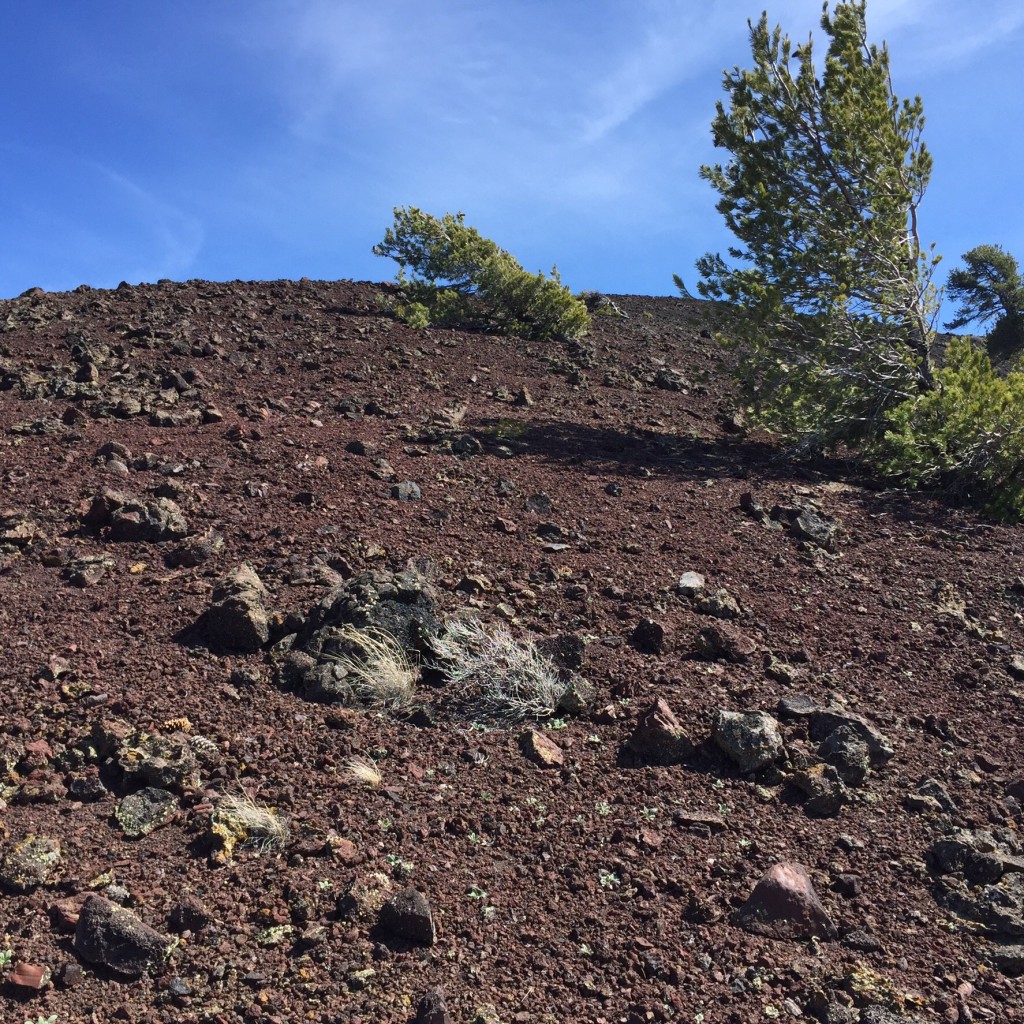
The upper west slope is a land of cinders
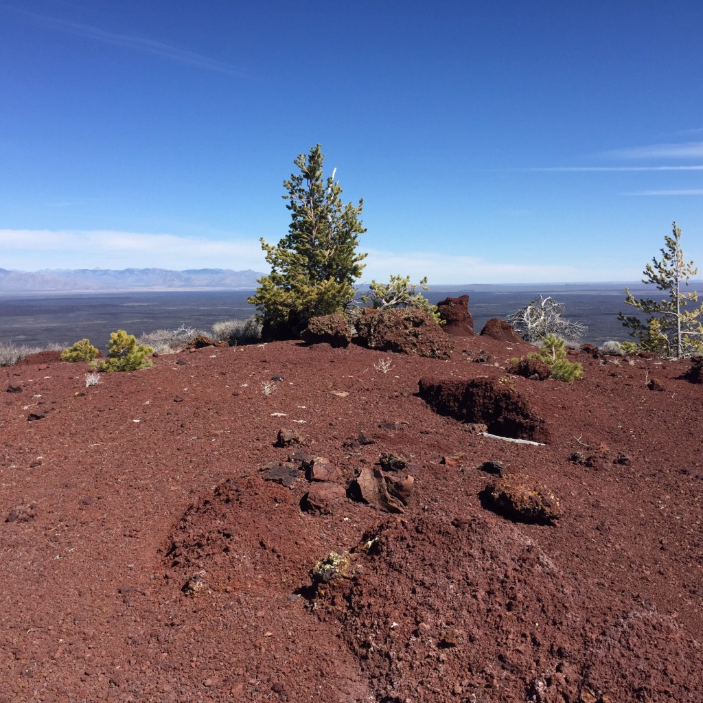
The summit of Big Cinder Butte
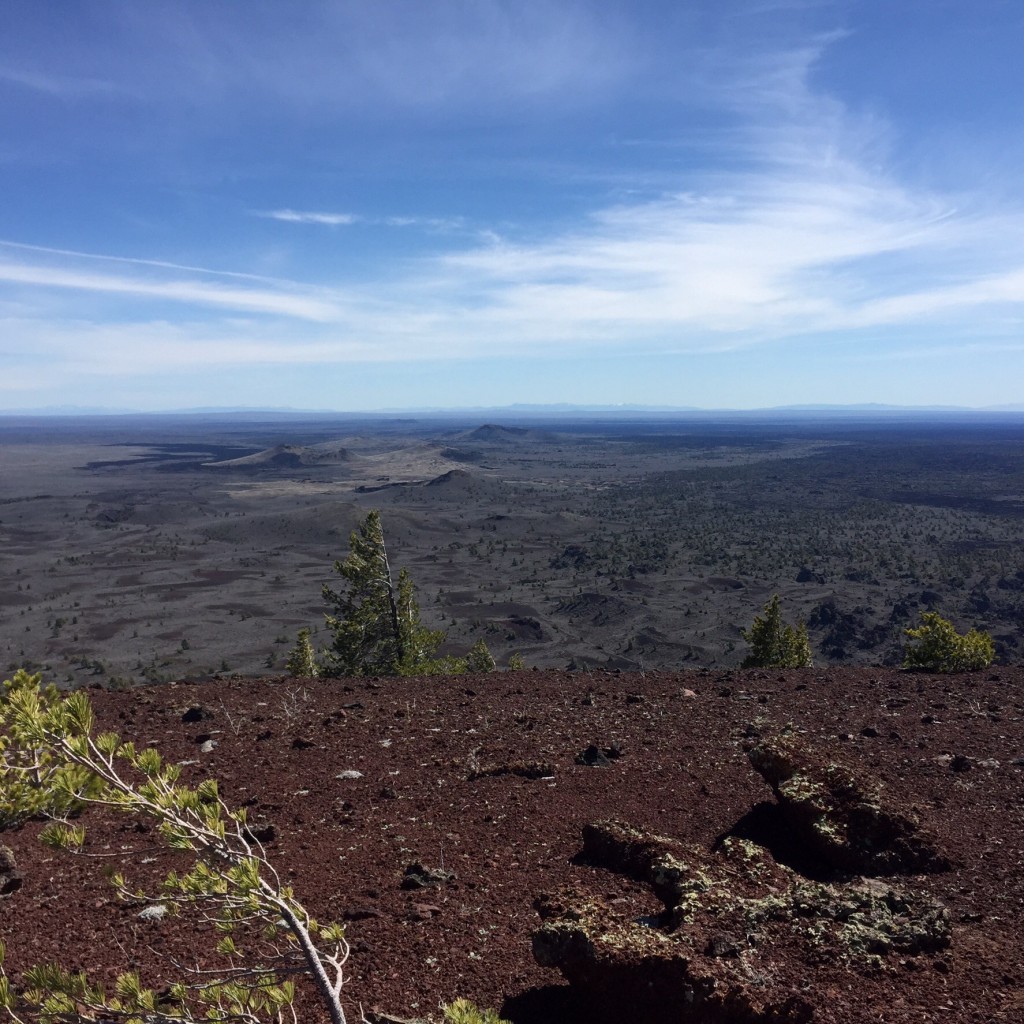
Looking at the volcanic terrain from the summit.
Another approach is via the Wilderness Trail. The Park Service describes the Wilderness Trail as follows.
Wilderness Trail
The Wilderness Trail leads four miles from the Tree Molds parking lot to the Sentinel. The Lava Trees and Echo Crater both make good day hike destinations. Most backpackers spend the night at Echo Crater, three miles from the trailhead, but there are also camping opportunities at the Sentinel and beyond. The Wilderness Trail begins at the Tree Molds parking lot. Walk along the sidewalk approximately 75 yards to a trail on the right. Here you can choose to hike over or around Broken Top cinder cone.
The trail continues past Big Cinder Butte, which rises 700 feet above you. A half mile beyond Big Cinder, look for a series of lava trees and fissures west of the trail. The trail winds between Coyote and Crescent Buttes to Echo Crater. Be sure to climb to the rim for a spectacular view of the row of cinder cones that mark the Great Rift. From the top, it is an easy walk down the south side of the cone. You can go into the crater and find protection from the sun and wind under the limber pines.
The hiking trail becomes less distinct beyond Echo Crater, but can be followed as far as the Sentinel, where it disappears altogether. You can travel cross-country beyond that point; however, dense shrubs and uneven lava make the going slow and sometimes unpleasant. Wear long pants for bushwhacking or your legs will get shredded!
See the Park Service Web site.
North Face and East Face Routes by Livingston Douglas
North Face, Class 2
Access
Same as for Broken Top. This is the final leg of a traverse from Broken Top to Big Cinder Butte.
The Climb
From the Buffalo Caves, scramble south across lava flows and lava slab rock to reach the gully at the base of the north face of Big Cinder Butte. Cross the gully and scramble up crumbly lava face rock then loose gravel for a short distance. From here, bash your way up through thick sagebrush and prickly brush to reach some open gravel areas. After a final section of scrub-bashing, you reach the top of Big Cinder Butte. The high point is a massive lava boulder. The summit is a mix of scrub, scattered pines, ground boulders, and protruding rocky outcrops.
The east face of Big Cinder Butte as viewed from the summit of Half Cone. Livingston Douglas Photo
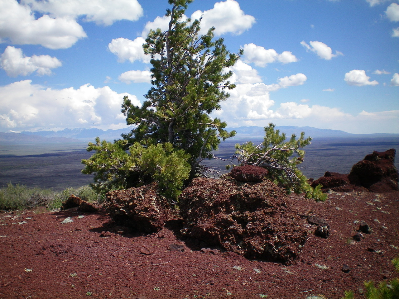
The summit area of Big Cinder Butte. Livingston Douglas Photo
East Face, Class 2
Access
Same as for the north face. This is the first leg of a traverse from Big Cinder Butte to Half Cone.
The Descent
From the summit, descend the arduous, thick scrub/prickly brush on the east face. The underlying loose gravel doesn’t help. Bushwhack through a short section of forest to reach the open terrain of the connecting saddle to Half Cone. The terrain here is mostly open lava gravel.
Additional Resources
Regions: SNAKE RIVER PLAIN
Mountain Range: Snake River Plain
Year Climbed: 2015
Longitude: -113.5389 Latitude: 43.417