Elevation: 9,391 ft
Prominence: 4,076
Climbing and access information for this peak is on Page 351 of the book. The newest 7.5-minute quadrangle shows a spot elevation on the summit as 9,385 feet. The National Geodetic Survey data sheet shows the elevation as 9,389 feet. The USGS Benchmark does not have an elevation stamped on it. Recent LiDAR-based assessments have determined that the elevation is 9,391 feet, a foot higher than Black Pine Peak (9,390 feet) about 1.25 miles to its south on the high ridge. Black Benchmark is now officially the highest point in the Black Pine Mountains. The debate is finally over. Case closed. Livingston Douglas provides detailed route descriptions for both the south ridge and the east ridge of Black Benchmark. He also describes the double-humped summit of Black Benchmark. Updated March 2025
Black Benchmark is located 1.25 miles north of Black Pine Peak. It is now officially the highest point in the Black Pine Mountains. USGS Sandrock Canyon
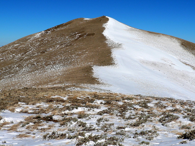
Black Peak/Black Benchmark. Dan Robbins Photo
Use this link to read about the Classic Black Pine Mountains Traverse.
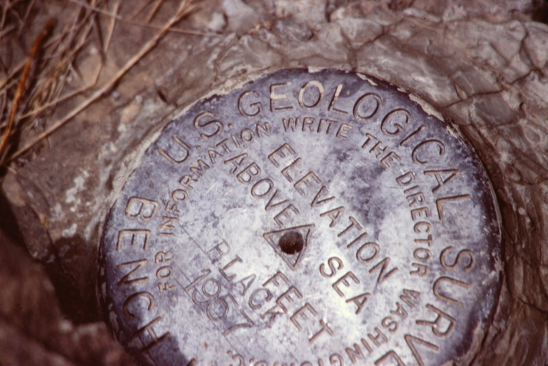
The USGS benchmark atop Black Peak
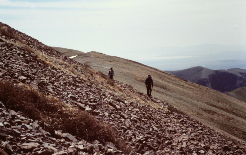
Traversing the ridge between Black Peak and Black Pine Mountain
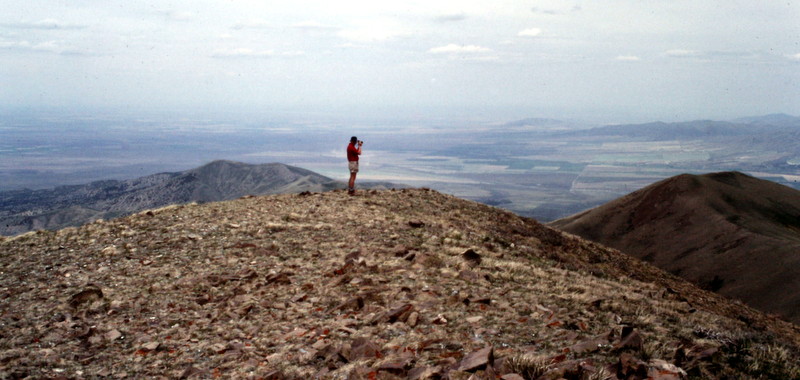
Gary Quigley on the summit of Black Peak
2018 Update by Livingston Douglas
Access
Same as for the north ridge of Peak 8376
South Ridge, Class 2
The Climb
This route is part of a ridge traverse from Black Pine Peak to Black Benchmark. The route begins at the 9,180-foot saddle at the base of the south ridge of Black Benchmark. This is a short ridge scramble up open terrain that is a mix of embedded talus/scree, short scrub, and a narrow/poor footpath on the ridge crest.
Black Benchmark has two summits. The south summit has a large cairn atop it. The nearby north summit has two USGS benchmarks—one in a ground boulder and another that is cemented into the ground itself. It also had a torn-down cairn, which I studiously rebuilt and stuck a triangulation post into. Now climbers will be totally confused and will have to do both high points of Black Benchmark as they should.
The south summit measures about 10 vertical feet higher than the north summit. The two summits are only 100-150 horizontal feet apart. If you are a purist peakbagger like me, you must stand on the highest point (the unofficial south summit). But since the official summit is the north summit (with the USGS benchmarks), you must visit the [slightly lower] north summit as well.
East Ridge, Class 3
Access
Same as for the south ridge
The Descent
This route is the final leg of a magnificent ridge traverse from Peak 8376 to War Eagle Peak to Black Pine Peak to Black Benchmark and back down to the meadow in the center of Pole Canyon. Black Benchmark has a beautiful east ridge that bends northeast as it drops to the canyon floor. Better yet, it descends to the original departure point on Pole Canyon Road for the ridge traverse.
From the south summit of Black Benchmark, descend the ridge on a dead east line. The upper section of the ridge is a combination of short scrub and loose gravel/scree with lots of sheep trails crossing the ridge. The scrub thickens and gets taller as you descend so it gets tedious. But there are still gaps and sheep trails to help navigate through this unpleasant stuff. Just below Point 8370, there is a hidden, rocky buttress that requires Class 3 downclimbing of its ledges. The ledges have vegetation and loose gravel on them so caution is advised here.
The ridge bends left/northwest after you downclimb the rocky ridge buttress. Enter the forest at just below 7,400 feet. Now is when things get rather unpleasant. It begins with scattered mountain mahogany. The forest soon becomes dense, the brush thickens, and the side-hilling is more challenging. A mix of pine forest and open scrub/veg then combine to punish your body. Find open areas on the right/southeast side of the ridge and stay there to avoid the steep, dense forest on the left/northwest side of the ridge. Unfortunately, the open terrain gets rough too, as the scrub and vegetation gets thick/tall and scattered trees and blowdown join the mix.
The terrain steepens as you approach the toe of the ridge and the canyon floor. For the final 50-100 feet of vertical descent, drop off the left/northwest side of the ridge into a gully and you will almost immediately reach Pole Canyon Road. Follow the road northeast then east back to the lovely meadow where you are parked and/or camped.
Additional Resources
Regions: Black Pine Mountains->SOUTHERN IDAHO
Mountain Range: Black Pine Mountains
Year Climbed: 1988
First Ascent Information:
- Other First Ascent: East Ridge -Descent
- Year: 2018
- Season: Summer
- Party: Livingston Douglas