Elevation: 9,390 ft
Prominence: 199
Climbing and access information for this peak is on Page 351 of the book. The book used an elevation of 9,385 feet based on an older 15-minute quadrangle. The newer 7.5-minute quad lists the elevation as 9,386 feet. However, the most recent LiDAR-based calculations assess the elevation at 9,390 feet which, according to LiDAR, is now a foot SHORTER than Black Benchmark to its north (9,391 feet). Consequently, Black Pine Peak is no longer the highest point in the Black Pine Mountains and is no longer a ranked summit. Margo Mandella provides a review of the west ridge route. Livingston Douglas details route descriptions for both the southeast ridge and the north ridge. Updated March 2025
This officially-named peak is the second-highest (albeit unranked) point in the Black Pine Mountains. The highest peak is Black Benchmark (by a measly foot) about 1.25 miles to the north on the high ridge. The dispute about which peak is higher is now officially CLOSED. USGS Black Pine Peak
Use this link to read about the classic Black Pine Mountains Traverse.
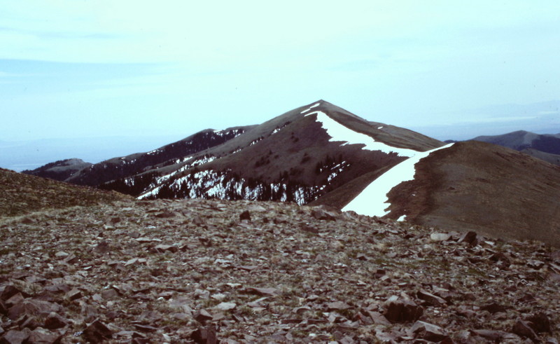
Black Peak (left) and Black Pine Peak as viewed from the west. Margo Mandella Photo
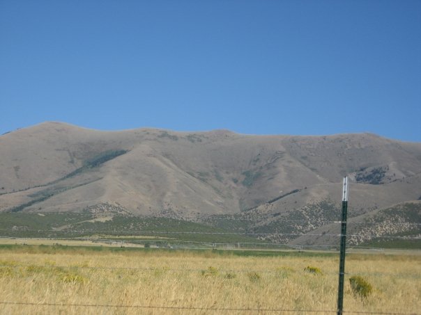
Black Pine Peak as viewed from Black Peak.
West Ridge, Class 2 by Margo Mandella
If you are not put off by steady, steep Class 2, then this might be the route for you. The west ridge route takes you toward the midpoint of the summit ridge between Black Pine Peak and Black Peak/Black Benchmark.
Access
Access the peak from ID-81, south of Malta, Idaho. From ID-81, take 6 Mile Road east and continue on it as it heads toward the Black Pine Mountains. The road turns south (straight is Gunnell Road) and intersects with FSR-773. Travel east and when you reach a 3-way intersection, turn left (north) to stay on FSR-773. At the road’s intersection again with Gunnell Road, turn right (east). You have basically driven around private property that Gunnell Road passes by. That said, FSR-773 also travels through a section of private property.
Remember, it never hurts to call the Sawtooth National Forest/Minidoka Ranger District, to verify access and road conditions for this peak before heading out. Trespassing in Idaho can have serious consequences. Continue on FSR-773 as it heads into Sixmile Canyon. Pass Sixmile Reservoir on your right and drive to the road’s end, staying to the left of any fork you pass. We found these roads rugged and passable in an SUV. However, we concluded that if the roads are muddy, it might not be possible to get far into the canyon.
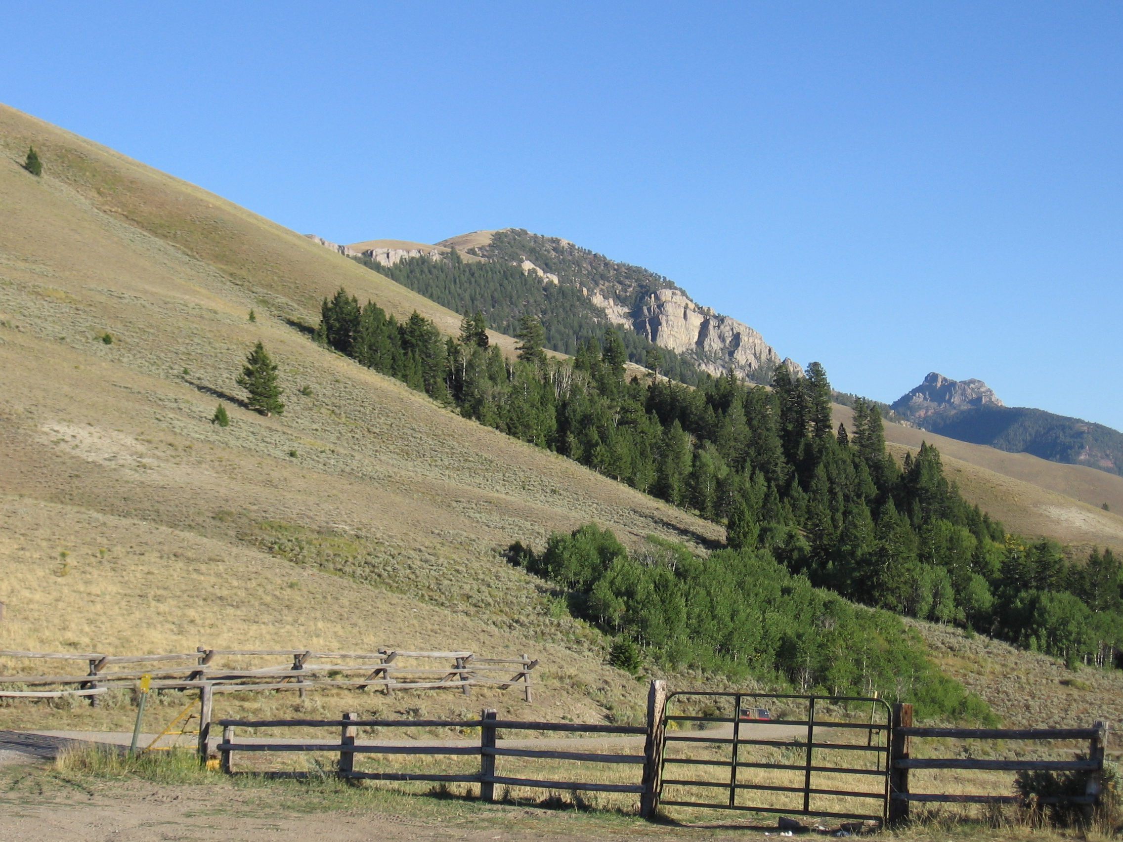
Sixmile Canyon access for Black Pine Peak. Margo Mandella Photo
Route
From where you park, you can backtrack a little and ascend west toward Point 6627, or you can continue from the end of the canyon to ascend a steep ridge that heads eastward to Point 9254 (which we did). As you near the summit ridge and Point 9254, decide which peak to bag first, Black Pine Peak or Black Benchmark and then tag the other, assuring that you have stood atop the high point of the Black Pine Mountains.
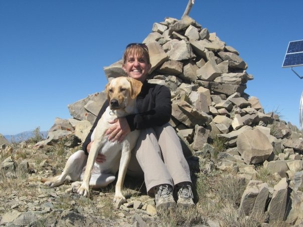
Margie and Maka on the summit of Black Pine Peak. Margo Mandella Photo
2018 Update by Livingston Douglas
Updates/corrections to the text: Forest Service Trail (FST)-018 [(A)(1.1)(a)] is now FST-833. The USGS topo map and the Sawtooth National Forest/Minidoka Ranger District map both show FST-833 still in existence (FST-018 on the USGS topo map). But I saw no signs of any trail coming out of Pole Canyon and crossing Pole Canyon Pass (7,980 feet). I also saw no trail descending southward from the pass to curl around to the south slopes of War Eagle Peak that are referred to in the book. Does FST-018/FST-833 still exist? I doubt it.
Southeast Ridge, Class 2
Access
Same as for the north ridge of Peak 8376
The Climb
This route is part of a ridge traverse from War Eagle Peak to Black Pine Peak. The route begins at the 8,540-foot saddle at the base of the southeast ridge of Black Pine Peak. Follow the ridge crest as it heads west then northwest then north to the summit of Black Pine Peak. There is a faint trail (narrow and rocky) on or near the ridge crest, but sometimes it is so poor that it’s less cumbersome to simply scramble up the open terrain on the ridge crest.
If you draw a straight line from the summit of Black Pine Peak to the 8,540-foot saddle, the direction is southeast, not south. The summit of Black Pine Peak has a repeater antenna (+ solar panel + aluminum storage shed) and a large cairn. The views of the west-side valleys are stunning, with two of the drainages having beautiful reservoirs/dams near the end of the forested terrain.
North Ridge, Class 2
Access
Same as for the north ridge of Peak 8376
The Descent
From the summit of Black Pine Peak, follow the ridge north over three ridge humps to reach the final saddle below Black Benchmark. This saddle is at 9,180 feet. The terrain on the ridge traverse is open with embedded talus/scree, short scrub, and a narrow/poor footpath on the ridge crest. A relatively easy stroll, at least on a non-windy day. Don’t be up here on a windy day or when thunderstorms are in the area.
Additional Resources