Elevation: 8,020 ft
Prominence: 800
This peak is not in the book. Published January 2023
Black Pine Cone is located at the southeast end of the Black Pine Mountains, east of Black Pine Canyon at the head of Mineral Gulch. The easiest access is from the east via Mineral Gulch Road. This is the first leg of a 2-peak adventure that includes Black Pine Peak and Peak 7620. This journey covers 7.0 miles with 2,575 feet of elevation gain and is entirely on Sawtooth National Forest land. Be aware that there may be small mining operations currently operating in this area. USGS Black Pine Peak
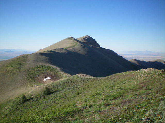
The undulating north ridge of Black Pine Cone. The summit is the right hump even though the nearby, lower ridge hump is more cone-shaped. Livingston Douglas Photo
Access
From Exit 263 (Juniper) on I-84, drive south on [unsigned] BLM-587 (38000W Road) on the west side of I-84. Reset your odometer at Exit 263. At 0.9 miles, reach a signed junction with Pole Canyon Road/FSR-761. Continue south on BLM-587. At 3.6 miles, reach a signed junction with BLM-586 (5000S Road). Continue south on BLM-587. At 3.9 miles, reach a signed junction with BLM-198. Go right/west onto BLM-198. This is Mineral Gulch Road. Reset your odometer at this junction.
Drive west up Mineral Gulch Road. At 1.4 miles, reach a confusing 3-way junction. Do NOT go left here onto [incorrectly-signed] BLM-198. Instead, jog right for 50 feet then go left/northwest to remain on Mineral Gulch Road/BLM-198. At 3.7 miles, reach the end of Mineral Gulch Road (now FSR-198). Park here at a locked road closure gate (6,475 feet).
Northeast Face, Class 2
The Climb
From the gated closure, hike up the old, unused mining road as it crosses Mineral Gulch early on and continues to switchback its way up the northeast face of Black Pine Cone. Bear right at an early junction on the south side of Mineral Gulch. At about 7,500 feet, reach a “T” junction with a smooth mining road (currently used for an active mining operation higher up on the northeast face) and go right/southwest onto it. Follow this road up to a right switchback and close to a small mining operation.
Leave the road just before reaching the small, active mining operation and scramble west up the face to the summit of Black Pine Cone on easy sagebrush and scrub. The final 300 vertical feet is the only part of this climb that is not on a mining road. The summit has a survey market just below the high point. I built a new cairn on the high point. Interestingly, the summit hump of Black Pine Cone is NOT conical in shape. The first ridge hump to its north (Point 7880+) IS conical in shape and probably fools many people into believing that IT is Black Pine Cone. But, alas, it is not.
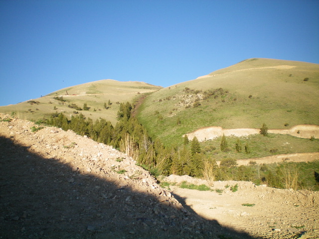
Looking southwest up the mining road toward Black Pine Cone (the left hump). Livingston Douglas Photo
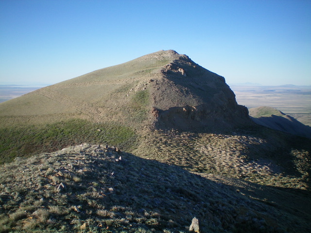
The summit hump of Black Pine Cone as viewed from high on the north ridge. Livingston Douglas Photo
North Ridge, Class 2
The Descent
From the summit, descend the ridge crest north in open terrain with a few humps to go over. The terrain is initially shale and rocky outcrops but morphs into easy scrub with a shale base. Follow a diagonal game trail on the left side of the ridge to complete the final northwesterly descent to the 7,220-foot connecting saddle with Peak 7620. This concludes the first leg of today’s 2-peak journey. Peak 7620 is up next.
Additional Resources
Regions: Black Pine Mountains->SOUTHERN IDAHO
Mountain Range: Black Pine Mountains
Longitude: -113.0579 Latitude: 42.0819