Elevation: 9,271 ft
Prominence: 3,410
Climbing and access information for this peak is on Pages 360-361 of the book. For information on traversing Bonneville, Snow Peak and Haystack Mountain, click on this sentence. Below you will find additional, detailed climbing route information by Livingston Douglas and Ken Jones. Updated November 2018
Although not reaching 10,000 feet, Bonneville Peak is a big mountain. It is the highest point in Bannock County and it takes a long climb to reach its summit. Fortunately, the trails are good. The scenery is even better. USGS Bonneville Peak
Livingston Douglas 2018 Updates
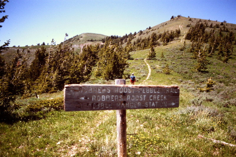
The northwest spur/north ridge route provides a detailed description of the ascent route from the Pebble Creek Ski Area.
Northwest Spur/North Ridge, Class 2
Access
Drive up to the Pebble Creek Ski Area (on paved roads) and park near the buildings at the base of the ski lifts. The elevation here is 6,630 feet. The ski area is open to hikers during the Summer and Fall months.
The Climb
From the base of the ski lifts, hike south then southeast up flattened field grass then thick desert scrub. Follow a beaten footpath under the southernmost ski lift briefly until it dies out. Bushwhack right/south up onto the obvious northwest spur. Climb up the spur, staying right/southwest of the ridge crest to have easier going in dirt-cleared areas. Grind your way upward until you reach the CAT track/service road at about 7,850 feet as it crosses the northwest spur as part of its ascent from the ski lifts to the north. Hike up the CAT track as it does a series of steep switchbacks and ends at the top of a ski lift at about 8,500 feet. There is a ski patrol shack here. Please note that the ski lift and CAT track/road end at a higher point than is indicated on the USGS topo map.
The top of the ski lift (and the ski patrol cabin) are directly on the ridge crest of the northwest spur. From here, pick up a good use trail that goes from the ski patrol cabin up into the steep forest above. This use trail goes all the way to the north ridge of Bonneville Peak. If you happen to lose the trail while in the forest, simply follow the ridge crest southeast and you will eventually pick up the trail again. The ridge crest has a wide, massive gully on its left/northeast side that is a good navigational tool if you end up bushwhacking a section of this climb to the summit ridge.
You eventually emerge from the forest in an open grassy field just below a rocky buttress. The trail bends right/south here to skirt the west side of the buttress. Immediately after passing the south side of the rocky outcrop, the trail bends left/east to climb up onto the summit ridge. The trail quickly reaches the crest of the north ridge of Bonneville Peak. The ridge is open terrain and is a combination of ground boulders, talus, and desert scrub. The use trail is weaker here but is generally on the right/east side of the ridge crest. But you don’t really need it at this point anyway. There are areas where the forest on the west side of the mountain reaches up to the ridge crest. Avoid the forest at all costs. The open terrain is much easier to navigate.
Follow the ridge southward as it drops 25 vertical feet to a minor saddle. It is about a half-mile hike along the north ridge from the entry point to the summit of Bonneville Peak. The summit is at the south end of a flattish ridge crest area with trees on the crest proper. The high point is marked with a large cairn and a damaged ski sticking out of it.
South Ridge, Class 2+
Access
Same as for the northwest spur/north ridge
The Descent
This route is part of a ridge traverse from Bonneville Peak to Snow Peak (and back). The south ridge of Bonneville Peak is much more difficult than its north ridge. The terrain is rougher and there is no trail to help you. I was quite surprised myself. The USGS topo map makes the south ridge look like a lark, but it’s not.
From the summit of Bonneville Peak, follow the rounded ridge south-southeast then south to reach the gentle 8,660-foot saddle connecting Bonneville to Snow Peak. The south ridge is a combination of thick desert scrub, trees, talus fields, and a boulder/scrub mix. Near its south end, it has cliff bands and boulders to navigate (with veg mixed in to complicate matters). This is no simple Class 2 walk-up.
The south ridge is best on its east side higher up (open terrain with easy talus slopes). Lower down, the ridge crest and just to the west of it seems to work best. If you wander off, the west side gets very rough. It is better to err on the east side of this ridge.
Ken Jones Route Report
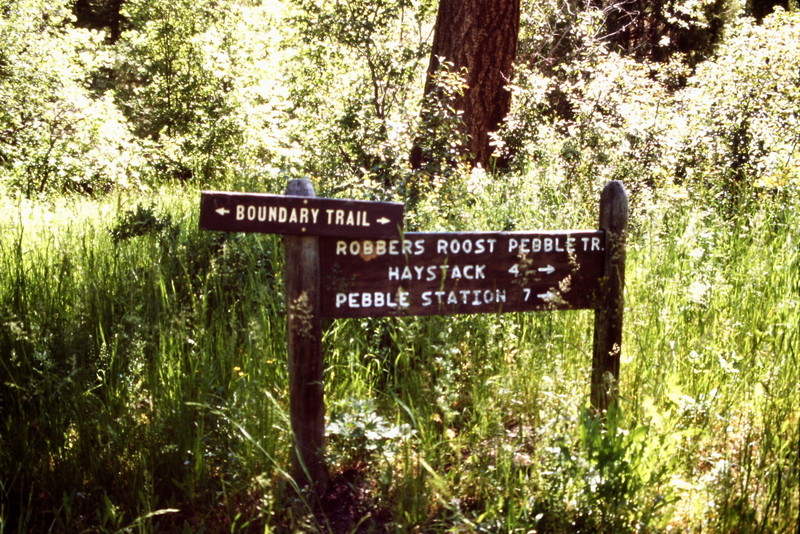
From I-15 at Inkom, take Exit 58 southbound. Bear right at the bottom of the ramp toward Inkom. Continue straight at 0.8 miles (don’t bear left to return to I-15). Go left at 2.2 miles, signed to Pebble Creek ski area. Go right 0.3 mile later onto Green Canyon Road (again signed for the ski area). Follow this road uphill to its end at the ski area, about 4.25 more miles. Park in the upper lot.
Hike up the ski hill. Near the head of the lower ski lift (the short one from the lower parking lot), pick up the service road/jeep trail. Follow the main track (there are a number of branches) up under the two main lifts. Eventually, you will reach the top of the highest lift. From here, go up and right, following the path of least resistance. If you head straight up the ridge you will meet a cliff band — this can be bypassed by skirting its base to the right. Continue up and right to the ridge, turn right and follow the ridge to the summit of Bonneville Peak. There is a small building that used to house an antenna on top — I didn’t find or leave a register.
Round trip statistics: 4 to 7 miles (depending on if you go straight uphill or do the switchbacks on the service road), 2,600 feet of elevation gain, 4 to 5 hours without rushing.
The Portneuf Range gets wild not far from downtown Pocatello.
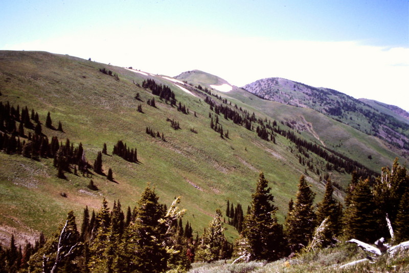
As you gain altitude, Snow Peak and Bonneville Peak come into view.
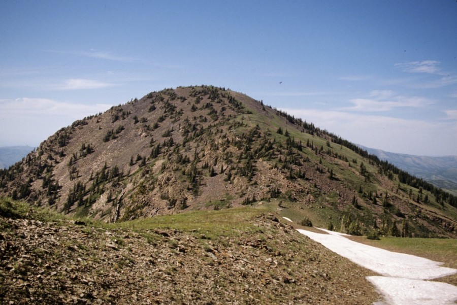
Bonneville Peak
The Portneuf Range encompasses a lot of varied terrain. It is steep, but when you reach the crest you will be rewarded.
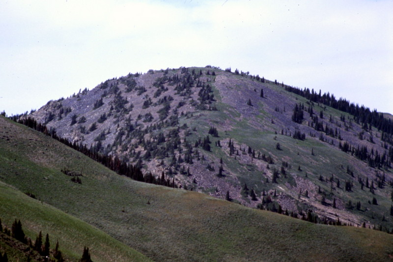
Bonneville Peak as viewed from Snow Peak.
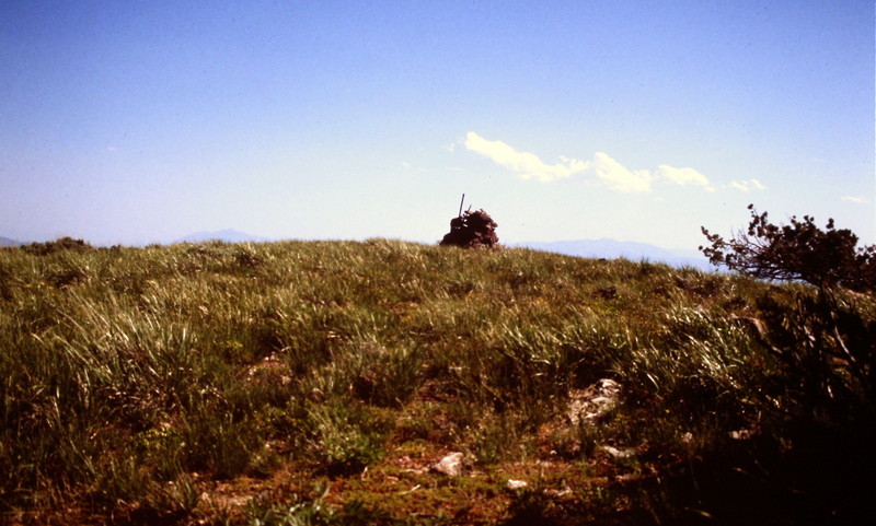
The summit of Bonneville Peak.
Additional Resources
Pingback: Idaho County Highpoints by Andy Martin - IDAHO: A Climbing Guide