Elevation: 6,680 ft
Prominence: 630
This peak is not in the book. Published November 2022
Camas Benchmark is a seldom-climbed peak that is located at the head of the Negro Creek drainage in the Soldier Mountains. This area is a mix of public and private land, so be careful. This hike is entirely on BLM land and is probably the only publicly-accessible route to the summit. USGS High Prairie
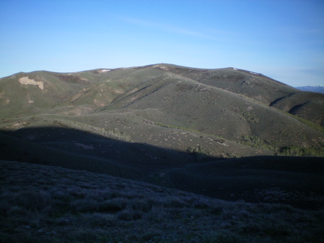
Camas Benchmark (dead center) as viewed from the east. Livingston Douglas Photo
Access
Same as for Peak 6850. This is the final leg of a 2-peak adventure that includes Peak 6850 and Camas Benchmark.
East Ridge, Class 2
The Climb
From the junction of two drainages, skirt the right/north side of the aspen patch and climb a steep sagebrush slope to reach a shoulder that heads left/southwest. Once on the shoulder, follow it southwest up to a ridge juncture and a fence corner. Follow the dilapidated fence row right/northwest as it skirts the top of a large drainage to its right/northeast, does a few minor ups and downs, and reaches the east ridge of Camas Benchmark.
The fence row turns left/west here and goes all the way to the summit. The summit of Camas Benchmark has a triangulation post laying on the ground and no USGS benchmark (though there is a USFS survey marker nearby). The high point is a rocky outcrop and has no summit cairn. From the summit, retrace your ascent route back to the meadow and then climb the west face of Peak 6850. Descend the northeast ridge/east shoulder of Peak 6850 to return to your vehicle at the campsite along Cow Creek Road.
Additional Resources
Regions: Soldier Mountains->WESTERN IDAHO
Mountain Range: Soldier Mountains
Longitude: -115.16949 Latitude: 43.36989