Elevation: 8,124 ft
Prominence: 344
This peak is not in the book. Published November 2020
Castle Peak is located in the Western Centennials and sits on a ridge south of Big Table Mountain. Castle Peak separates the Pete Creek from Castle Creek. It is a relatively short climb from Pete Creek Road/FSR-010. There are many map errors with regard to the roads in this area. FSR-172 (not shown on the USGS topo map) still exists. The USGS topo map shows many old roads in the Castle Peak area but the road placements are erroneous, so ignore them. There are other old roads in this area that do not show up on any maps, so it’s all a bit confusing. When in doubt, use your GPS and go with the topography. USGS Lookout Point
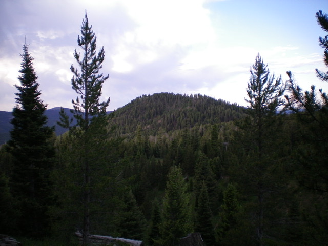
Castle Peak as viewed from the northeast. Livingston Douglas Photo
Access
From its signed junction with West Camas Creek Road/FSR-006 northwest of Kilgore (and 2.0 miles east of Porcupine Pass) drive 2.1 miles up Pete Creek Road/FSR-010 to a road junction and a dispersed camping area. Park here (7,300 feet).
West Face, Class 2
The Climb
From the road junction, follow an old 2-track southeast then south for about 0.5 miles until it ends at a lateral fence row. Hike left/east along the right/south side of the fence row and soon intersect an old jeep road that is now gated and closed to motor vehicles (this may be the side road that goes left-ish/northeast from the road junction where the hike begins). Hike south up this overgrown, grassy 2-track road until it reaches a sharp left/north switchback. Leave the road here and continue south on a well-beaten cattle trail briefly. You are now on the west face of Castle Peak.
Leave the cattle trail (it is going too far south) and scramble left/east up a steep hillside to a forested shoulder. Follow this shoulder upward to reach the north ridge of Castle Peak just below the summit. There are lots of game trails in the forest here to help skirt the blowdown. Hike a short distance to the top. The summit of Castle Peak is open and has a large cairn with a post in it.
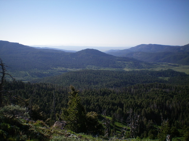
Castle Peak (forested hump in mid-ground) as viewed from the Continental Divide to its west. Livingston Douglas Photo
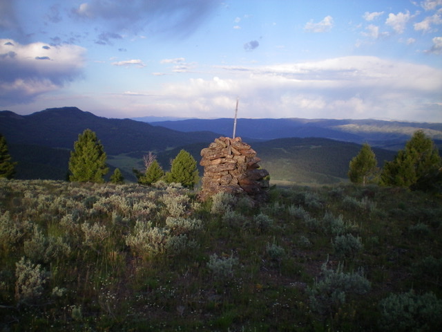
The large summit cairn atop Castle Peak. Livingston Douglas Photo
North Ridge, Class 2
The Descent
From the summit, descend the thick, narrow, forested north ridge (somewhat ill-defined in spots), skirting blowdown by using game trails when available. You will quickly reach a 7,760-foot saddle at the base of the north ridge where there is a junction of two jeep roads. One road crosses the saddle from east to west. A weaker road heads north along the left/west side of the ridge crest (this is old FSR-172). This concludes the first leg of today’s 2-peak journey. Big Table Mountain is next.
Additional Resources
Regions: Centennial Range->EASTERN IDAHO
Mountain Range: Centennial Range
Longitude: -112.04889 Latitude: 44.49179