Elevation: 7,434 ft
Prominence: 1,334
This peak is not in the book. Published January 2023
Cedar Hills HP is a dominating, forested hump and is the high point of the Cedar Hills in the City of Rocks National Reserve. It has a notable 1,334 feet of prominence. Unlike some of its neighbors, the Cedar Hills HP is entirely on public land. This is the third leg of a 4-peak journey that includes Peak 6864, Peak 6888, Cedar Hills HP (7,434 feet), and Peak 6822. The journey covers 8.5 miles with 2,900 feet of elevation gain round trip. USGS Buck Hollow
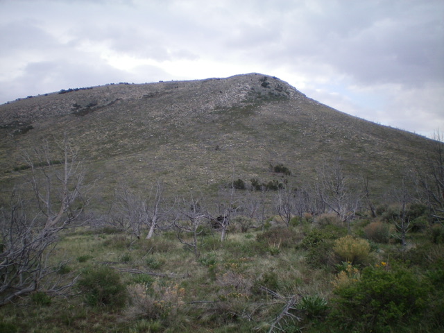
Cedar Hills HP as viewed from the northwest. The summit is just left of center. Livingston Douglas Photo
Access
Same as for Peak 6864. This is the third leg of a 4-peak adventure.
Northwest Face, Class 2+
The Climb
From the 6,500-foot connecting saddle with Peak 6888, scramble up the northwest face on decent scrub and a burnt forest initially. The terrain steepens and changes to a mix of thicker scrub and boulders/talus with more snags and fallen timber. Higher up, the terrain is a tedious combination of white granite boulders and thick brush. Reach the summit ridge at its west end. Scramble east along the ridge crest amongst more boulders and brush to reach the summit. The summit of Cedar Hills HP has the Moulton USGS benchmark on it, some triangulation posts/wiring, and a rebuilt summit cairn.
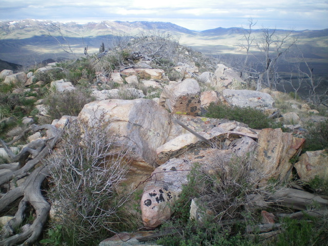
The rocky summit of Cedar Hills. Navigating the white granite blocks is a tedious affair. Livingston Douglas Photo
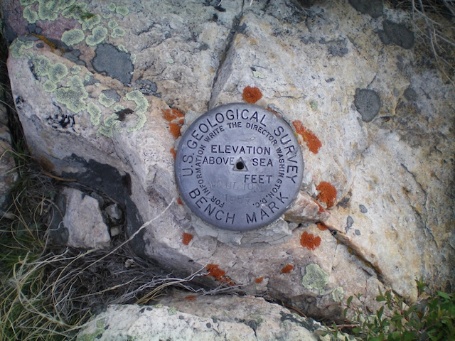
The “Moulton” USGS benchmark atop Cedar Hills. Livingston Douglas Photo
North Face, Class 2+
The Descent
From the summit, descend north down the tedious, somewhat-steep mix of white, blocky granite boulders/talus, thick brush, snags, and fallen burnt timber. The slope eventually relents and the terrain becomes thinner brush and easier scrub with no boulders. Reach a gentle, gravelly/sandy saddle at 6,320 feet. This saddle is the connecting saddle between Cedar Hills HP and Peak 6822. This concludes the third leg of today’s 4-peak journey. Peak 6822 is up next.
Additional Resources
Regions: Albion Range->SOUTHERN IDAHO
Mountain Range: Albion Range
Longitude: -123.7017 Latitude: 41.9985