Elevation: 6,864 ft
Prominence: 364
This peak is not in the book. Published January 2023
Peak 6864 is a double-humped summit on the south side of Twin Sisters Road in the City of Rocks. The west summit is the high point. This area is a mix of private and public land so please obtain permission from the landowner(s) if you plan to cross a section of private land. This is the first leg of a 4-peak journey that includes Peak 6864, Peak 6888, Cedar Hills HP (7,434 feet), and Peak 6822. The journey covers 8.5 miles with 2,900 feet of elevation gain round trip. USGS Almo
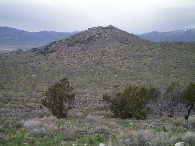
Peak 6864 as viewed from the north. The summit is in dead center and the north gully (ascent route) is just left of center. Livingston Douglas Photo
Access
From the junction of ID-77 and the signed City of Rocks Road south of Almo, reset your odometer and drive 4.0 miles west to reach a signed junction with Twin Sisters Road. Go left/south onto Twin Sisters Road and drive 3.4 miles to a sharp right/west bend in the road at [signed] Emigrant Canyon (left). Park at this junction (6,044 feet).
North Gully, Class 2
The Climb
From the road junction at Emigrant Canyon, cross a high, stiff cattle fence and bushwhack south up a sagebrush shoulder briefly. Head right-ish/southwest across a dry gully to reach a face that leads to the base of the [obvious] north gully. The terrain is gapped sagebrush and is not too steep, so it goes quickly. Once in the north gully, climb it to reach the summit area. The gully is a steeper affair with thicker sagebrush. Stick to a minor shoulder on its right/west side for easier going. Once at the top of the gully, stroll right/west on tundra to reach the cairned summit of Peak 6864.
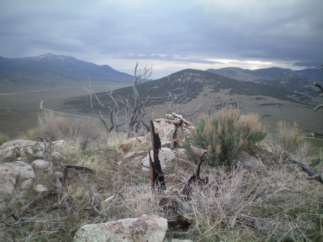
The summit of Peak 6864. Livingston Douglas Photo
South Face, Class 2
The Descent
From the summit, drop south off the ridgeline about 100-150 vertical feet to get back on BLM land. Contour east on the south face below the rugged, rocky southeast ridge then cross the southeast ridge at a flattish, gentle area and descend east to reach an area just below the connecting saddle with Peak 6888. Stay just south of a stiff cattle fence that demarcates the property line between private and public land. This concludes the first leg of today’s 4-peak journey. Peak 6888 is up next.
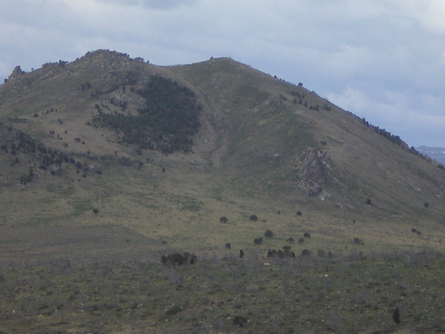
Rocky Peak 6864 as viewed from the southeast. Livingston Douglas Photo
Additional Resources
Regions: Albion Range->SOUTHERN IDAHO
Mountain Range: Albion Range
Longitude: -113.7294 Latitude: 42.0122