Elevation: 5,396 ft
Prominence: 1,136
This peak is not in the book. Published April 2021
Cherry Spring Benchmark is the highest point on Cherry Ridge, which runs north from the Squaw Butte massif for 20 miles. This long ridge has 5 widely-spaced, ranked peaks with Cherry Spring Benchmark crowning its middle. This country is treeless and wide-open for hiking. Unfortunately, private property limits access options to the summit. The summit’s isolated position on the ridge offers an enormous view of the surrounding country. USGS Ola
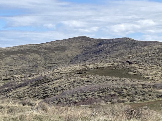
Cherry Spring Benchmark as viewed from the south.
Access
Private land blocks all access from the Sweet-Ola Valley on peak’s east side. Frustratingly, a small parcel of private land impacts the most direct access on the peak’s west side. Primary access to the west side of Cherry Ridge is via the Big Flat/Van Deusen Road which is accessed from Emmett, Idaho. From the ID-16/ID-52 junction in Emmett, take ID-52 north to a 4-way intersection and a stop sign. Continue north through the intersection on Van Deusen Road. At 16.0 miles, you will reach a Y-junction at a stream crossing. The left fork is Fourmile Creek Road. The right fork is the Big Flat Road. Take the right fork. The name of this road changes to the North Crane Road when it crosses the county line. At 11.0 miles from the Y-junction, park alongside the road.
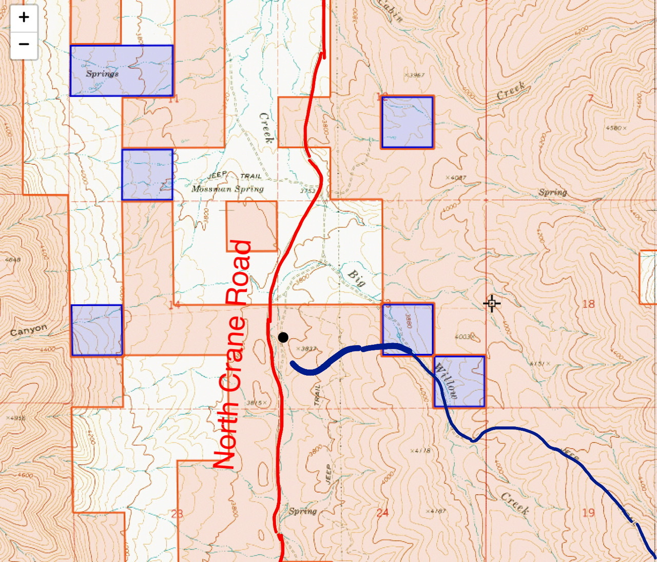
White is private land. Tan is BLM land. Purple is State of Idaho land.
Big Willow Creek/South Ridge, Class 1
A 4WD/ATV road leads all of the way to the summit of Cherry Spring Benchmark. Unfortunately, posted private land blocks the beginning of the road (see the land status map below). From the parking spot, the route leaves the road, crosses the range fence and climbs a small hill. Drop off the hill and descend to the 4WD road shown on the USGS Ola quadrangle. Follow the road to the summit. The route is just over 10.0 miles round trip with just under 1,800 feet of elevation gain to the summit.
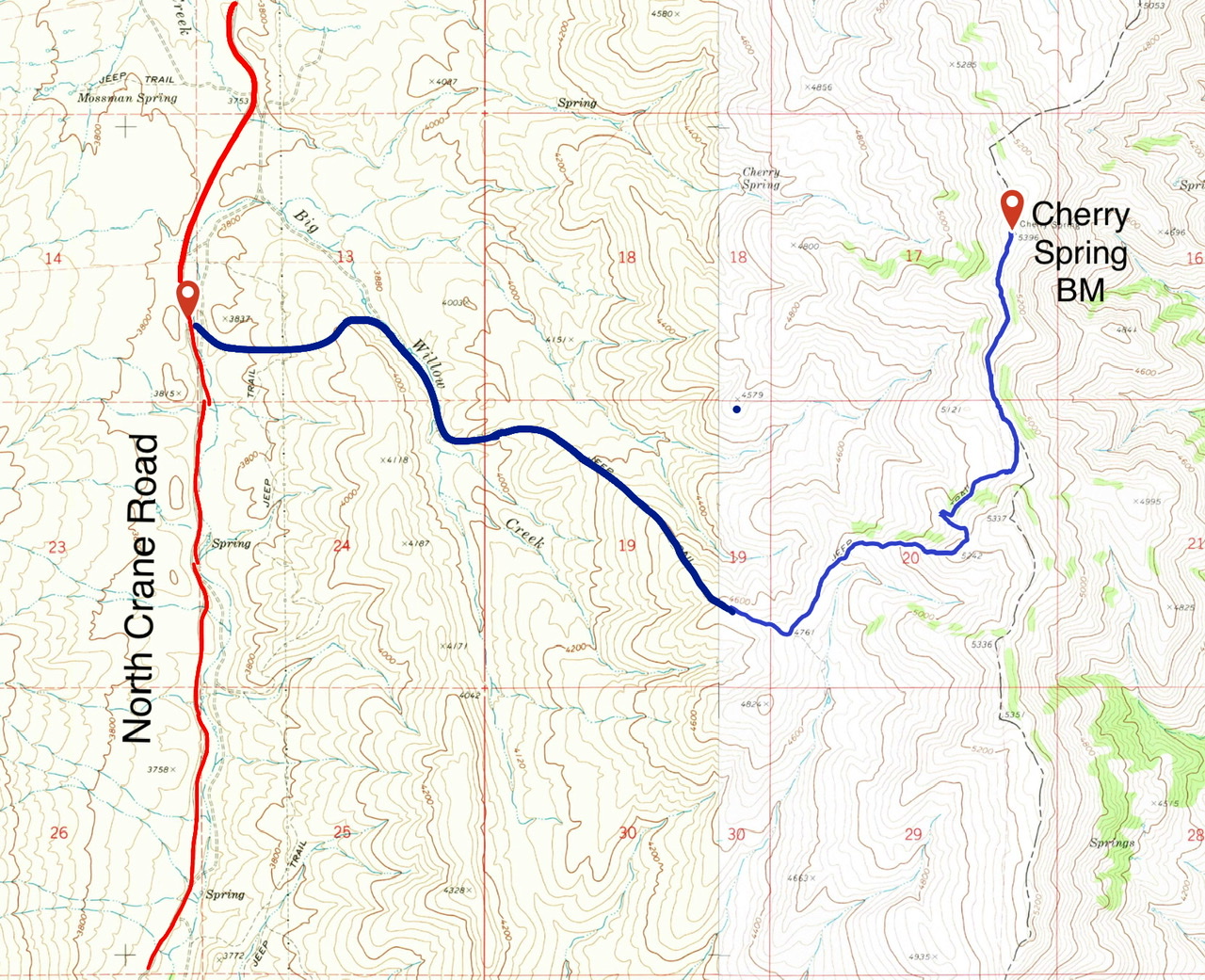
The route. Once you reach the road east of the private land, you discover that it is drivable by 4WDs and does get some vehicle use.
Other Options
I talked with a ranch hand who told me that an ATV track leads to the top of Cherry Ridge from Cabin Creek and then follows the ridge south to the summit. He reported that there were no private property issues. Cabin Creek is a little over a mile north of the Big Willow Creek/South Ridge parking spot. The road he mentioned is not mapped and was not obvious to me. Please let me know if you climb this route.
Additional Resources
Regions: West Mountains->WESTERN IDAHO
Mountain Range: West Mountains
Year Climbed: 2021
Longitude: -116.35539 Latitude: 44.20289