Elevation: 5,635 ft
Prominence: 694

Climbing and access information for this peak is on Pages 55-56 of the book. Published September 2018.
This peak is located west of US-95 and north of South Chilco Mountain. At one time, this former fire lookout site was designated as the highest point in the Chilco Mountains Subrange of the Couer d’Alene Mountains. New measurements give that honor to South Chilco Mountain and the name Chilco Mountain is disappearing from use.
The peak’s career as a fire lookout started in 1931 when a camp was set up on the summit. In 1939, a tower was built. Sometime before 1959, the tower came down. Today you will find sparse debris from the lookout on the summit. USGS Bayview
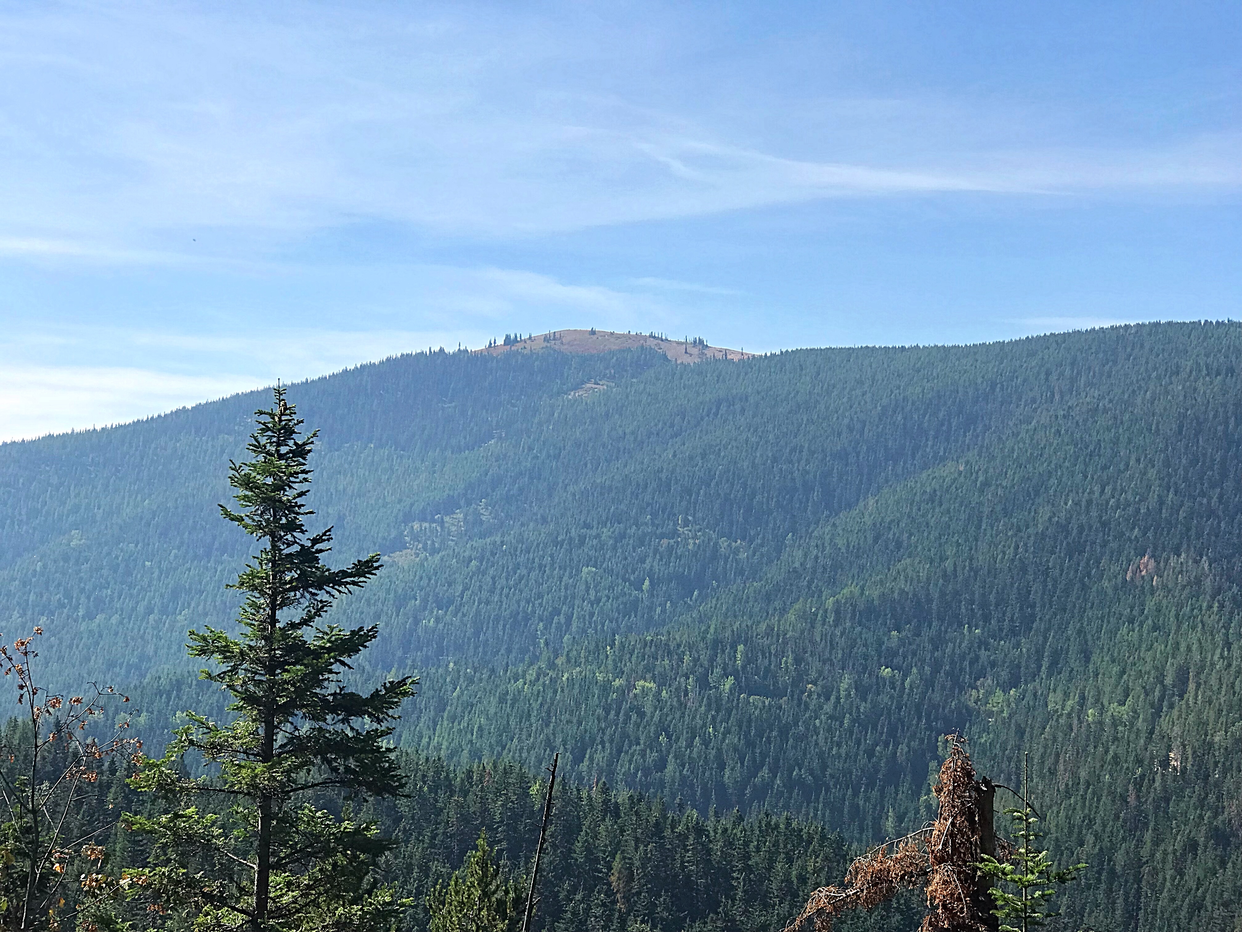
North Chilco Mountain as viewed from Prospect Peak.
Access
Leave US-95 at the Silverwood Theme Park (Exit 446) and follow Bunco Road east for 2.6 miles. Bunco Road turns north/right at this point for 1.0 mile and then turns east again. Continue on this paved road until it turns into well-graded FS-332. Continue on FS-332 for a total of 13.7 miles from US-95 to the trailhead at the junction of FS-332 and FS-385. There is no sign identifying the trailhead.
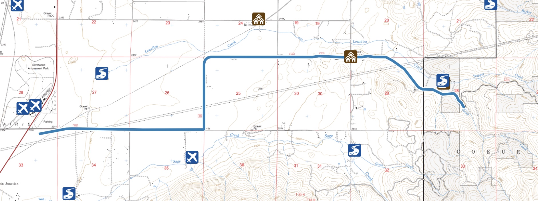
Bunco Road access to FS-332.
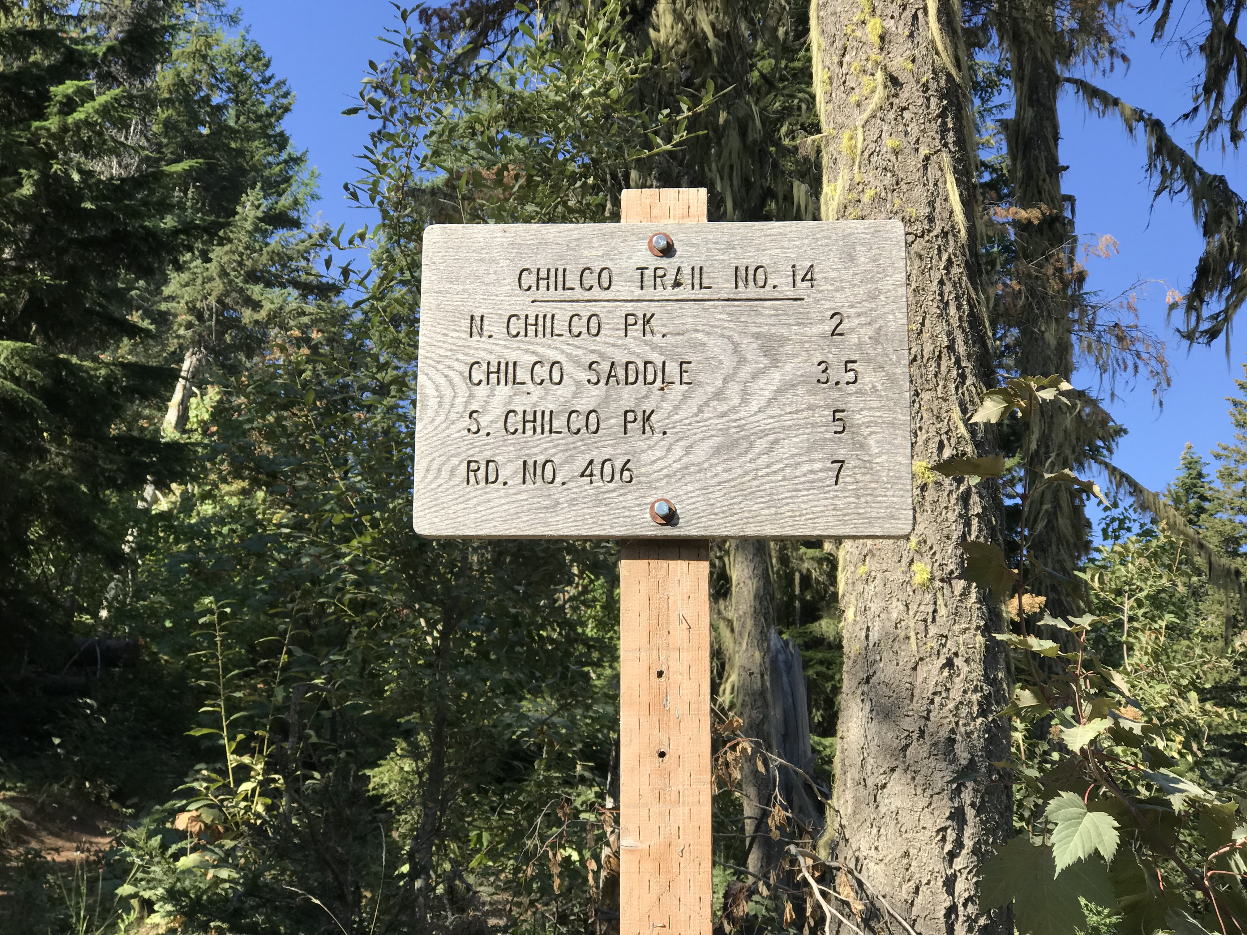
Chilco Mountain National Recreation Trail, Class 1
The trail starts in the southwest corner of the intersection. It is a well-maintained, albeit steep, trail. The trail climbs to the bald summit in 1.7 miles gaining 1,400 feet in elevation through a dense forest. About 0.25 mile below the summit, the trail reaches the ridge top and a signed junction. The main trail continues on toward South Chilco Mountain. A short side trail leads to the summit of North Chilco Mountain.
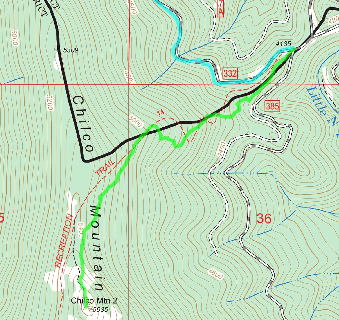
My GPS track.
My GPS measured the distance at 1.7 miles.
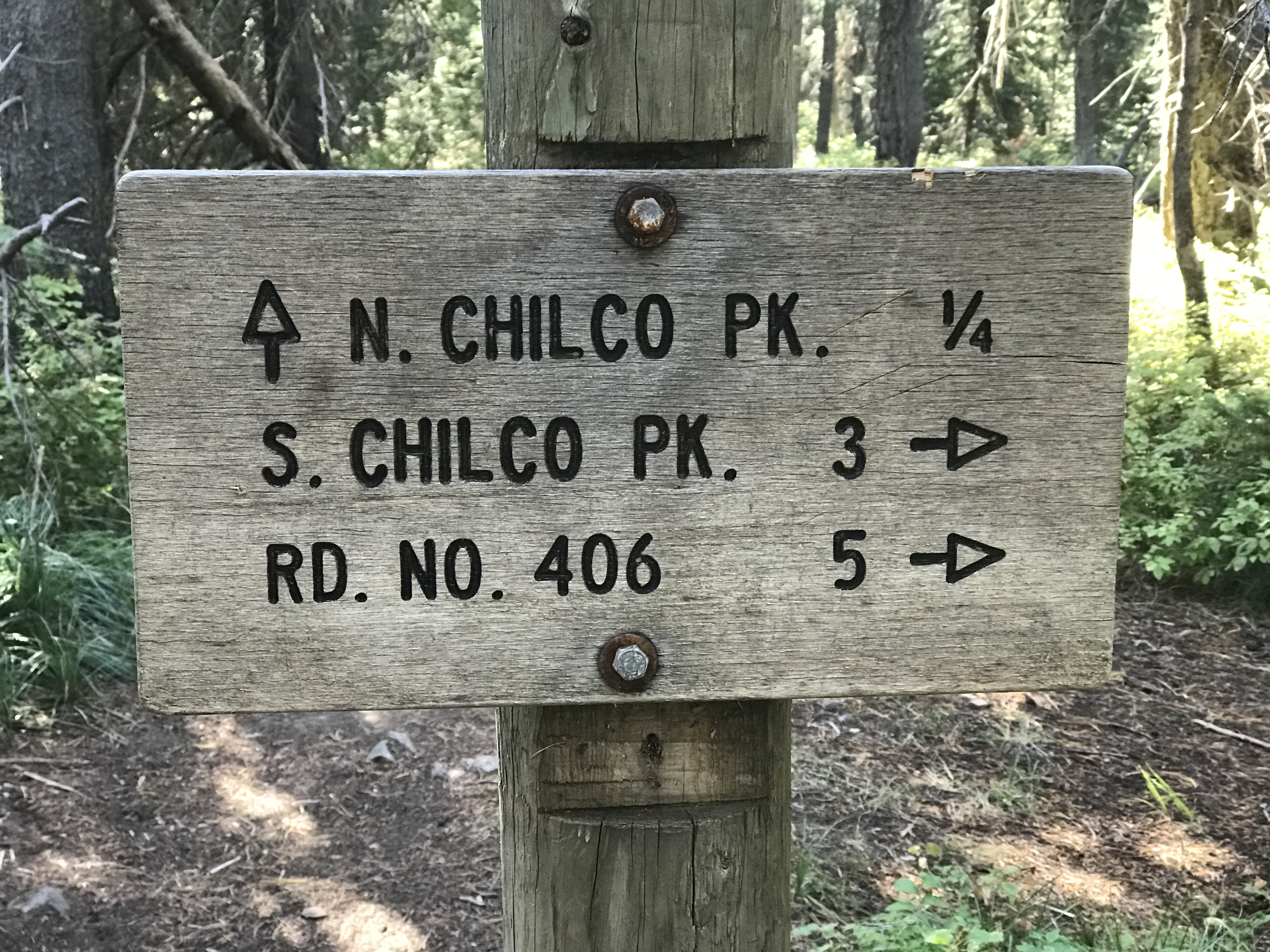
The trail junction 0.25 mile from the summit.
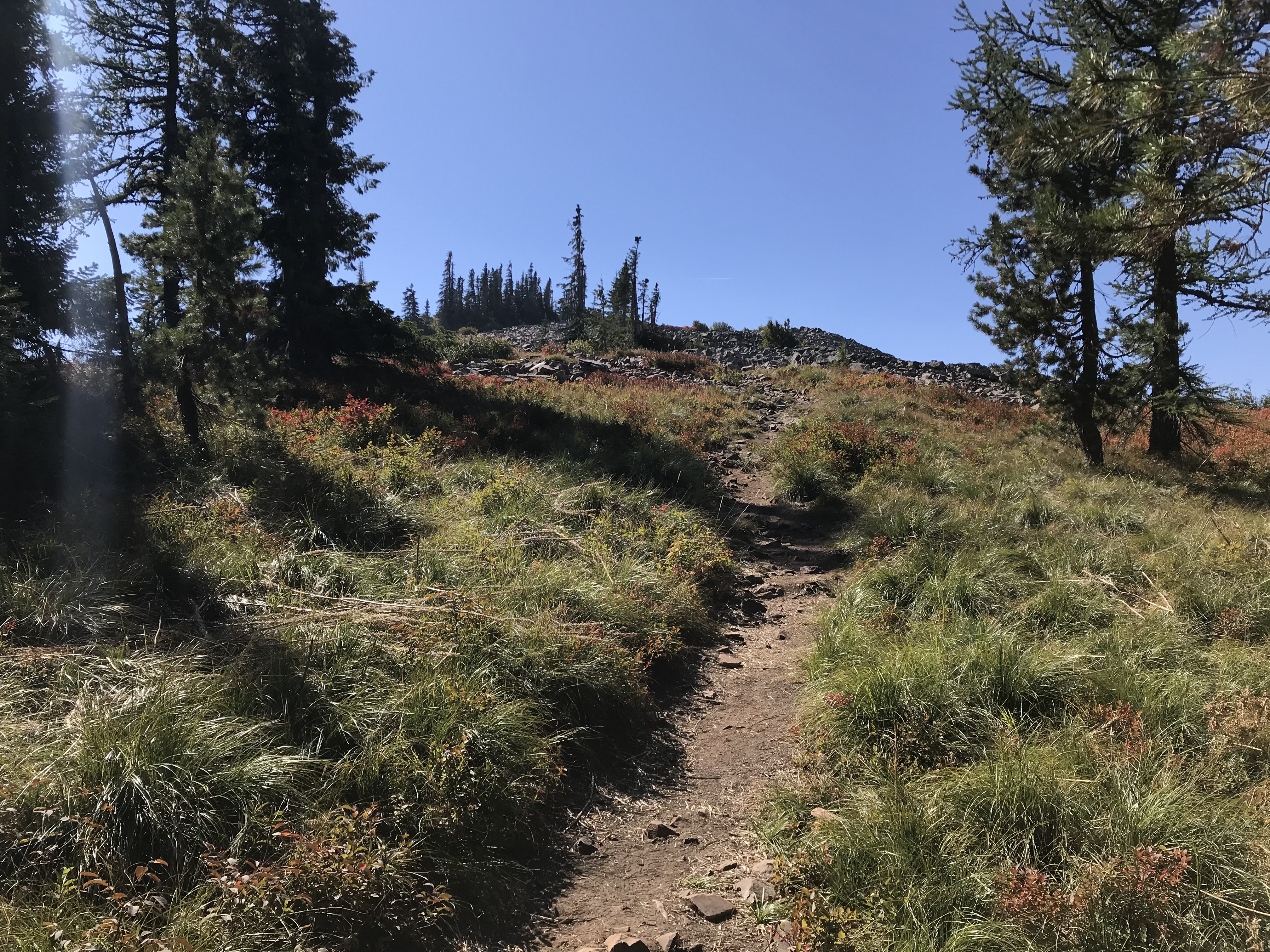
The trail breaks out of the trees just past the trail junction.
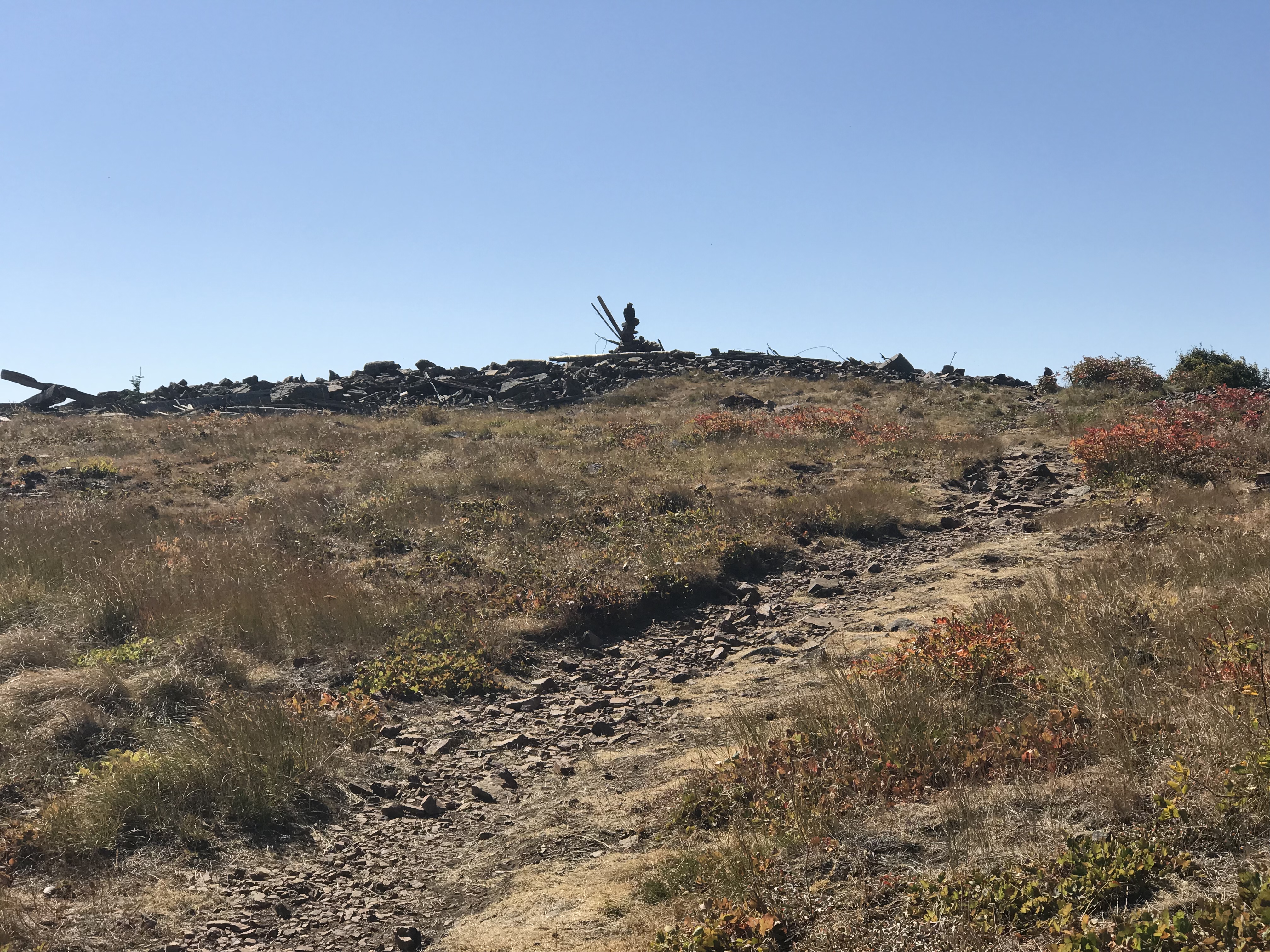
The summit. Huge views on clear days.
Additional Resources
Regions: Coeur d'Alene Mountains->NORTHERN IDAHO
Mountain Range: Coeur d'Alene Mountains
Year Climbed: 2018
Longitude: -116.53019 Latitude: 47.89159