Elevation: 6,772 ft
Prominence: 517
This peak is not in the book. Livingston Douglas’ narrative covers the traverse from Peak 6725. I have added a map, photo, and alternative route information. Updated November 2021
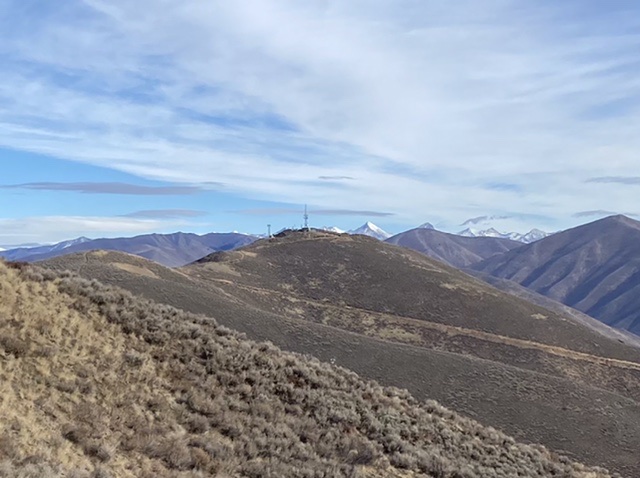
Della Mountain is an antenna-clad peak that towers over nearby Hailey, ID. It sits above Croy Creek, the Wood River, and Colorado Gulch. Its east face is intimidatingly steep. The easiest ascent route is via an old jeep road coming up its southwest ridge by traversing over from Peak 6725. USGS Bellevue
Della Mountain as viewed from Peak 6725
Southwest Ridge, Class 1
Access
Same as for the south ridge of Peak 6725. This is the final leg of a ridge traverse from Peak 6725 to Della Mountain.
The Climb
From the connecting saddle, follow a jeep road as it climbs northeast to a ridge hump then continues northeast to the true summit. The summit has three radio towers on it and a USGS benchmark in a ground boulder. It has a stunning aerial view of Hailey, ID.
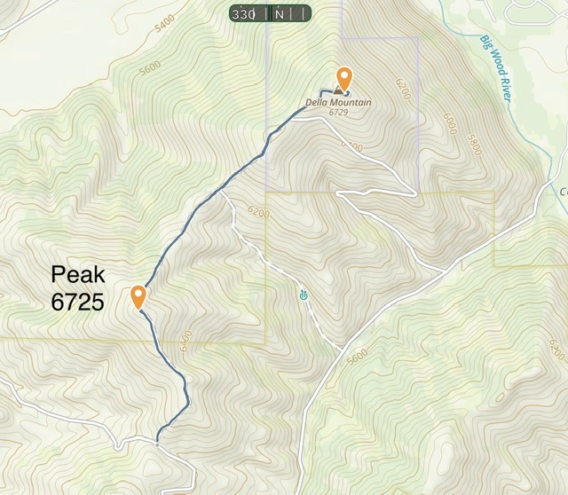
The traverse covers 3.24 miles with 1,100 feet of elevation gain round trip.
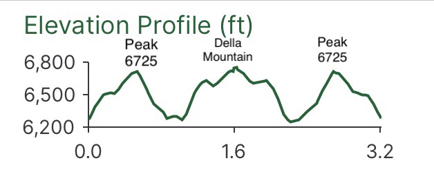
The elevation profile for the round trip. Yes, you get to climb Peak 6725 twice.
Alternative Routes by Tom Lopez
With a 4WD and dry, snow free conditions, you can drive to the summit. The Colorado Gulch Road, that begins in Croy Canyon, crosses the pass where the route described above begins and the drops down into Colorado Gulch. The road eventually reaches the Big Wood River where it ends as a result of a missing bridge. The road can be driven down Colorado Gulch to the access road that leads to the summit. A few people have climbed the peak by wading the Big Wood River when the water is low and following the Colorado Gulch Road and the access road to the summit.
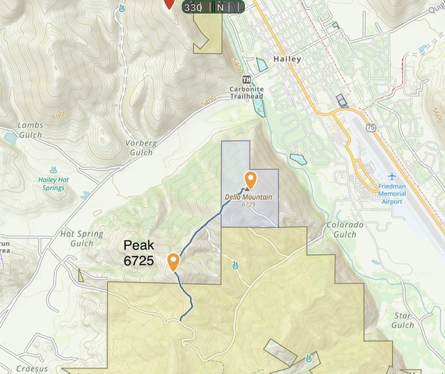
This map shows the entire Colorado Gulch Road and the Della Mountain access road.
Additional Resources
Regions: Smoky Mountains->WESTERN IDAHO
Mountain Range: Smoky Mountains
Longitude: -114.32159 Latitude: 43.50329