Elevation: 6,725 ft
Prominence: 453

This peak is not in the book. I added a map/GPS track to the original posting. Updated November 2021
Peak 6725 is a ranked summit on the same ridge as its [slightly-higher] sister to the north, Della Mountain (6,772 feet). The easiest ascent route is via a spur road coming up from Colorado Gulch Road to the south. This peak is located on private property which is currently open to the public. Yes, this is a road hike, albeit a steep one in spots. USGS Bellevue
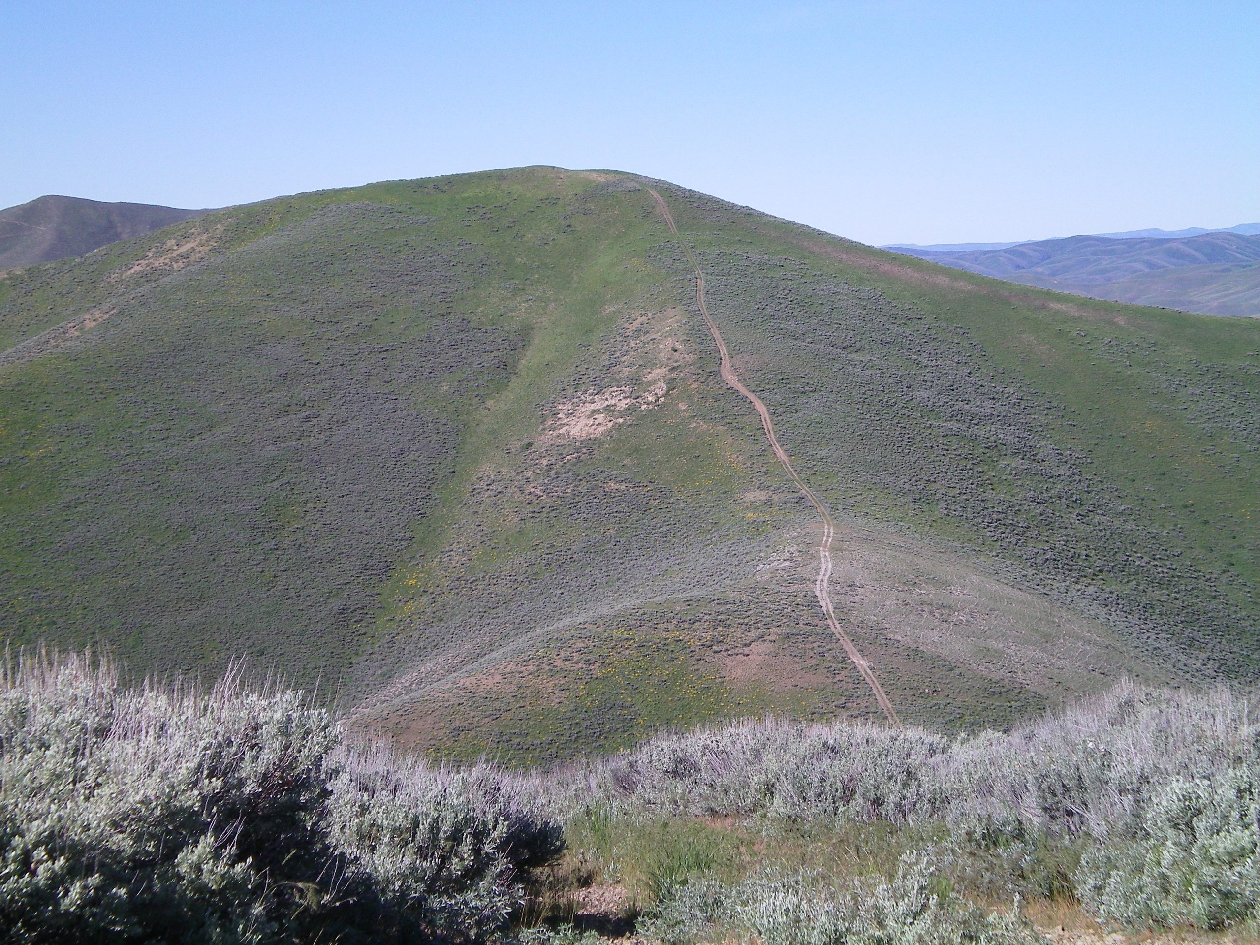
Peak 6725 as viewed from high on Della Mountain. An old jeep track weaves its way up the northeast ridge. Livingston Douglas Photo
South Ridge, Class 1
Access
From the junction of ID-75 and Bullion Street in downtown Hailey, drive west on Bullion Street. It becomes Bullion Road and then Croy Creek Road. It bends southwest to follow Croy Creek upstream for quite a number of miles. From ID-75, drive west on Bullion Street/Bullion Road/Croy Creek Road for 2.7 miles to reach Colorado Gulch Road (signed).
Turn left/southeast onto Colorado Gulch Road and drive 1.5 miles up a steep, somewhat-rutted, dried mud road to reach a narrow pass. Park just off the road here (6,272 feet). This is the high point for Colorado Gulch Road before it drops rapidly down to the Wood River. The bridge across the Wood River is washed out and has not been replaced.
The Climb
From the pass, follow the eroding jeep road as it steeply climbs northeast then north to the gentle, open summit of Peak 6725. This ascent climbs 0.5 miles and gains 418 feet. To continue on to Della Mountain, descend the peak’s northeast ridge.
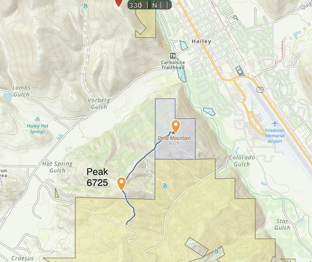
From the pass to Peak 6725 and Della Mountain and back covers 3.25 miles with 1,100 feet of elevation gain. This overview shows the land ownership pattern. BLM = yellow, Blue = State of Idaho.
Northeast Ridge, Class 1
Access
Same as for the south ridge. This is the first leg of a ridge traverse from Peak 6725 to Della Mountain (6,772 feet).
The Descent
From the summit, follow a deteriorating jeep road northwest along the ridge crest as it descends steeply to a saddle at 6,255 feet. This is the connecting saddle between Peak 6725 and Della Mountain.
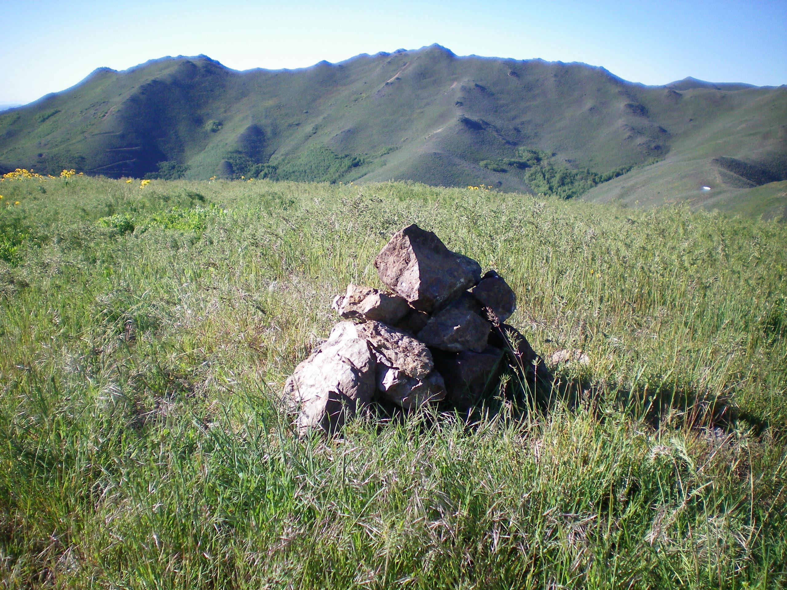
The summit cairn atop Peak 6725, looking north. Livingston Douglas Photo
Additional Resources
Regions: Smoky Mountains->WESTERN IDAHO
Mountain Range: Smoky Mountains
Longitude: -114.33501 Latitude: 43.49301