Elevation: 12,197 ft
Prominence: 5,387
Climbing and access information for this peak is on Page 308 of the book. This update includes a lot of photos as well as information on climbing the peak from the west. Dan Paulson provided a photo essay showing the entire East Ridge Route. Use the link below to read Rick Baugher’s discussion of the peak’s early history.
Diamond Peak is the highest peak in the Lemhi Range. It is located in the Caribou-Targhee National Forest, except for a portion of its West Side, which lies in the Challis National Forest. Diamond Peak is the 4th-highest peak in the State of Idaho and is the only 12er in the Lemhi Range. Diamond Peak is one of 3 peaks in Idaho (the others being Borah Peak and He Devil) that have over 5,000 feet of prominence. Diamond Peak ranks #43 of 57 summits in the Lower 48 States in this category. USGS Diamond Peak
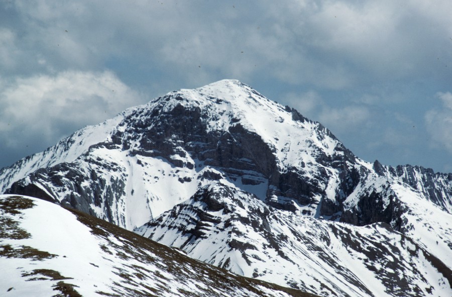
The great and unclimbed North Face of Diamond Peak. Larry Prescott Photo
Back in 1981, when I climbed the peak, no one was talking about climbing all of the 12,000-foot Idaho peaks. Consequently, Diamond Peak was seldom climbed. Since that time, the peak has gained in popularity, especially among the 12ers, because of its straightforward eastern approach, its proximity to cities on in Eastern Idaho (Idaho Falls, Rexburg, and Pocatello), and growth of outdoor recreation programs at BYU-Idaho and Idaho State University.
The peak’s East Ridge is the standard route. It is a classic line that should not be overlooked. I have included a few photos from my 1981 climb of that route below. Farther down, you will find the entire route documented in a photo essay by Dan Paulson. Please also see Larry Prescott’s excellent photo essay on the East Ridge Route.
East Ridge Access by Ken Jones
From Idaho SR 28, take the signed Pass Creek Road (north of Blue Dome site) westward. At 1.8 miles, a fork to the right immediately fords Pass Creek and climbs above the creek, then turns north. Follow the main track keeping right at 3.4 miles and passing through a gate. Stay on the main track as it winds northerly and westerly, and enters Targhee National Forest (gate and sign) at about 6 miles. Half a mile further, you are in Section 29 (see the 1987 Diamond Peak 7-1/2″ quad) at the 4WD junction from the road.
From here, the high clearance road becomes rough jeep tracks. The routes have numbered signs, which I did not write down. You want to head south, keep left at the first junction, cross the North Fork Pass Creek (dry when we were there, and the mapped 4WD tracks up and down the creek were obscure) and climb up to the south. Turn right in the lower middle of Section 32. We followed this track to the closed 8000′ contour and parked there; there is a sign in the immediately adjacent saddle indicating “RTE CLOSED” beyond this point. This drive was definitely 4WD only, and a passenger sedan might not have got beyond the 1.8 mile mark.
East Ridge Route, Class 3
This is the Standard Route. The top half of the route is a sustained Class 3 climb. Stay as close as possible to the ridge crest—as the terrain on both sides of the crest quickly becomes Class 5 difficulty. BE CAREFUL
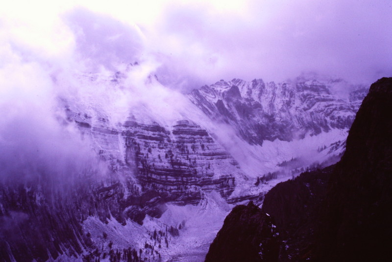
The West Face of Diamond Peak on the day before my November 1981 climb.
It was almost Winter when we climbed the peak. Though there was a lot of snow in the canyon to the south, the East Ridge was blown mostly clear of snow.
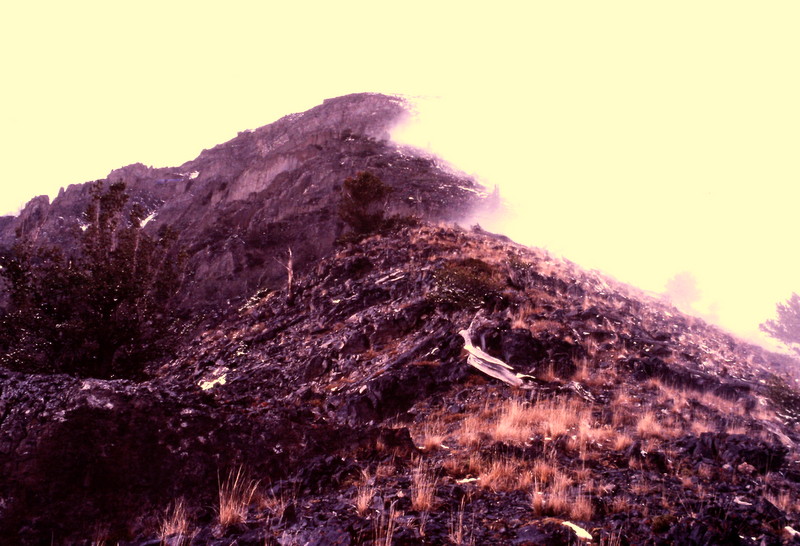
Starting up the peak’s East Ridge (November 1981).
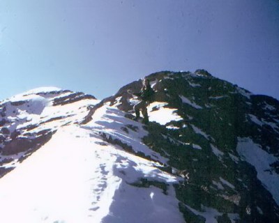
The East Ridge of Diamond Peak (November 1981).
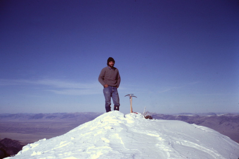
The summit of Diamond Peak (November 1981). Notice the climbing attire of the day.
East Ridge Route Photo Essay
by Climber and Photographer, Dan Paulson
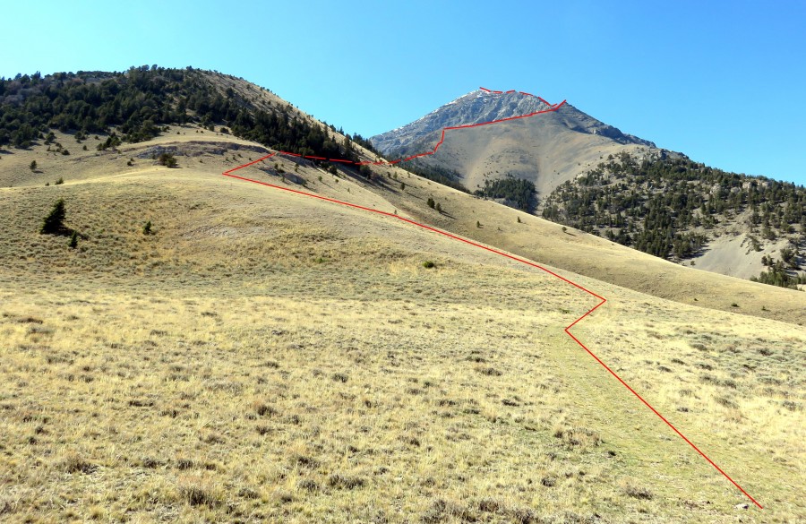
The East Ridge Route begins by climbing out of the Birch Creek Valley.
Another view of the lower route in the foreground. The Upper East Ridge is on the skyline climbing from right to left. Dan notes: “Once you find your way through the trees and get into the saddle where you finally get a good view of The Riddler, this is what you see when you look at your path. Follow the best way through the trees to the start of the trail up the talus slope. This is a fairly short talus slope. The ridgeline is less steep and more firm once you top out above the talus.”
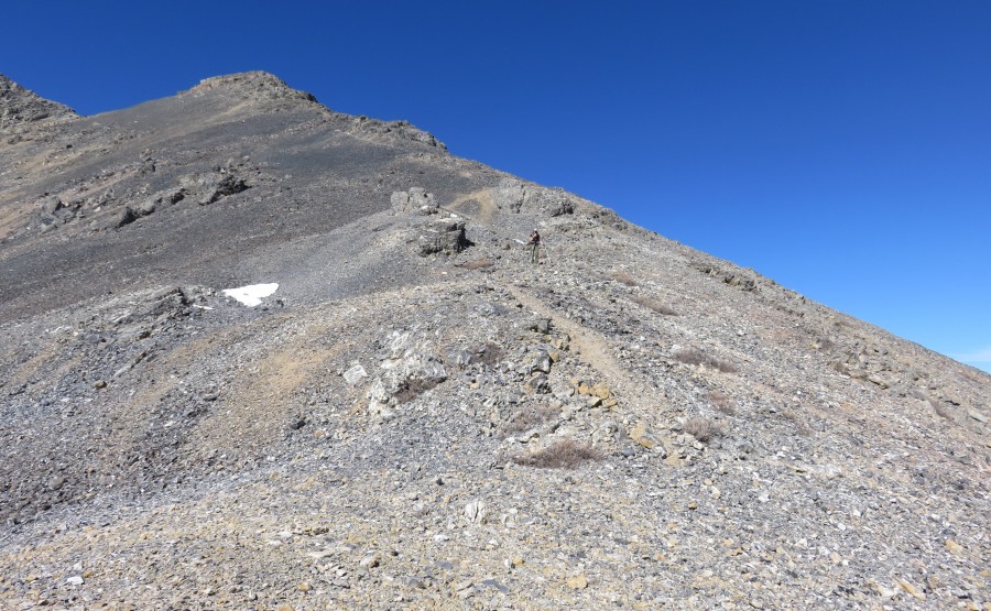
The ridge is a talus slog in its mid-section.
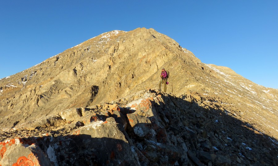
Moving up the East Ridge.
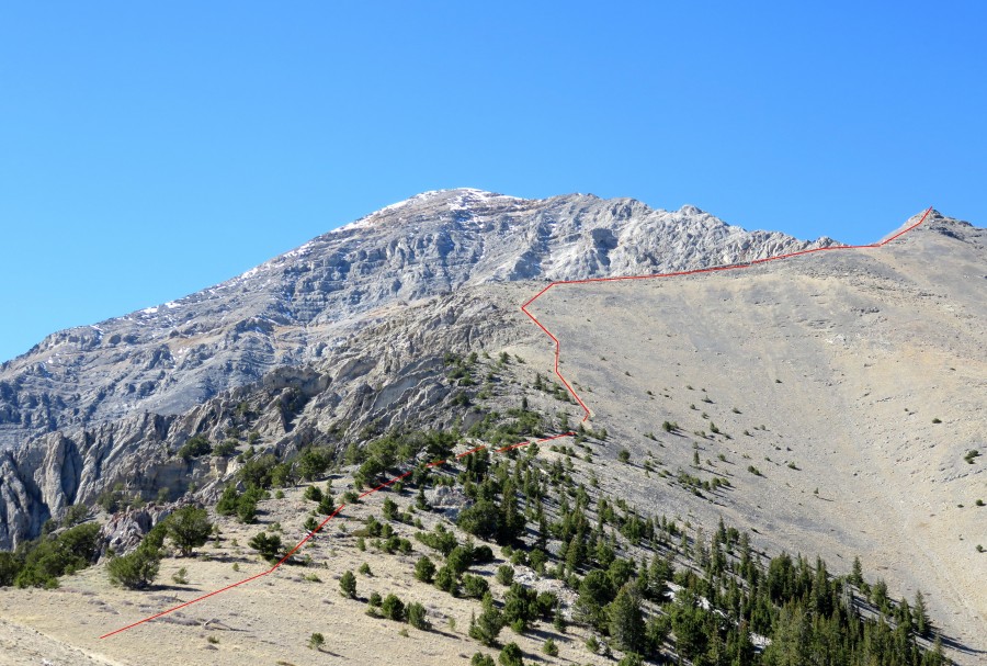
The Upper East Ridge.
The Upper East Ridge is a rocky rib. You should be able to find a Class 3 route up the ridge, but keep in mind that there is a lot of Class 4 territory. Be careful where you tread.
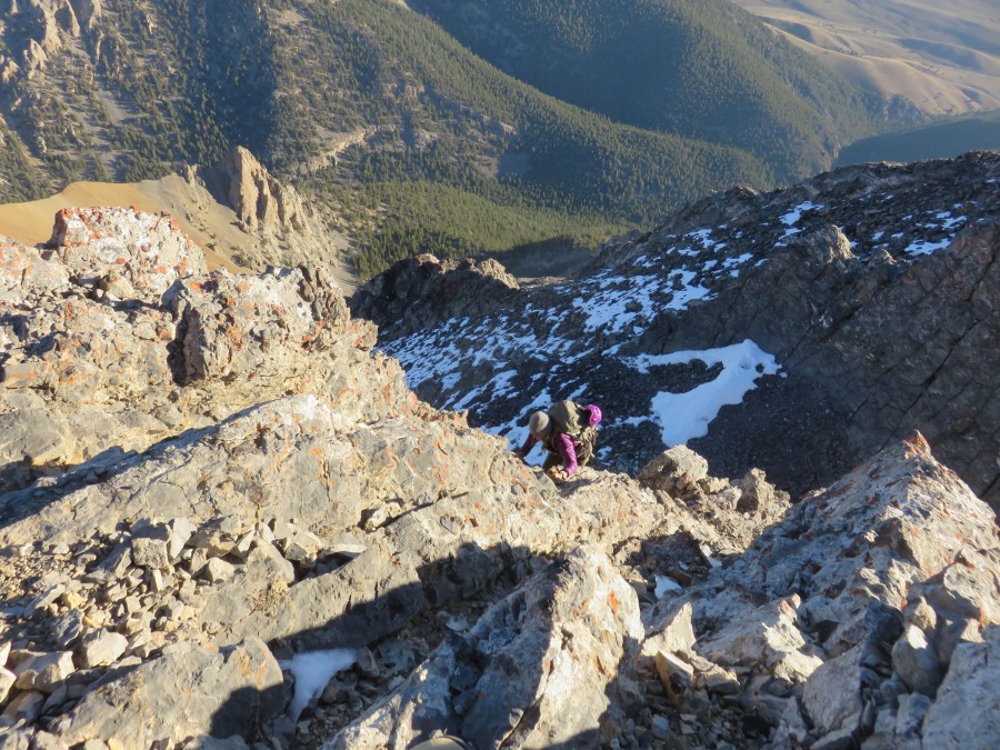
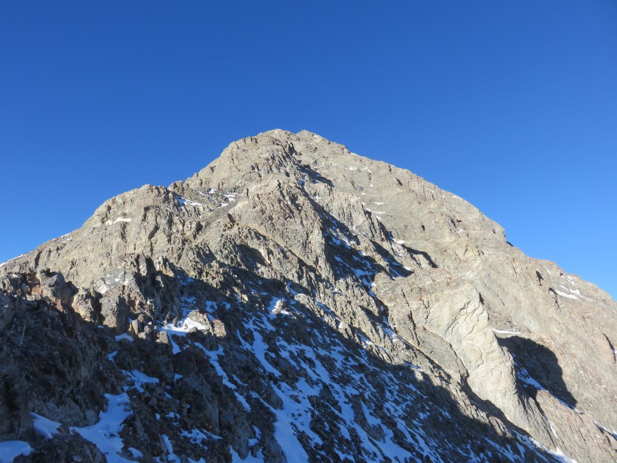
The East Ridge is one of the longest, pure ridge routes in Idaho.
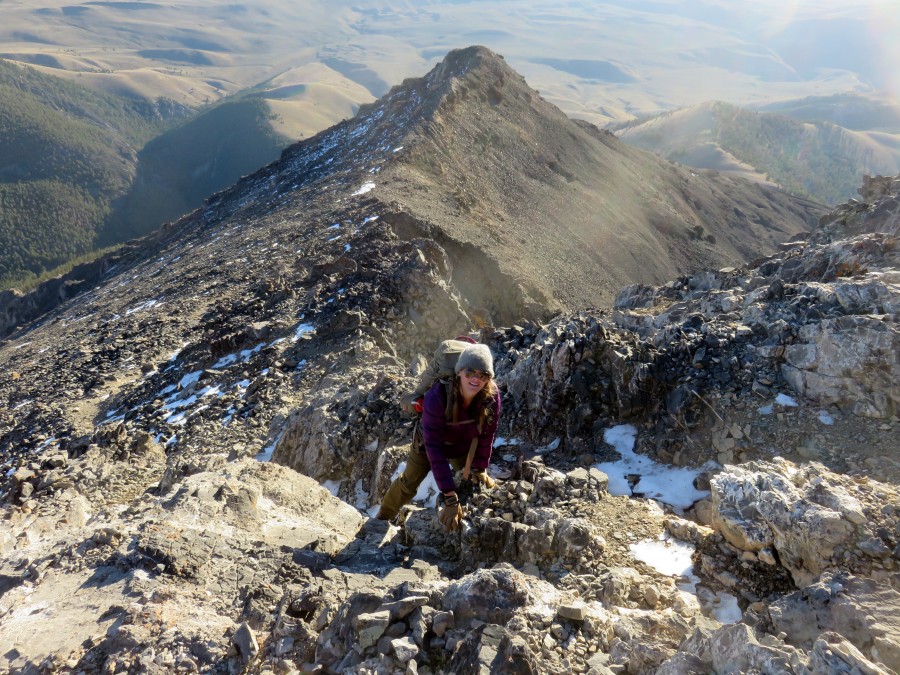
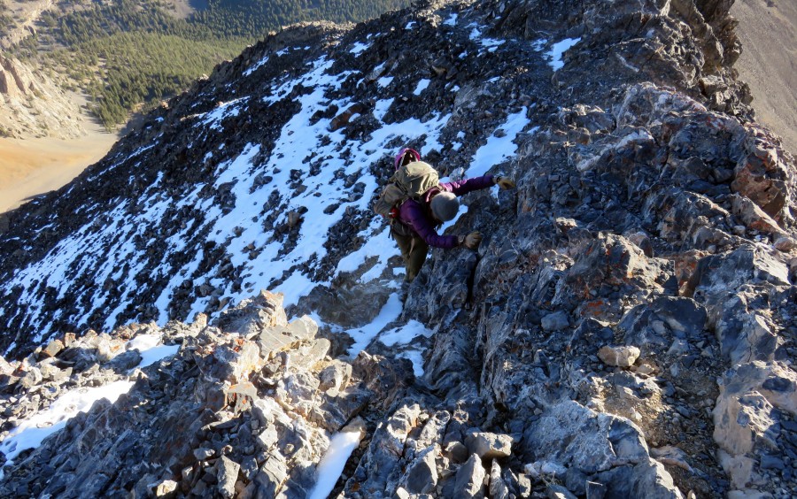
Misty Broesicke enjoying classic ridge climbing at its best.
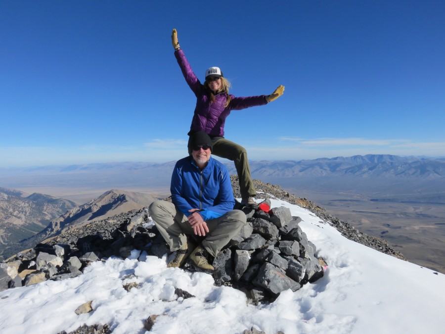
Dan Paulson and Misty Broesicke on the summit.
West Side Route, Class 3
Not many people climb the peak from the west because it involves a steep scree climb. Here is a West Side Route photo courtesy of Zach Vickery.
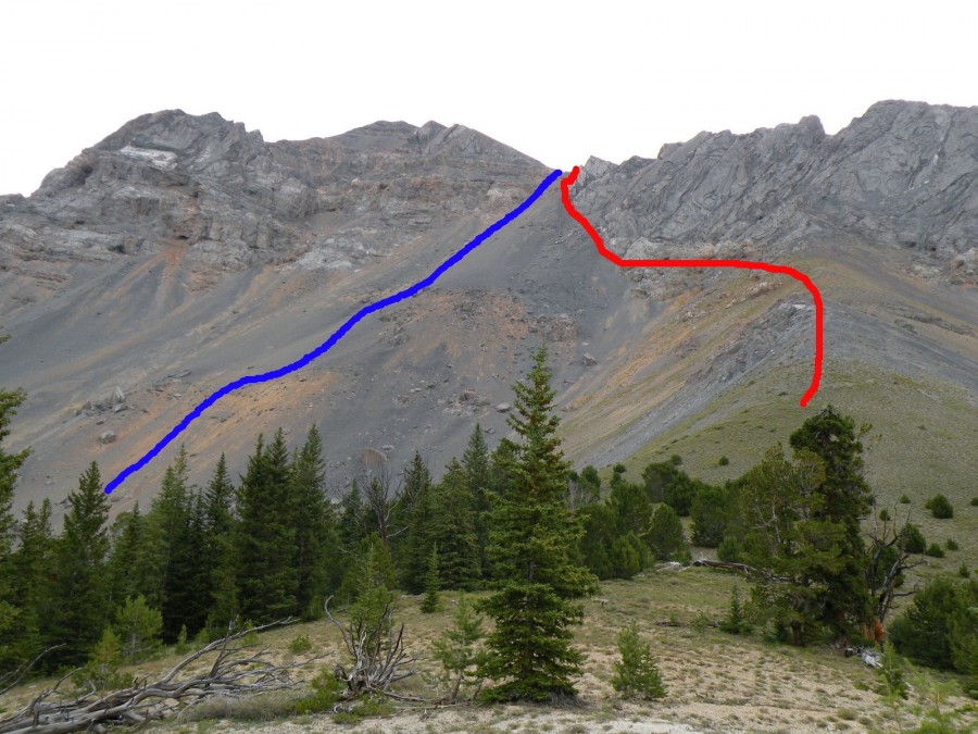
Ascending the West Side of Diamond Peak involves a classic talus climb. The red line is the ascent route and the blue line is the descent route taken by Zach Vickery and Matt Durant. Zach Vickery Photo
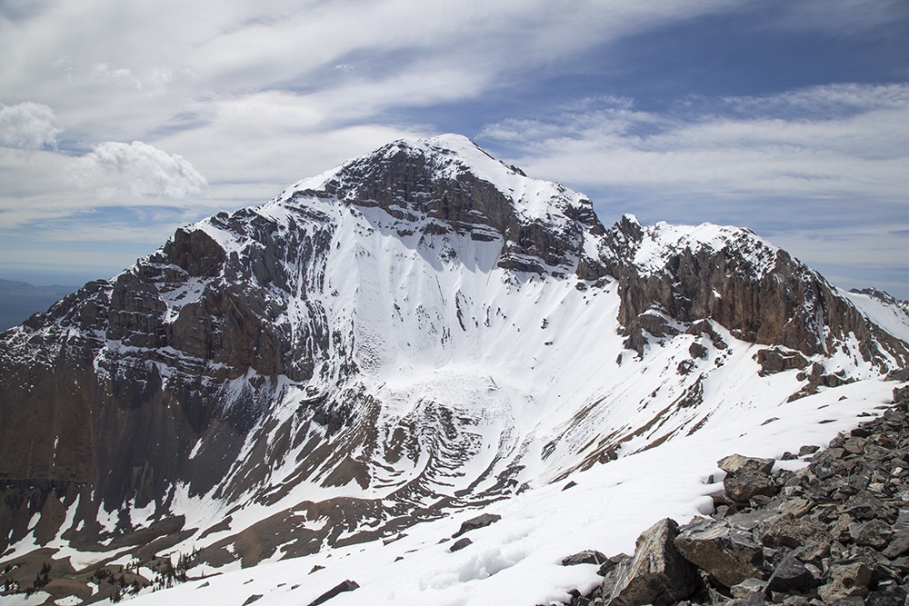
More Views of Diamond Peak
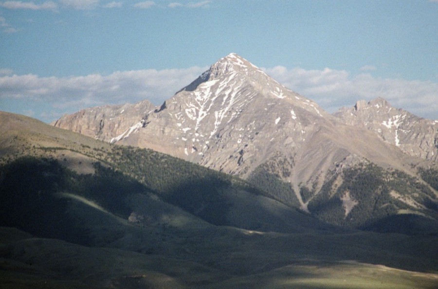
Diamond Peak as viewed from Italian Peak.
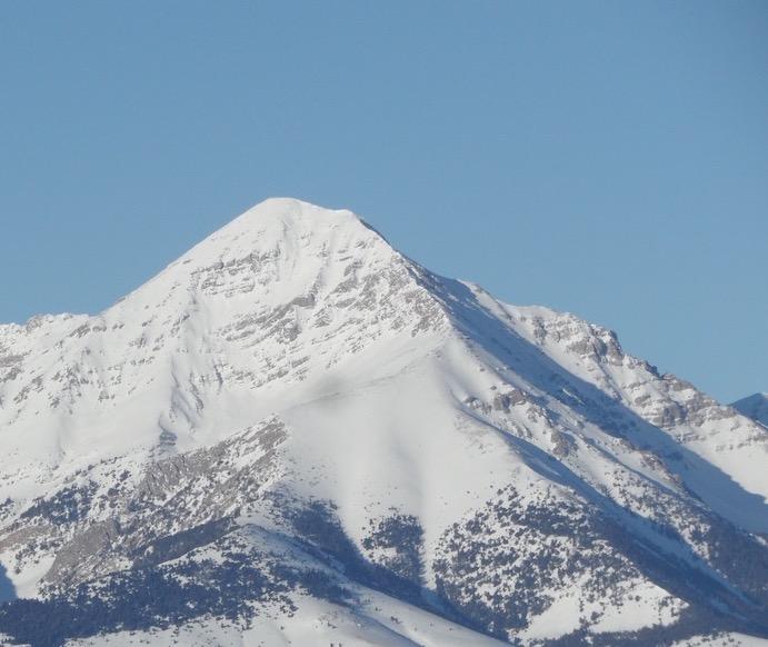
Diamond Peak as viewed from Copper Mountain (February 2017). John Platt Photo
Return to the Idaho 12ers page.
Additional Resources
Regions: EASTERN IDAHO->Lemhi Range
Mountain Range: Lemhi Range
Year Climbed: 1980
Longitude: -113.082778 Latitude: 44.14667
Pingback: Idaho County Highpoints by Andy Martin - IDAHO: A Climbing Guide
Pingback: From Diamond Peak to Hyndman Peak: Kelly Lance’s 12er Traverse by Tom Lopez - IDAHO: A Climbing Guide
Pingback: My Class Essay – hoganoutletols
Pingback: Southern Lemhi Traverse by Daniel Todd - IDAHO: A Climbing Guide