Elevation: 9,070 ft
Prominence: 577
Climbing and access information for this peak is on Page 120 of the book. Published August 2019
Dixie Mountain is located north of Yellow Pine, Idaho. The peak is part of an impressive ridge system that runs between Profile Gap and Elk Summit. While this ridge is not found within the Frank Church River of no Return Wilderness, it is every bit as wild and impressive as anything found in the Wilderness. USGS Profile Gap
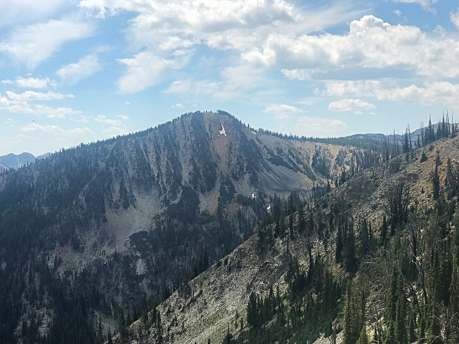
Dixie Mountain as viewed from the ridgeline connecting it to Mount Eldridge.
Access
[(B)(3.2) on Page 137]
South Ridge/Western Slopes, Class 2+
This is not the route recommended in the book, which begins at Profile Gap. This route begins with an ascent of Mount Eldridge and then follows the connecting ridgeline to Dixie Mountain’s West Slopes. While the walk is strenuous, it only encounters a few obstacles along the way.
The ridge connecting Eldridge and Dixie forms an arc and loses 588 vertical feet (788 vertical feet from the summit of Mount Eldridge) to the connecting saddle and then gains 563 vertical feet to the broad summit of Dixie Mountain. The distance is 2.1 miles if you start on the summit of Mount Eldridge. There is one rocky cliff structure along the way to bypass on its east side. Otherwise, the only obstacles are downed trees and a few areas of talus.
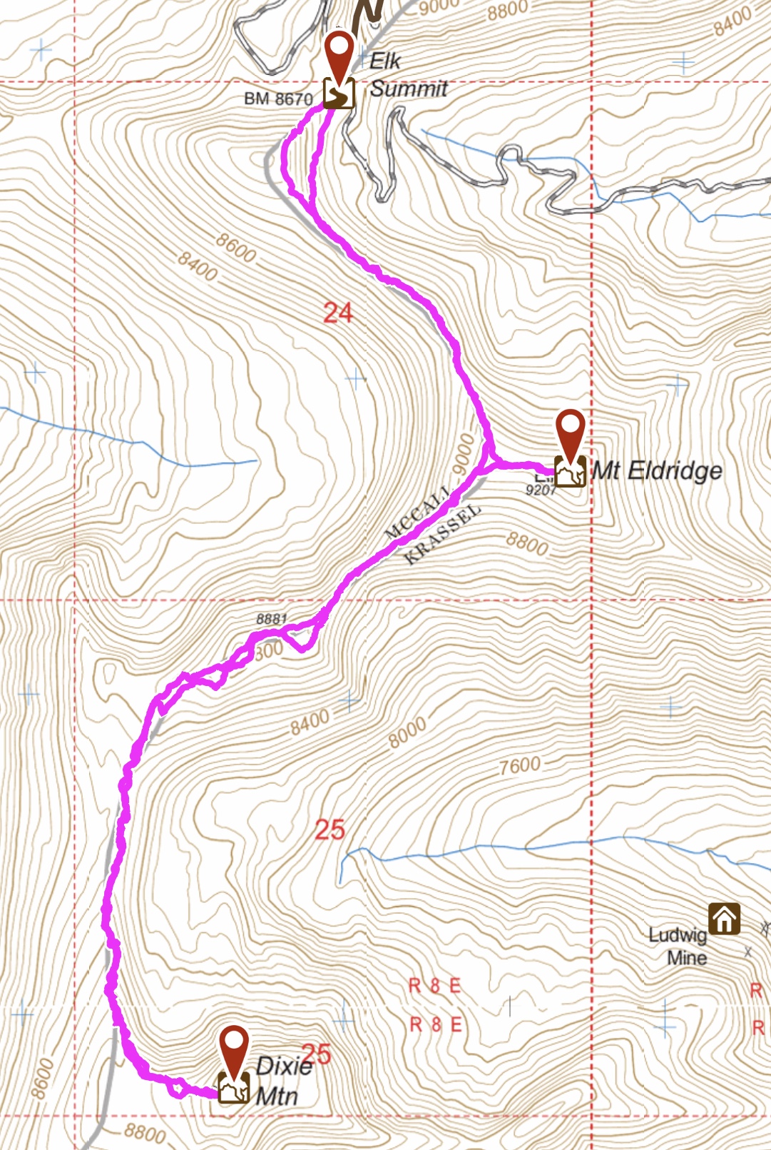
My GPS track for the route to Mount Eldridge and Dixie Mountain.
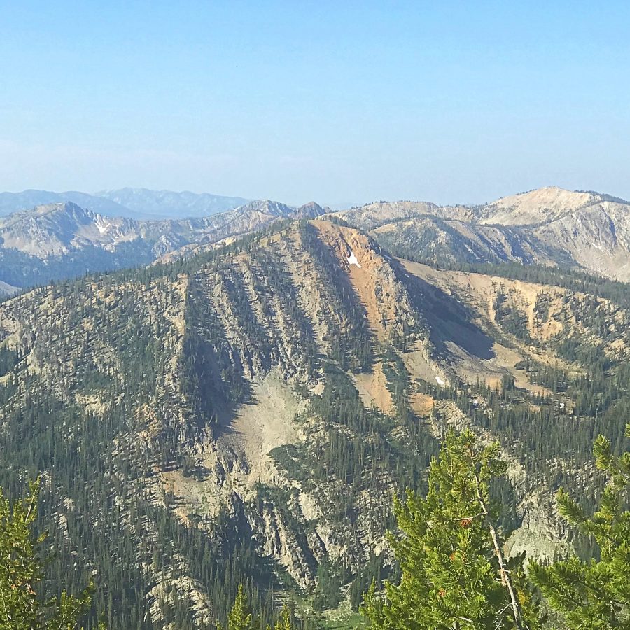
Dixie Mountain as viewed from the summit of Mount Eldridge.
Additional Resources
Regions: Big Creek to Red Ridge Peaks->Central Salmon River Mountains->Salmon River Mountains->WESTERN IDAHO
Mountain Range: Central Salmon River Mountains
Year Climbed: 2019
Longitude: -115.42759 Latitude: 45.12259