Elevation: 7,333 ft
Prominence: 393
This peak is not in the book. Published November 2019
Dugout Hill is a seldom-climbed scrub hill that overlooks Mackay Reservoir from the west. Due to private land in this area, it can be difficult to approach. The easiest ascent route on BLM land is via 4800N and BLM Road #143. 4800N is reached from the west via Fish Hatchery Road at a 4-way junction near Barton Cemetery. USGS Mackay Reservoir
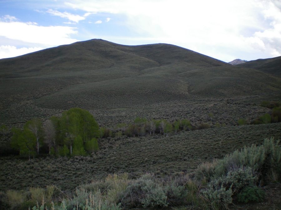
The west face of Dugout Hill as viewed from Navarre Creek. Livingston Douglas Photo
West Face, Class 2
Access
Drive south on Fish Hatchery Road to a 4-way road junction near the Fish Hatchery. Please consult the north ridge route for Lehman Butte for specific driving directions to reach this junction. From the junction, head east on 4800N for 3.3 miles to a junction with [signed] BLM Road #143. Park at this junction or ¼ mile west of it at a gravel pit. Do NOT hike BLM Trail #143 which is located near the gravel pit. That is NOT the correct road/trail.
The Climb
Hike (or drive) up BLM Road #143 about 1-1/2 miles as it climbs a ridge on the west side of Navarre Creek. This is all BLM land. Navarre Creek Road is a private road on private land. BLM Road #143 drops slightly to reach a saddle at 6,480 feet. Leave the road here and bushwhack southeast down a gully to reach Navarre Creek. Stay on the right/south side of the gully and use cattle trails there to expedite your descent. You must descend about 150 vertical feet to reach Navarre Creek. Cross the creek and scramble up the sagebrush-choked west face. The sagebrush gets easier about halfway up the face.
High up, the sage thins even more and you have 2 sections of easy broken scree/gravel to cross. The summit of Dugout Hill has a rocky west face but is flat and gentle on top. There is a modest cairn on top. The summit offers a splendid view of the braided Big Lost River above the upper end of the Mackay Reservoir. When you descend the west face, the gully you descended from BLM Road #143 has yellowish dirt/gravel on its right/north side. Aim for the base of this gully as you approach Navarre Creek.
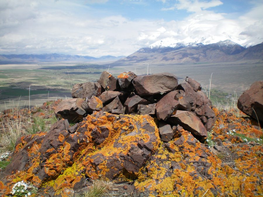
The summit cairn atop Dugout Hill, looking northward. Livingston Douglas Photo
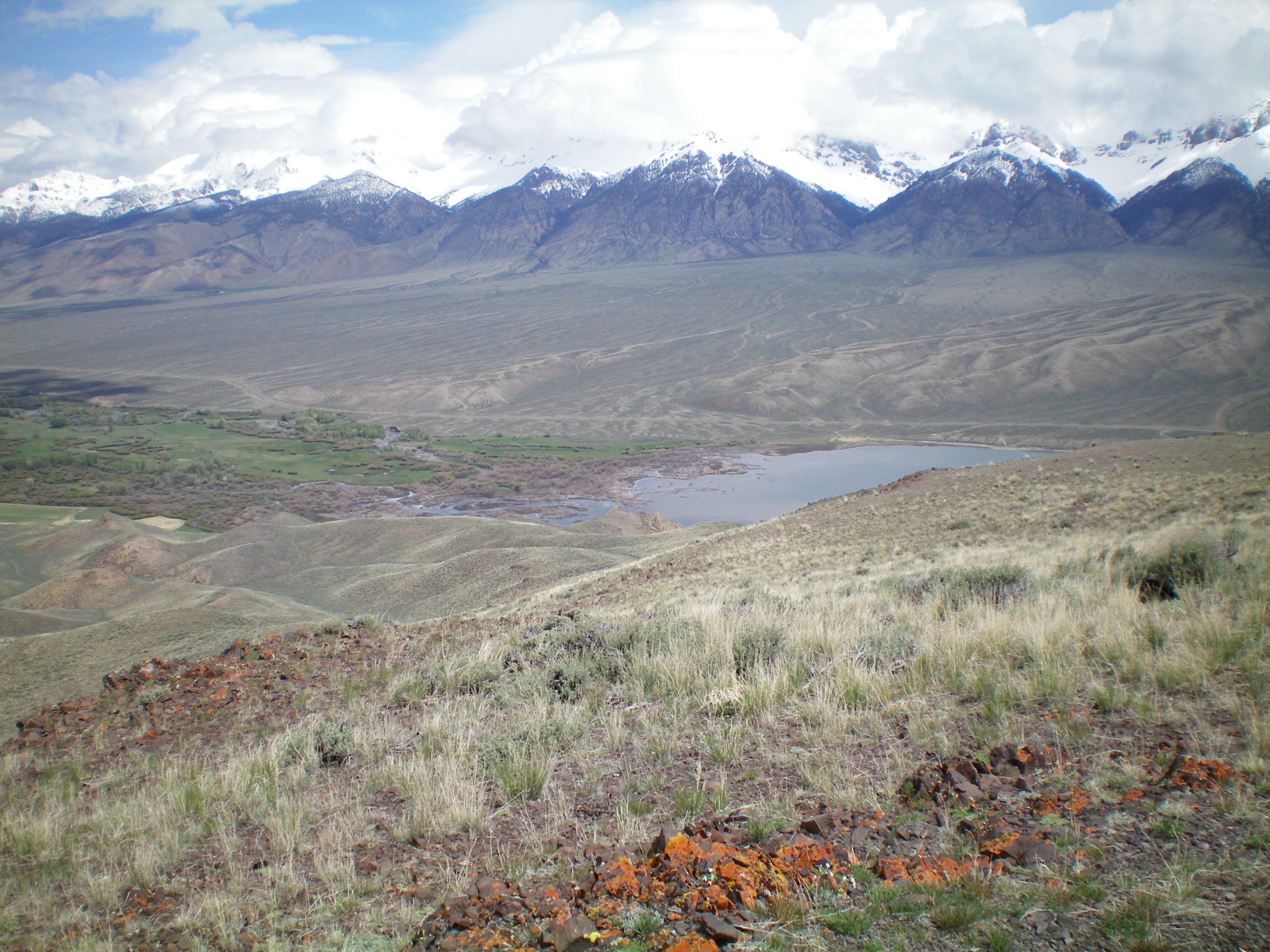
The north end of Mackay Reservoir with the braided Big Lost River feeding into it, as viewed from the summit of Dugout Hill. The beautiful, snow-capped Lost River Range is in the background. Livingston Douglas Photo
Additional Resources
Regions: EASTERN IDAHO->White Knob Mountains
Mountain Range: White Knob Mountains
Longitude: -113.72779 Latitude: 43.94479