Elevation: 6,558 ft
Prominence: 218
This peak is not in the book. Published January 2023
Eagle Point is a beautiful hump that sits north of Shirley Creek and east of the vast, open Raft River Valley. This is the second leg of a 2-peak journey that includes Peak 6711 and Eagle Point (6,558 feet). This adventure covers 4.5 miles with 1,800 feet of elevation gain round trip. USGS North Heglar Canyon
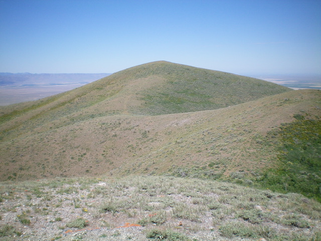
Beautiful, pyramidal Eagle Point as viewed from the east. Livingston Douglas Photo
Access
Same as for Peak 6711. This is the final leg of a 2-peak journey.
East Ridge, Class 2
The Climb
From the 6,340-foot connecting saddle with Peak 6711, follow the weaving, undulating ridge crest southwest then west to the summit of Eagle Point. The ridge terrain is short grass/scrub with a broken rock base. Much of it is on an old 2-track road. The summit hump is small and bare. It lacked a cairn so I built a small one. The view of the Raft River Valley to the west is simply stunning.
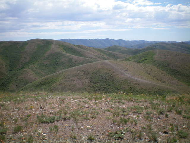
The final approach to the summit of Eagle Point on the east ridge. Livingston Douglas Photo
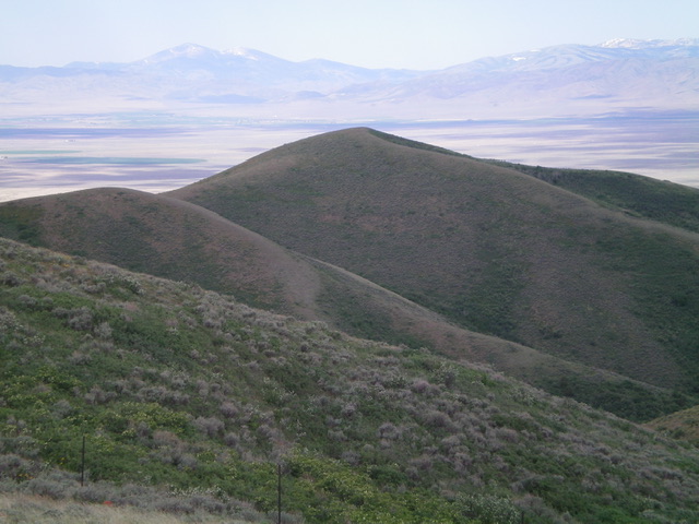
The undulating connecting ridge between Eagle Point and Peak 6711 (the ridge left of center) as viewed from the summit of Eagle Point. Livingston Douglas Photo
The Descent, Class 2
Return down the east ridge to the connecting saddle with Peak 6711. Re-climb the southwest ridge of Peak 6711 up to a saddle just below the summit. Descend the east spur of Peak 6711 down to Pine Canyon and your parked vehicle.
Additional Resources
Regions: SOUTHERN IDAHO->Sublett Range
Mountain Range: Sublett Range
Longitude: -113.1219 Latitude: 42.4005