Elevation: 6,711 ft
Prominence: 531
This peak is not in the book. Published January 2023
Peak 6711 is located at the head of both Pine Canyon and Pole Canyon, deep in the Sublett Range. This is the first leg of a 2-peak journey that includes Peak 6711 and Eagle Point (6,558 feet). This adventure covers 4.5 miles with 1,800 feet of elevation gain round trip. USGS North Heglar Canyon
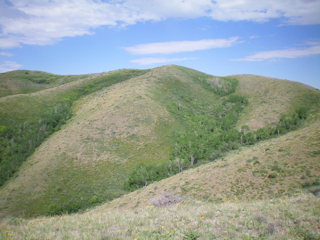
Peak 6711 (hump in dead center) as viewed from high on the east ridge. Livingston Douglas Photo
Access
From Exit 245 (Malta/Sublett) on I-84, drive southeast on Sublett Road. Continue on the road as it bends east then north and passes the west side of Sublett Reservoir. At 10.0 miles, reach a signed junction with Lake Fork Road/FSR-564 at the northwest end of the reservoir. Drive 6.9 miles north up Lake Fork Road to a signed junction with FSR-711. Turn left/west onto FSR-711 and drive west up the 2-track road as it follows the center of Pine Canyon. Just before entering the pine forest, you reach an unsigned junction. Go right onto FSR-712 to continue west up Pine Canyon. At 1.3 miles from Lake Fork Road, you reach a large downed tree that blocks the final 0.2 miles of the road. Park here (5,920 feet; GPS coordinates: 42⁰24’07”N, 113⁰05’38”W). FSR-712 goes farther up Pine Canyon than maps indicate.
East Ridge, Class 2
The Climb
From the parking pullout, hike 0.2 miles west up Pine Canyon Road to its end in a meadow at a fork in the canyon at 6,000 feet. From the meadow, scramble northwest up a steep, open scrub slope (thick at first) to reach the crest of the east ridge of Peak 6711. Follow the weaving, undulating ridge west then northwest to Point 6635 on short, easy scrub. From Point 6635, follow a 2-track road west then left/south to the summit hump of Peak 6711. There is a small cairn on top.
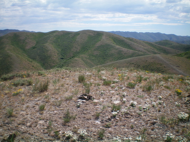
Peak 6711 (ridgeline in center) as viewed from Eagle Point to its west. Livingston Douglas Photo
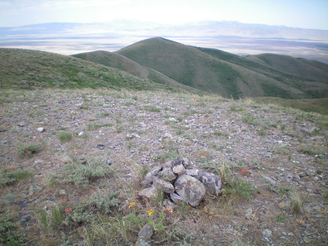
The summit of Peak 6711 with Eagle Point in the distance (dead center). Livingston Douglas Photo
Southwest Ridge, Class 2
The Descent
From the summit, follow the ridge crest south then southwest to the 6,340-foot connecting saddle with Eagle Point. The ridge terrain is short scrub/grass with a broken rock base and is often helped by an old 2-track road. This concludes the first leg of today’s 2-peak journey. Eagle Point is up next.
South Ridge/East Spur, Class 2
The Descent
From the summit, descend south to a minor saddle then follow a ridgeline southeast down to Point 6469. Initially, the ridge terrain is thick sagebrush and other brush but soon gives way to fence row and a 2-track road alongside it. From Point 6469, descend the east spur in thick brush and veg down into the pine forest. Bushwhack through the brush and deadfall in the pine forest to reach the meadow at the top of FSR-712. Follow FSR-712 for 0.2 miles east down to your parked vehicle.
Additional Resources
Regions: SOUTHERN IDAHO->Sublett Range
Mountain Range: Sublett Range
Longitude: -113.1062 Latitude: 42.40519