Elevation: 9,434 ft
Prominence: 454
This peak is not in the book. Published November 2021
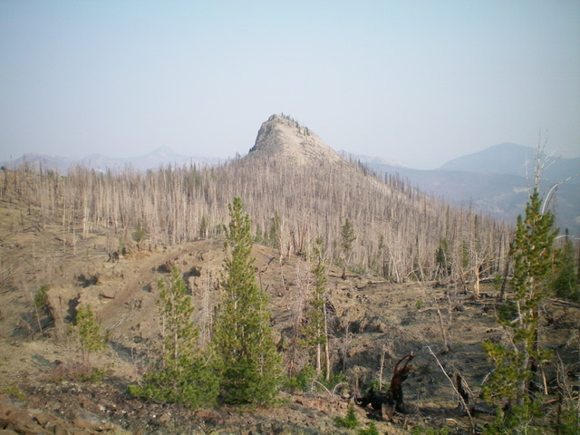
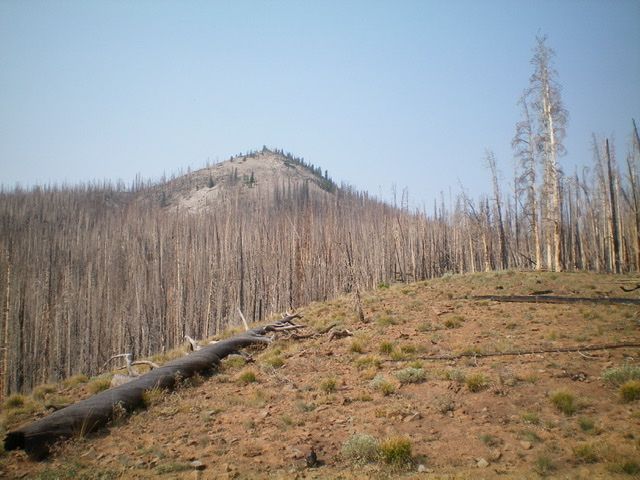
Eleven Miles Benchmark towers over Yankee Fork, McKay Creek, and Elevenmile Creek in the Eastern Salmon River Mountains. This entire area is a major burn area with lots of loose terrain and standing snags, so be advised. USGS Elevenmile Creek
Eleven Miles Benchmark and its southeast ridge (left skyline). This was my ascent route. Livingston Douglas Photo
Access
Same as for Peak 8805. This is the first leg of a 2-peak adventure that includes Peak 8805 and Eleven Miles Benchmark (9,434 feet). This journey covers 8.0 miles with 2,625 feet of elevation gain round trip.
Southeast Ridge, Class 2
The Climb
From the 8,460-foot connecting saddle with Peak 8805, bushwhack south up a rounded ridge through more snags, scrub, and scree. Follow the ridge south then southwest up a steeper section with some rocky ridge outcrops to reach a minor ridge point at a ridge corner. Head west through dense snags to reach the boulder-top of Point 9242. This ridge point is about midway between Peak 8805 and Eleven Miles Benchmark.
From Point 9242, head northwest and drop 60 vertical feet to a saddle then scramble 15 feet uphill to reach rocky, open Point 9200+. Descend west then northwest to reach a hidden but easy, open saddle of short grass and scattered snags. Scramble northwest then west through thicker snags to reach a rocky ridge point (mostly a pile of scree) at 9,293 feet. You can also skirt the right/east side of this point. Descend 110 vertical feet to another saddle. Skirt the right/east side of another ridge hump to reach the final saddle. This saddle is a mess of snags and downed, burnt timber. It sits at the base of the rocky summit hump that is Eleven Miles Benchmark.
From the saddle, climb north-northwest up a talus/scree slope (or rounded ridge) to reach the small, rocky summit. There is a modest cairn on top with a USGS benchmark hidden in it. I uncovered the benchmark and rebuilt the cairn. There is triangulation wiring and a triangulation post laying on the ground nearby.
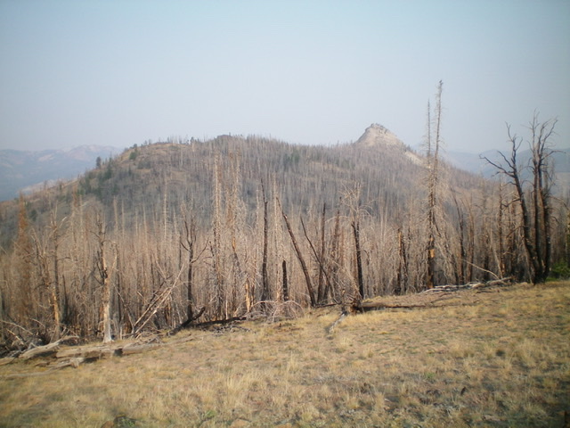
The rocky summit hump of Eleven Miles Benchmark as viewed from the south. Livingston Douglas Photo
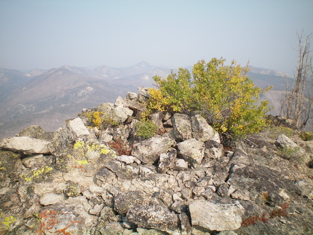
The summit of Eleven Miles Benchmark. Livingston Douglas Photo
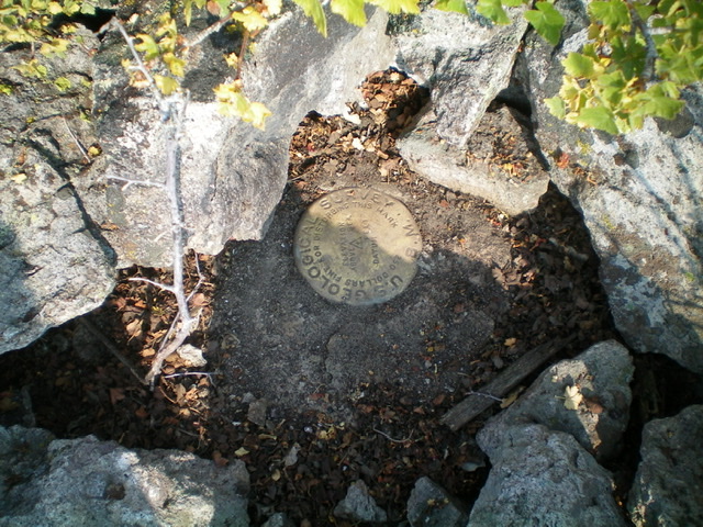
The USGS benchmark atop Eleven Miles Benchmark. Livingston Douglas Photo
Northeast Shoulder, Class 2
The Descent
From the summit, notice that the northeast shoulder is not as thickly forested as the USGS topo map indicates. And, of course, it is entirely burned. There are two bare, open, flattish areas on the ridge to target. Descend a steep face of loose embedded boulders/talus, gravel/sand, and loose scree to reach the top of the forested shoulder. The northeast shoulder is rounded but is not difficult to follow. Bushwhack northeast down the shoulder through pine snags and find your way to the open areas of short scrub and gravel that were visible from the summit.
Upon reaching about 8,500 feet, look for a side shoulder heading diagonally right/east down to the creek drainage. Descend that side shoulder down to the wet creek drainage. Follow the tedious terrain northeast then north alongside the stream in thick/tall veg, downed snags/logs, and difficult/angled side-hilling to get back to McKay Creek and the Custer Motorway just below the trailhead for FST-4151. Scramble up a steep slope to reach the Custer Motorway and hike briefly east up it to reach the trailhead and your parked vehicle in the nearby pullout.
Eleven Miles Benchmark as viewed from the northeast shoulder (my descent route.) Livingston Douglas Photo
Additional Resources
Regions: Eastern Salmon River Mountains->Salmon River Mountains->Southeast Corner Peaks->WESTERN IDAHO
Mountain Range: Eastern Salmon River Mountains
Longitude: -114.55479 Latitude: 44.46339