Elevation: 7,933 ft
Prominence: 838
This peak is not in the book. The elevation is based on LiDAR measurements. The map measurement is 7925. I added photos and my GPS attack to this page. Large sections of the peak burned in the 2024 Wapati Fire. Burned timber has been cleared from the access road but a windstorm could lead to snags falling across the road. Despite the fire the meadows have recovered and there are sections of forest along the route that did not burn. Updated June 2025
Elk Mountain sits above both Elk Meadow to its west and Stanley Lake to its south. It has a narrow, rocky Forest Service road that leads up to its south end near Point 7674. Surprisingly, Elk Mountain has no trail (official or unofficial) leading to its summit. A somewhat miserable bushwhack is required to bag this summit. USGS Elk Meadow
Elk Mountain in the foreground viewed from the north and the Basin Butte Road. The large meadow just right of center in this photo is where the summit is located.
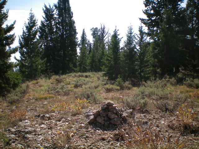
The semi-open summit of Elk Mountain with my unofficial summit cairn. Livingston Douglas Photo
Access
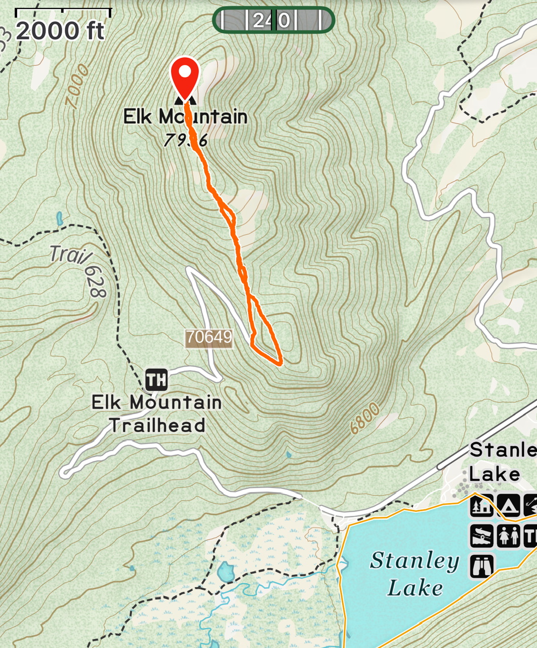
From ID-21 northwest of Stanley, turn left/west onto [signed] Stanley Lake Road/FSR-455. Reset your odometer here. At 3.6 miles, reach the end of FSR-455 at the top of a large trailhead parking lot (for FST-640 and FST-641). An unsigned dirt road (FSR-649) continues straight here. At 5.2 miles, reach the turnoff for the Elk Mountain trailhead. Ignore it. It doesn’t lead up to Elk Mountain and only skirts its west side briefly then drops into Elk Meadow. Continue up FSR-649. At 5.5 miles, the road turns sharply left. At 6.0 miles, the road turns sharply right at an unsigned junction with a 2-track road heading left. Park here (7,360 feet). GPS coordinates: 44⁰15’39”N, 115⁰04’36”W.While FSR-649 is not overly steep, it does require good tires for all of the embedded rock.
West Face/South Ridge, Class 2
The Climb
From the sharp bend in the road, bushwhack northeast up a steep-ish slope of thick sagebrush and other veg with scattered pines. Higher up, bend right-ish/east to intercept the broad, rounded, almost-imperceptible south ridge of Elk Mountain. The south ridge is a mess of thick sagebrush and some blowdown (a miserable combination). Follow the ridge north to the minor hump that is the [lower] south summit (Point 7880). Drop 35 feet gradually in thick brush with too much deadfall and scattered pines to reach a minor saddle. From the saddle, bushwhack through more of the same mess to reach the semi-open summit of Elk Mountain.
The summit is semi-forested and offers no views. I built a cairn in an open area that I believe is the high point. However, I later found that there was already a summit cairn about 100 feet away on the edge of the forest. Both points measure of equal height. On the descent, return to Point 7880. Descend for a few minutes through the thick sagebrush on the ridge then leave the ridge and bushwhack south, staying just right/west of a dry drainage. This line was more forested and had less sagebrush than the ascent line. It returns to the bend in the road.
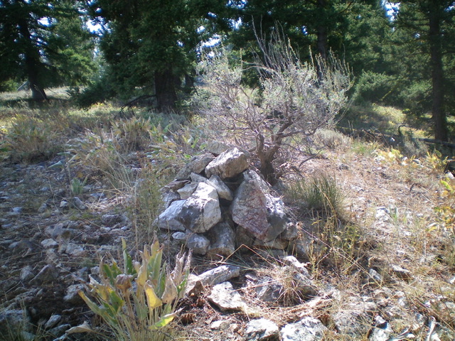
The official summit cairn atop Elk Mountain. My unofficial cairn is nearby in more open terrain. Livingston Douglas Photo
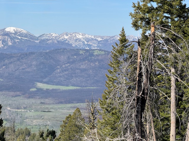
My GPS track measures 2.3 miles with 363 feet of elevation gain round trip. This is a beautiful hike with excellent views of the Sawtooth crest.
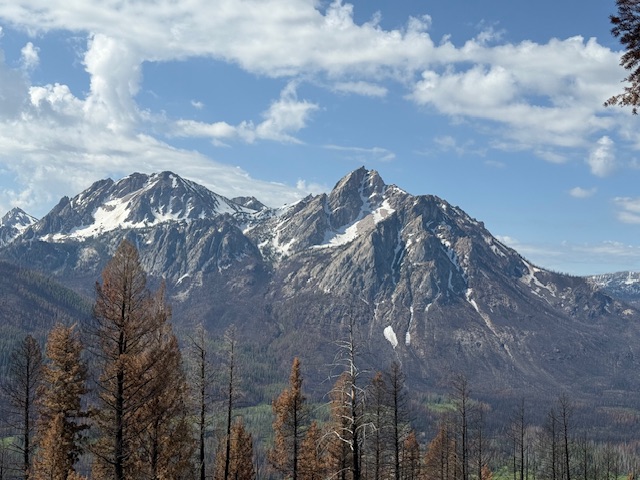
Mystery Mountain (left) and Mcgown from Elk Mountain.
Additional Resources
Mountain Range: Sawtooth Range
Year Climbed: 2025
Longitude: -115.07679 Latitude: 44.27011