Elevation: 8,583 ft
Prominence: 283
Climbing and access information for this peak is on Page 113 of the book. John Platt’s calls this peak “The Spear” in his trip report (linked below) because of the granite spear on the summit and because he believes that the more impressive Peak 8737 should be called Fitsum Peak. Published January 2020
Fitsum Peak is located just east of the main Lick Creek Range Crest on a ridgeline that separates Fitsum Creek and North Fitsum Creek. This peak is located in truly remote, difficult country. USGS Fitsum Peak
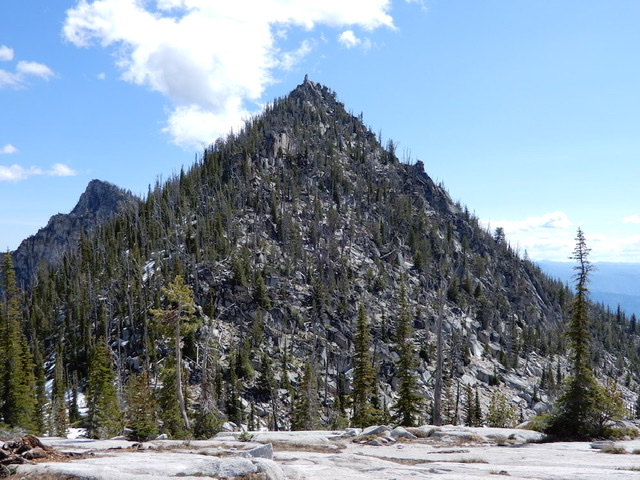
Fitsum Peak as viewed from the west. Note John Platt calls this peak “The Spear.” John Platt Photo
Access
East Fork Lake Fork trailhead [(B)(3)(b) on Page 136]. Hike up the East Fork Lake Fork Trail to the junction with the North Fitsum Summit Trail in 6.9 miles with 1,200 feet of elevation gain [(B)(3)(b.1) on Page 136]. The North Fitsum Summit Trail no longer shows up on USGS topographic map. Nevertheless, the trail is signed and is sort of there. See John’s trip report for a brief description of the trail conditions in 2019. The route to Mount Horrendous begins on North Fitsum Summit.
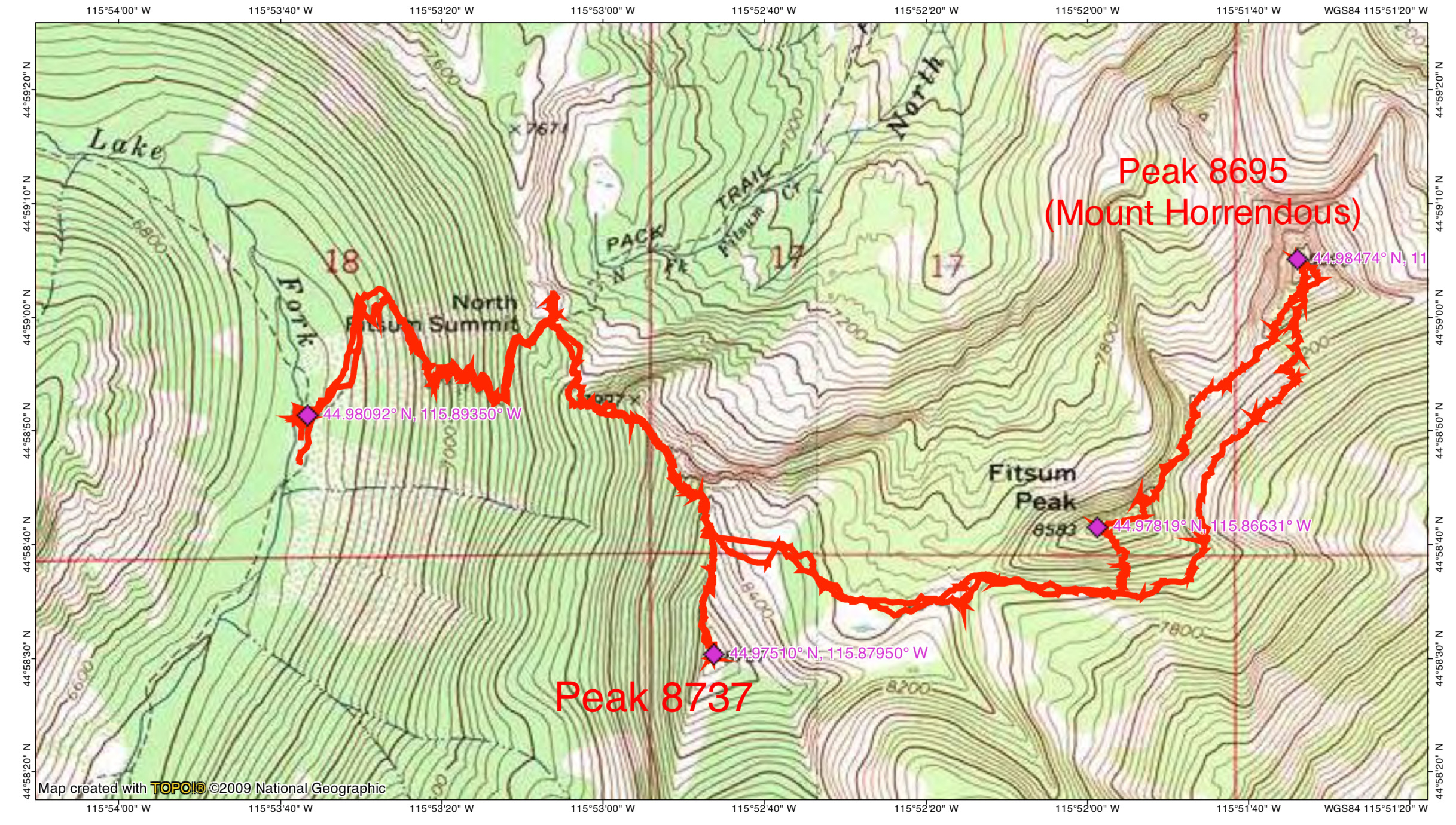
John Platt’s GPS track for climbing Mount Horrendous, Fitsum Peak and Peak 8737. This route covered 2 days, 8.7 miles and 4,000 feet of elevation gain.
South Face, Class 3; Class 4-5 Summit Spear
The route leaves North Fitsum Summit, climbs up the North Ridge of Peak 8737, drops down into the upper reaches of the North Fork Fitsum Creek drainage and then climbs to the saddle on Fitsum Peak’s West Ridge. From this saddle, traverse across the peak’s South Slopes until you find a line that leads up to the summit.
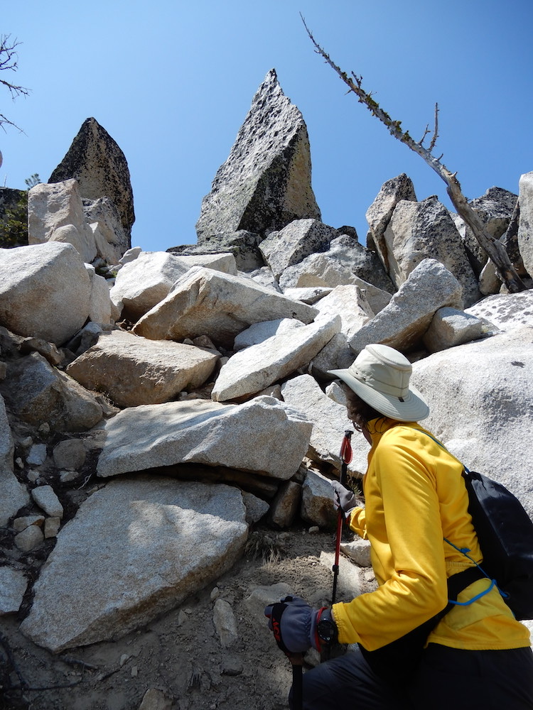
The last section of the climb showing “The Spear.” John relates: “There’s the summit block of the appropriately named Spear. We went up and investigated it. The landing is nasty, but it appeared to me that after a 5.9 mantle, the remaining moves would be at most 5.5. Throw a sling over the top and lower off. All on a generous layer of black lichen.” John Platt Photo
Additional Resources
Mountain Range: Western Salmon River Mountains
Longitude: -115.86649 Latitude: 44.97819