Elevation: 9,180 ft
Prominence: 520
This peak is not in the book. Livingston Douglas created the original page for Fox Peak. I added a new route. Updated July 2023
Fox Peak is located at the head of the Fox Creek and Rooks Creek drainages in the Smoky Mountains. It is most easily reached from East Fork Baker Creek Road, a narrow but drivable road from Baker Creek Road. Its northwest ridge is the shortest route to the summit. USGS Boyle Mountain
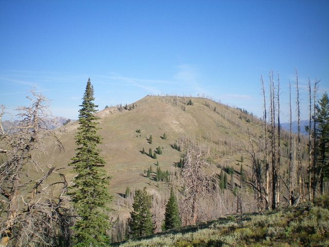
Fox Peak as viewed from the southeast. Livingston Douglas Photo
Access
Same as for Peak 8900. This is the second leg of a 2-peak adventure that includes Peak 8900 and Fox Peak.
Southeast Shoulder, Class 2
The Climb
From the 8,620-foot connecting saddle with Peak 8900, hike north briefly on FST-938 then leave the trail to scramble northwest up a steep-ish shoulder of grass/scrub and a few scattered pines/snags to reach the cairned south summit of Fox Peak, a rocky outcrop. The south summit is the official summit. However, the north summit (which is a gentle hump) measures of equal height.
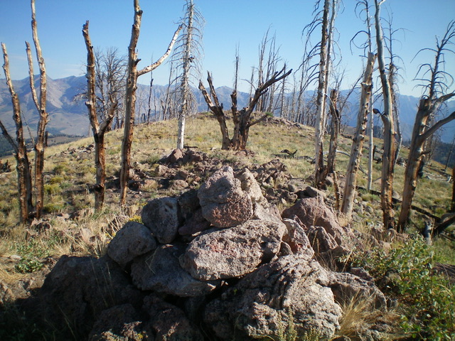
The summit of Fox Peak. Livingston Douglas Photo
Northeast Ridge, Class 2
The Descent
From the south summit, descend north to a minor saddle then up over the north summit hump. From the north summit, follow the ridge north-northeast then northeast then north-northeast to return to the parking pullout for the trailhead for FST-938. The northeast ridge is a mix of grass/scrub and bothersome, downed, charred logs and snags. There is a surprising amount of deadfall for such a thinly-forested ridge.
Northwest Ridge and South Ridge by Tom Lopez
Access
Primary access is from ID-75 and Baker Creek Road/ FSR-162 [(A)(4) on Page 213]. Turn onto Baker Creek Road and follow it south for just over 3.0 miles. Just pass the East Fork Campground, turn onto FSR-168/East Fork Baker Creek Road. Follow FSR-168 to the northwest side of Fox Peak and the trailhead for the signed FST-143 which is 11.8 miles from ID-75. This road was in good condition in 2023 and suitable for high clearance vehicles.
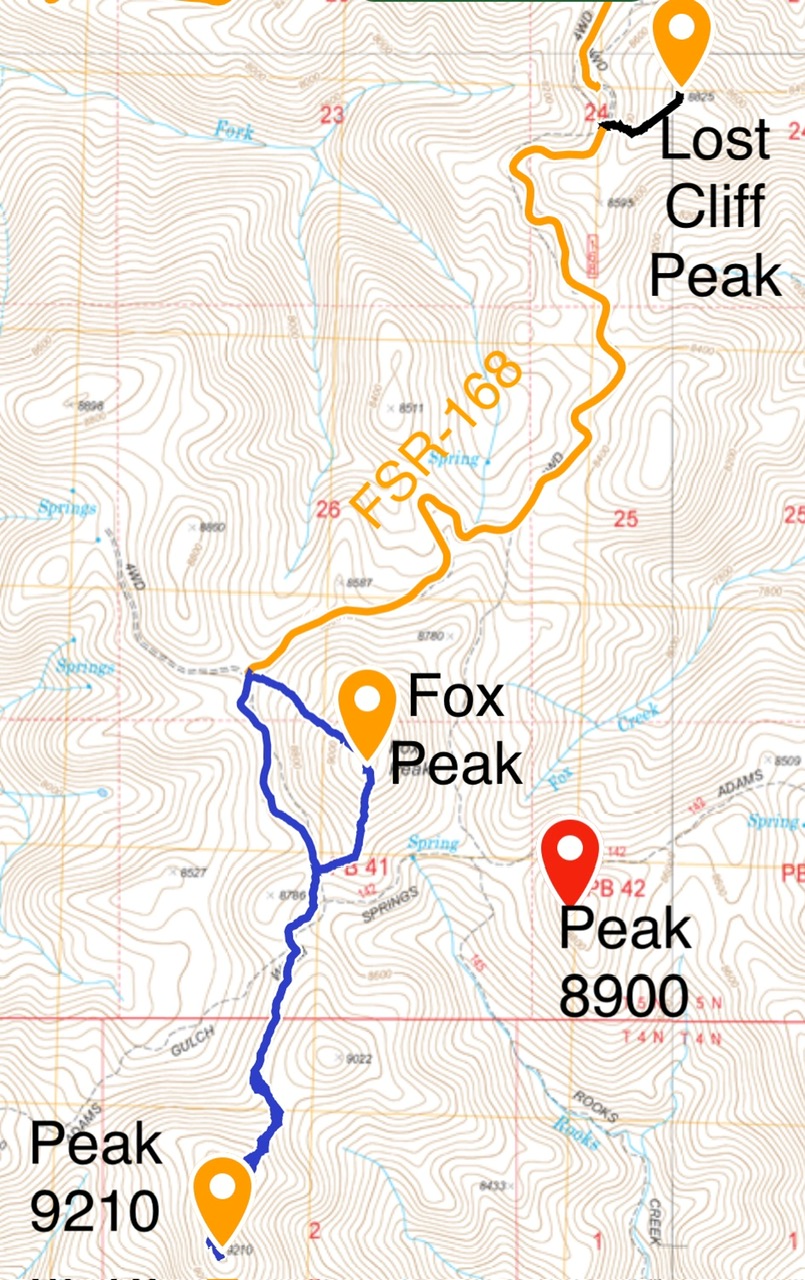
My GPS tracks for Fox Peak and Peak 9210.
Northwest Ridge, Class 2
From the trailhead climb southeast up the directly up the grassy northwest ridge to summit skirting snags and downfall. This climb gains 520 feet in 0.4 miles.
South Ridge, Class 2
The south ridge is characterized by open, grassy slopes and quickly leads down to a saddle crossed by FST-143. From this point you can take FST-143 back to your starting point or continue on to Peak 9210.
Additional Resources
Regions: Smoky Mountains->WESTERN IDAHO
Mountain Range: Smoky Mountains
Year Climbed: 2023
Longitude: -114.51469 Latitude: 43.72509