Elevation: 7,278 ft
Prominence: 658
This peak is not in the book. Published January 2023
Freedom Benchmark is located north of Fish Creek Reservoir and towers over Bradsfield Canyon. This is the first leg of a 2-peak adventure that includes Freedom Benchmark and its neighbor to the southwest, Peak 7151. USGS Trail Creek
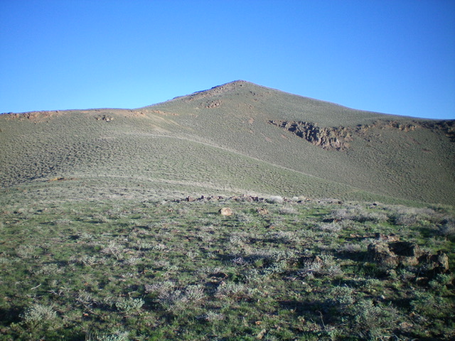
Freedom Benchmark as viewed from high on the southeast ridge. Livingston Douglas Photo
Access
Fish Creek Road is located along US-20 several miles east of Carey, Idaho and 25.1 miles east of the junction of US-20 and ID-75. Turn left/north onto [signed] Fish Creek Road and drive 5.4 miles north to a signed junction for the “boat ramp.” The “boat ramp” road is actually the West Fork Fish Creek Road. Turn left/north onto West Fork Fish Creek Road and drive 5.5 miles north to a meadow (and large parking area) at an unsigned 3-way road junction. Park here (5,550 feet).
This area is a patchwork of private and public land. I encountered no fencing or signage to prohibit entry to either of these peaks. Much of this area has “Access Yes” signs, so the landowners seem to be friendly to outdoorsmen. From the 3-way junction, a rugged 4WD road (the middle road) heads northwest to reach the 6,380-foot connecting saddle between Freedom Benchmark and Peak 7151. You can shorten this hike by driving up that 1.8-mile stretch of roadway if you wish.
Southeast Ridge, Class 2
The Climb
From the 3-way junction, hike northwest 0.7 miles up the middle road (unnamed) to 5,850 feet. There is a split in the canyon here and the road bends left-ish/northwest. Leave the road here and scramble right/east up onto the nearby toe of the southeast ridge. Scramble north-northeast up the gentle ridge, using an old 2-track road to expedite the ascent. The ridge crest is easy, open scrub. When the 2-track road dies out, continue up the ridge northwest then north to the summit. The terrain is thicker sagebrush higher up and then becomes a mix of talus and sagebrush as you approach the summit. The summit of Freedom Benchmark has a decent cairn and a USGS benchmark nearby.
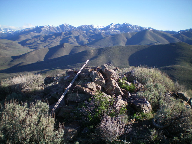
Looking north from the summit of Freedom Benchmark. Livingston Douglas Photo
Southwest Face, Class 2
The Descent
From the summit, descend west then southwest on a steep mix of loose talus and sagebrush to reach a flatter area of pure sagebrush, aiming to reach a wonderful, grassy saddle at 6,380 feet. I saw two herds of elk in this saddle on my descent. This completes the first leg of today’s journey. Peak 7151 is up next.
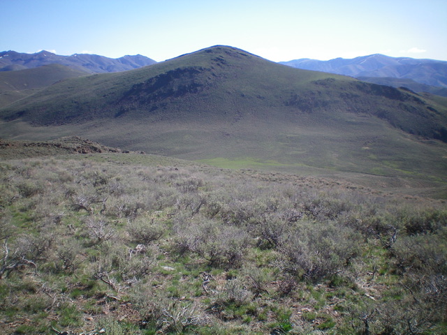
The southwest side of Freedom Benchmark with a beautiful meadow at its base. This was my descent route. Livingston Douglas Photo
Additional Resources
Regions: EASTERN IDAHO->Pioneer Mountains
Mountain Range: Pioneer Mountains
Longitude: -123.85579 Latitude: 43.50519