Elevation: 7,151 ft
Prominence: 771
This peak is not in the book. Published January 2023
Peak 7151 is located north of Fish Creek Reservoir and sits at the head of Scribbin Draw. This is the second leg of a 2-peak adventure that includes Freedom Benchmark (7,278 feet) and Peak 7151. Peak 7151 is most easily climbed from a 4WD road at the base of its northeast shoulder. USGS Lake Hills
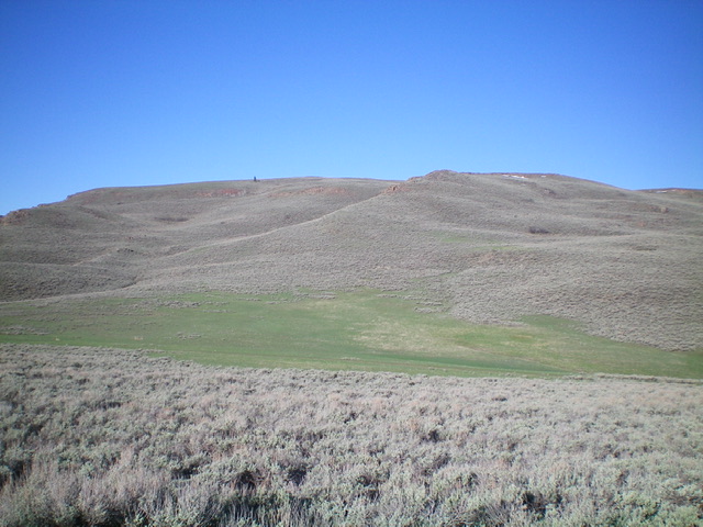
Peak 7151 (dead-center) as viewed from the east-northeast. Livingston Douglas Photo
Access
Same as for Freedom Benchmark. A 4WD road leads up to the connecting saddle between Freedom Benchmark and Peak 7151, shortening a climb of the northeast shoulder of Peak 7151 considerably. It is a narrow, rocky road and is best suited for ATVs.
Northeast Shoulder, Class 2
The Climb
From the 6,380-foot connecting saddle with Freedom Benchmark, bushwhack west-southwest up through thick sagebrush toward a prominent rocky outcrop. Skirt the left side of this outcrop and continue west up a sagebrush shoulder. Higher up, angle left/southwest to reach the summit ridge at the [lower] east summit. From the east summit, follow the grassy remnants of an old 2-track road west, dropping 40 feet to a saddle. Continue west up the 2-track road then leave the road to bushwhack left/south up onto the summit ridge. Work through more sagebrush (and some talus) to reach the cairned summit of Peak 7151.
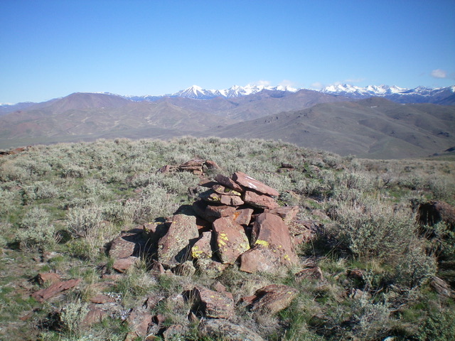
The summit cairn atop Peak 7151, looking north. Livingston Douglas Photo
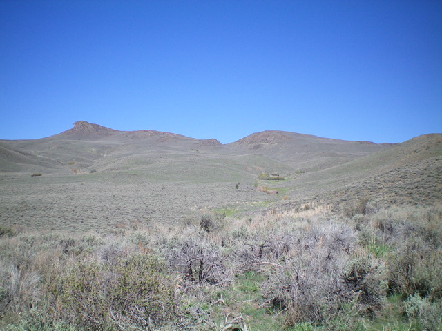
Peak 7151 as viewed from the east. The summit is just right of center. Livingston Douglas Photo
East Face, Class 2
The Descent
From the summit, return to the [lower] east summit. Follow the grassy remnants of an old 2-track road east briefly until it ends. Descend a ridge (of sorts) southeast then bend left/northeast to reach a minor shoulder. Descend this shoulder to a gully that has green areas free of sagebrush. Follow this dry gully east then southeast down to where it reaches the 4WD “middle road.” Hike 1.5 miles southeast down the old road to the 3-way junction where you are parked. This descent is mostly sagebrush weaving with some sections of steep, loose talus.
Additional Resources
Regions: EASTERN IDAHO->Pioneer Mountains
Mountain Range: Pioneer Mountains
Longitude: -113.88578 Latitude: 43.4967