Elevation: 6,100 ft
Prominence: 320
This peak is not in the book. Updated April 2020
Gallagher Peak is located in the southwest corner of the Salmon River Mountains, just north of the South Fork Payette River. John Platt first pointed this peak out to me, noting it was a great early season destination. He said this peak, which he has climbed three times, is a “Hidden in a seldom-visited area, Gallagher Peak becomes an instant favorite.” John’s trip report is linked below. Like almost all peaks rising directly out of the South Fork Payette River canyon, reaching this summit involves a steep, sustained hike. USGS Grimes Pass
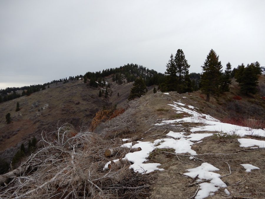
Gallagher Peak. John Platt Photo
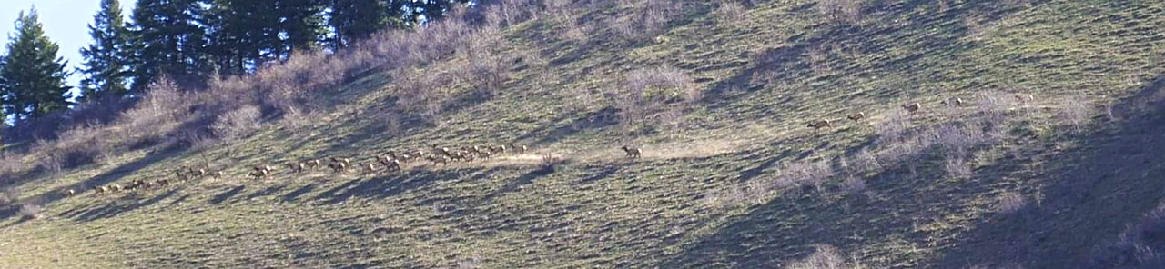
This area is prime elk habitat. On my climb we spotted over 200 elk running toward the saddle. Gilbert Gallegos Photo
Access
There are two viable access points. The Southeast Ridge Road set out below uses the Little Gallagher Creek drainage access. The alternative route is to climb the peak from the Deadwood River/Scott Mountain Road. Routes from this drainage are are undoubtedly feasible and would benefit from a higher starting elevation.
Little Gallagher Creek Access: This drainage is accessed from the Banks/Lowman Highway [(D)(1) on Page 140]. The drainage is 22.0 miles east of Banks and 12.0 miles east of Lowman. There is parking just off the highway. A 4WD road climbs up the drainage a short distance.
Deadwood River/Scott Mountain Road Access: This road is accessed from the Banks/Lowman Highway [(D)(1.2) on Page 140]. Turn north onto this road and follow it for 2.2 miles. Just after the road makes a major right turn park at just under 4,000 feet of elevation. The saddle described in the Southeast Ridge Route can be accessed from this point as can the peak’s east ridge.
Southeast Ridge, Class 2
This route climbs the Little Gallagher Creek drainage northeast to a 4,800 foot saddle on the peak’s Southeast Ridge. Some Forest Service maps show a trail up this drainage. There is no maintained trail. There are numerous elk carved game trails that can be followed steeply to the saddle in 1.6 miles with 1,245 feet of gain. Likewise, game trails can be followed for much of the climb from the saddle up the ridge to the summit. The ridge climbs steeply through varied terrain which includes grassy slopes, small, lush pine forest, brushy spots and a few granite outcrops. From the saddle it is another 1.6 miles with 1,250 of elevation gain to reach the summit.
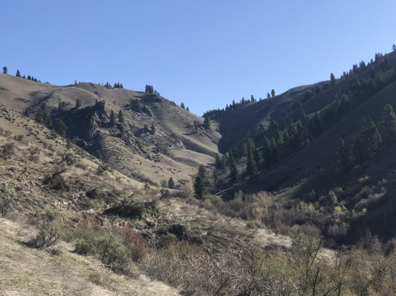
Looking up the Little Gallagher Creek drainage to the saddle. The game trails stay on the left hand, grassy slopes.

Halfway to the saddle.
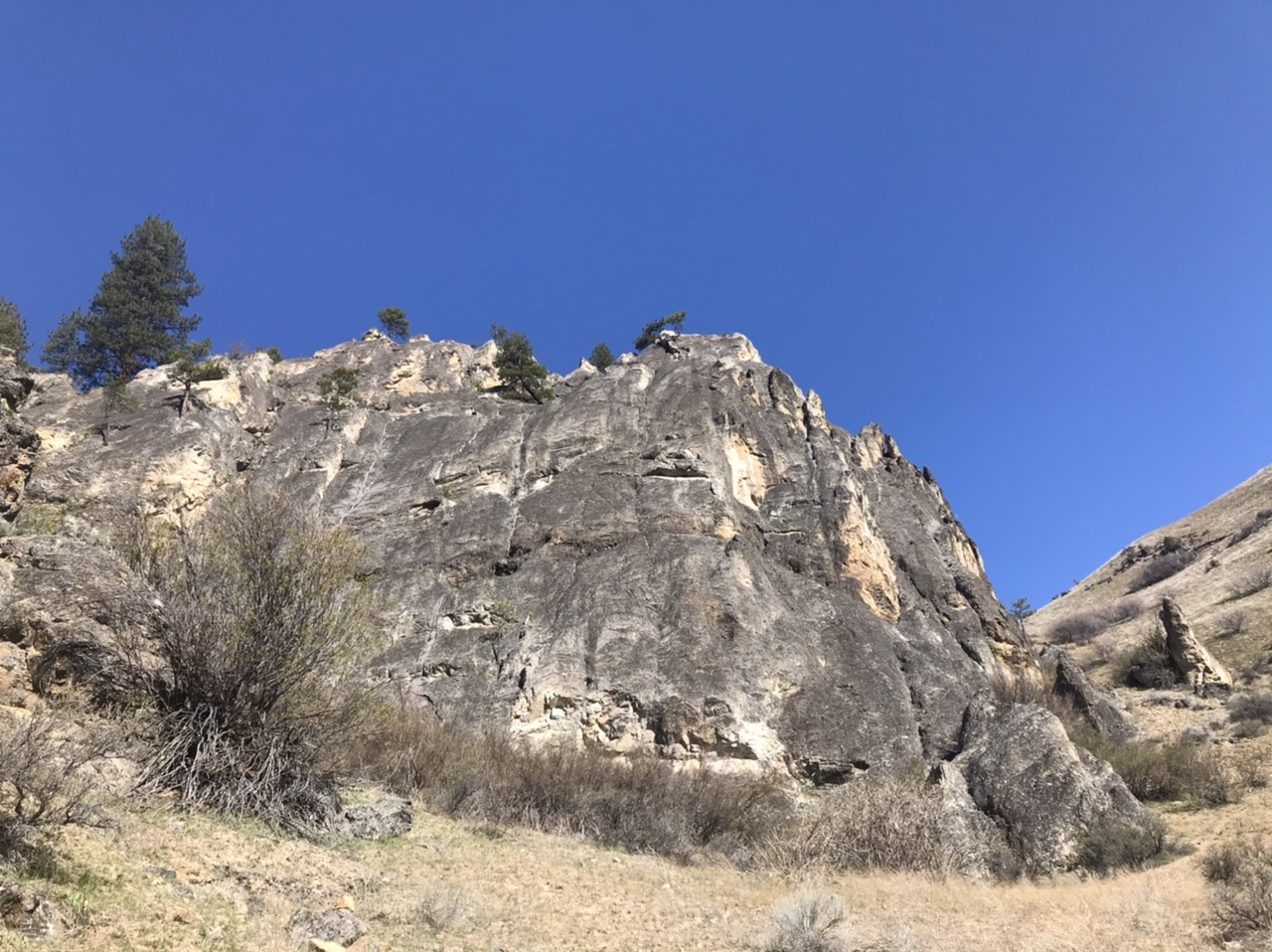
A granite wall on the north side of the drainage.
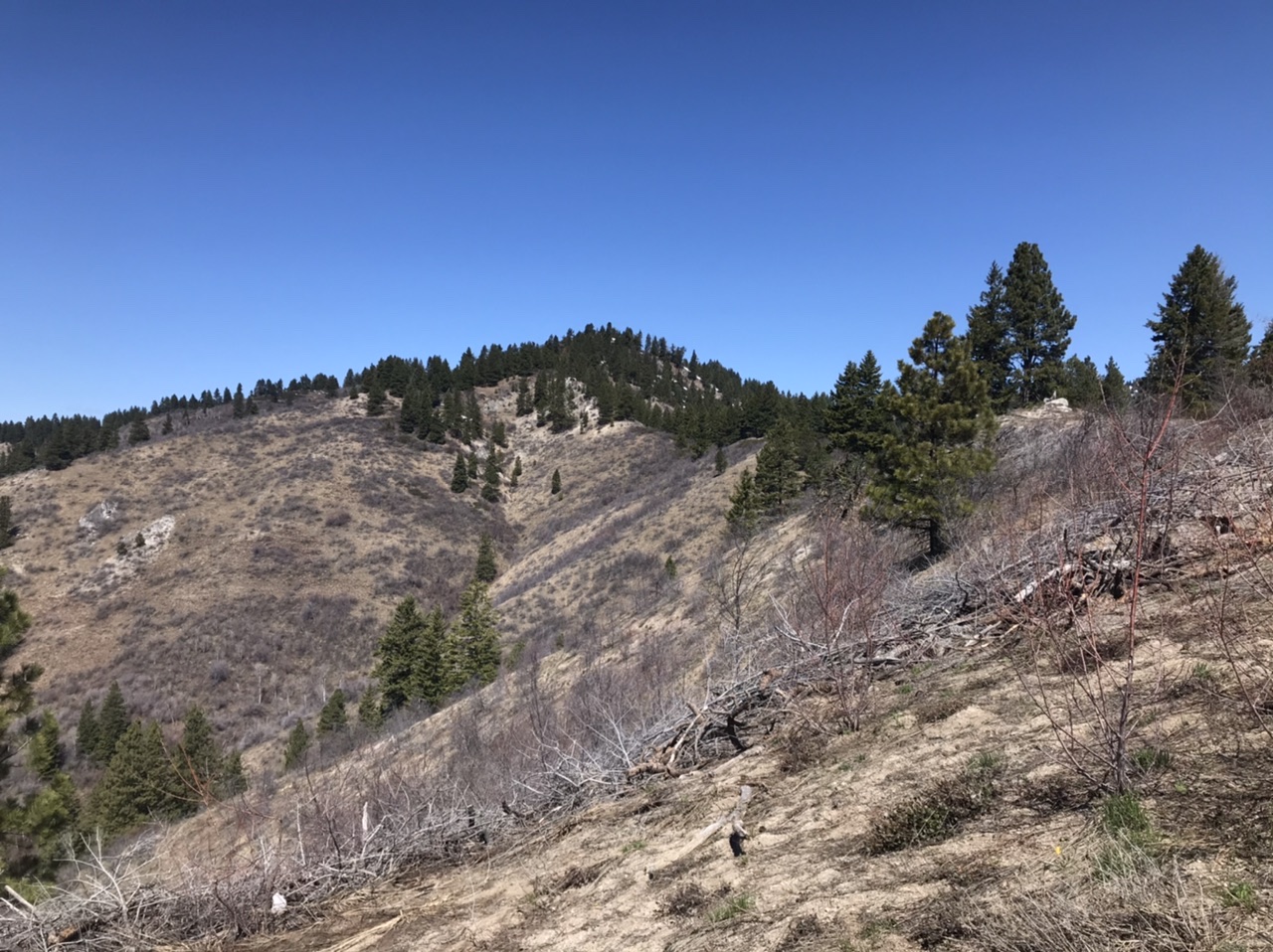
The first view of the summit from the Southeast Ridge.
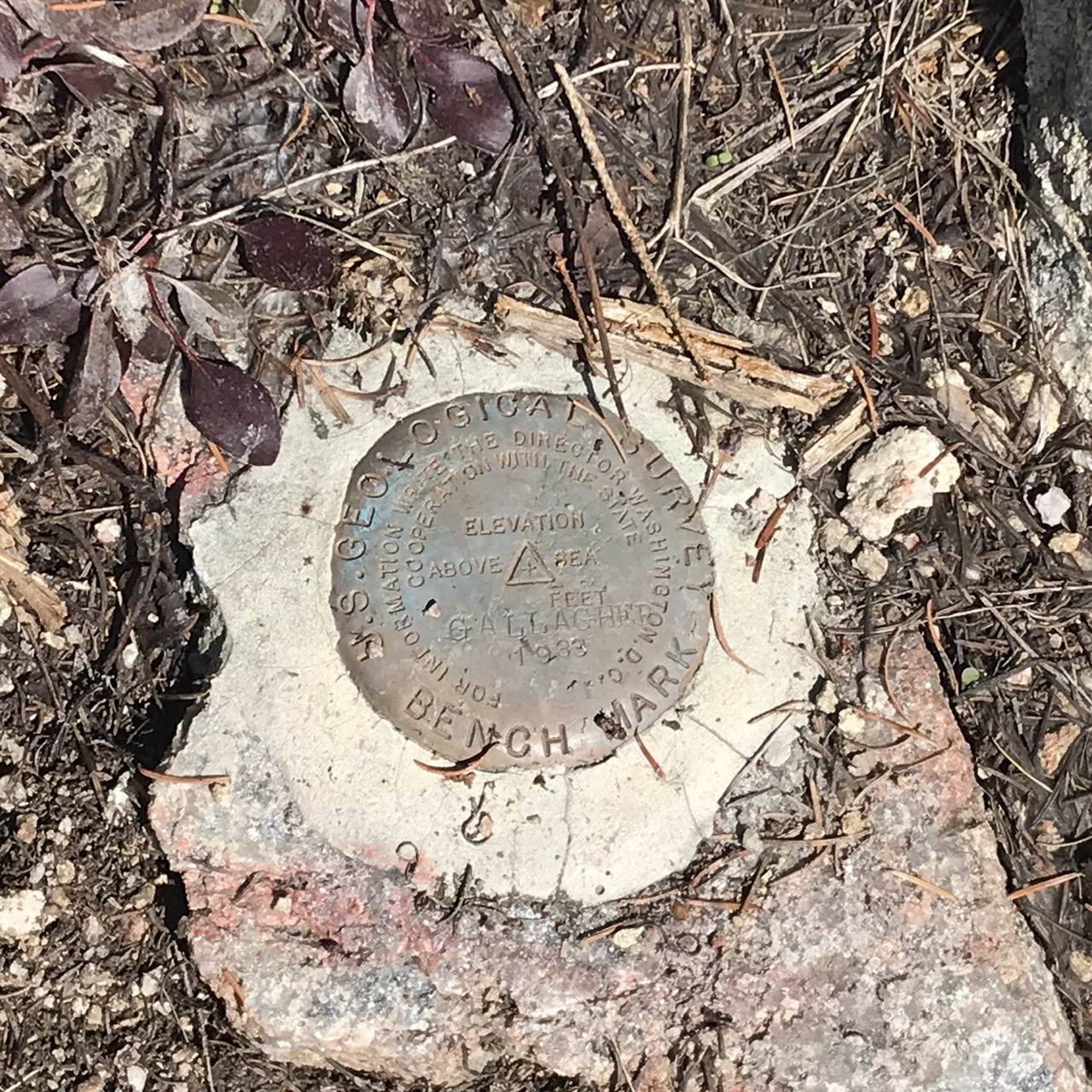
The summit benchmark.
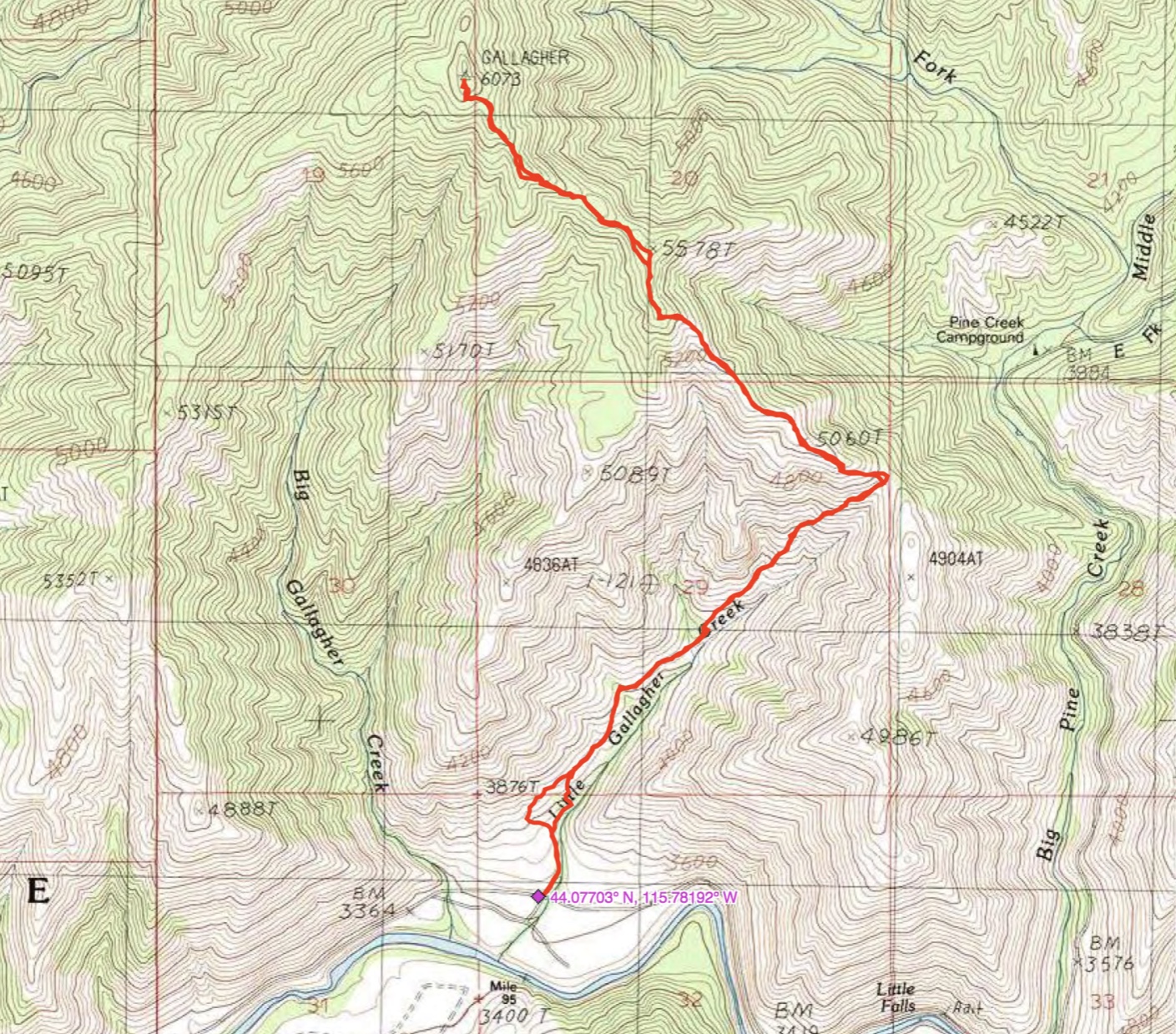
John Platt’s GPS track.
Additional Resources
Mountain Range: Western Salmon River Mountains
Year Climbed: 2020
Longitude: -115.78539 Latitude: 44.10619