Elevation: 5,988 ft
Prominence: 568
This peak is not in the book. Note: Jason traverses to this summit from Cavaney Hill. If you are only interested in this peak, you can use his descent route. Jason points out: “Our total stats were 6.23 miles with almost 4,000 feet of elevation gain. You could also easily add Lead Mountain to this route in a long day.” Published October 2021
Gerdie Hill is located on the east side of Silver City Road, north of the main Owyhee Crest. USGS Silver City
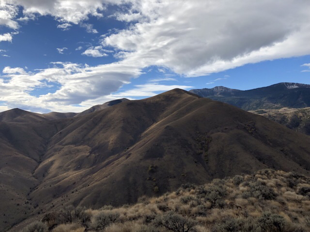
Gerdie Hill as viewed from Cavaney Hill. Jason Floyd Photo
Access
From ID-78, go east on Silver City Road [(A)(2) on Page 346] and park at the large parking area on the west side of the road at 10.8 miles. This is in Half Moon Gulch. There are no good parking spots for this peak on Silver City Road south of Half Moon Gulch.
Cavaney Hill/Gerdie Hill Traverse, Class 2
From the top of Cavaney Hill, we followed the south ridge down and chose a path to the drainage between Cavaney Hill and Gerdie Hill. From the bottom, we crossed the small creek which could be higher in the Spring and chose a route up what I would call a north spur of the west ridge. This spur hit the west ridge higher up and we followed it to the summit.
Descent, Class 2
On the way down, we chose to descend the west ridge to the drainage below. We then and climbed up over a small pass south of Cavaney Hill and then descended to the drainage below as shown on the map. This drainage was followed down to Silver City Road. From this point, it was 0.75 miles back to our parking spot.
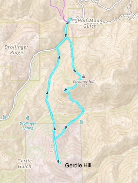
The GPS track for Cavaney Hill and Gerdie Hill
Additional Resources
Regions: Owyhee Mountains->Silver City Range->SOUTHERN IDAHO
Mountain Range: Owyhee Mountains
Longitude: -116.63769 Latitude: 43.02909