Elevation: 10,256 ft
Prominence: 596
Climbing and access information for this peak is on Page 255 of the book. Livingston Douglas pioneered the two new routes set out below. Updated November 2020
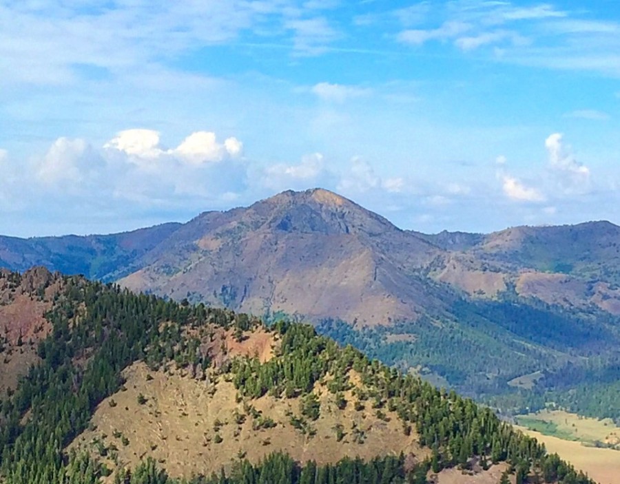
Glide Mountain is located at the southwest corner of Copper Basin. It is a rugged peak when viewed from the Star Hope Campground. USGS Star Hope Mine
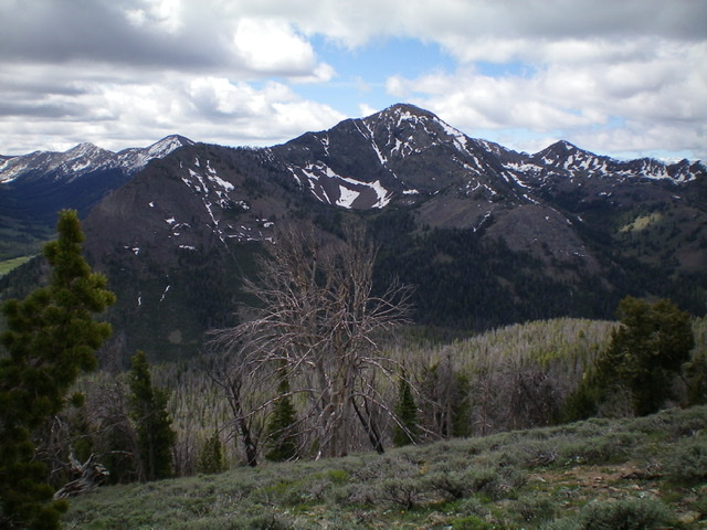
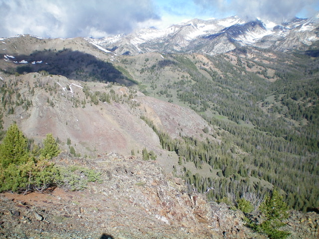
Glide Mountain as viewed from Roundup Peak
New Routes by Livingston Douglas
Access
The Bear Canyon trailhead is located at the back end of the Star Hope Campground. There is a pullout for three vehicles. Park here(7,955 feet). The Bear Canyon Trail/FST-062 begins about 50 yards from the parking pullout in an open meadow to the left/south, where it is signed. Star Hope Campground is located 8.0 miles southwest of the Copper Basin Guard Station on the Copper Basin Loop Road/FSR-138 and 9.1 miles south of the north end of the Copper Basin Loop Road/FSR-138 where it has a junction with Copper Basin Road/FSR-135. Carry a hiking pole with you for these two routes as you will need it to complete the log crossing of Bear Canyon Creek and the stream crossing higher up.
Northeast Spur/North Ridge, Class 3
The Climb
Hike about 0.6 miles up the Bear Canyon Trail to a log crossing of Bear Canyon Creek. Cross to the south side of Bear Creek and continue another 0.2 miles on Bear Canyon Trail and cross a small feeder stream that comes down from the north face of Glide Mountain directly to the left/south. Leave the trail and bushwhack south then southwest up the right/west side of the small stream. There is a lot of blowdown early in this bushwhack. A shoulder soon emerges with easier going than the blowdown-clogged stream drainage.
Climb the shoulder south then southwest to tree line then scramble west-southwest up a section of rocky terrain to reach the north ridge. Stay close to the ridge crest and skirt numerous patches of hard snow to advance up the rocky, narrow ridge. Higher up, move right/west across a short patch of hard snow (I used an ice ax and kicked steps here) to reach snow-free terrain to the right/west of the ridge crest. Scramble up through loose scree to regain the ridge crest. Follow the ridge south in open, somewhat-steep, loose scree to reach the summit. There is a modest cairn on top. Cloud cover limited my views.
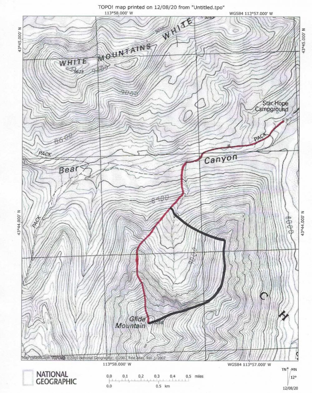
The ascent route (red) and descent route (black) for Glide Mountain. Livingston Douglas Map
Northeast Ridge/Northwest Spur, Class 3
The Descent
Having had to wrestle with many snow patches on the ascent of the northeast spur/north ridge, I decided to descend the [mostly snow-free] northeast ridge/northwest spur. Choose your poison because the upper northeast ridge is pretty rough. From the summit, follow the narrow, rocky, steep ridge line northeast for several hundred feet down to a flat, forested section of the ridge at 9,640 feet. This upper section is a narrow, choppy mess of rocky blocks/towers. It was a struggle to keep it at Class 3. Descend/downclimb some minor chutes/gullies on the right/south side of the ridge to pass a few of the towers. Loose scree on the ledges and in the chutes/gullies make this a rather challenging affair.
Breathe a sigh of relief once you reach the flat, forested ridge section. Follow the [still narrow] ridge northeast then north with some minor ups and downs to a critical juncture at 9,540 feet. There is a small, minor ridge point here (shown on the USGS topo map). Descend left/northwest from here down the northwest spur, which is a rounded, somewhat ill-defined shoulder, to get back to the critical stream drainage and the original ascent shoulder of the Northeast Spur/North Ridge ascent route. Follow that shoulder northeast then north to get back to the Bear Canyon Trail at the crossing of the small stream. Follow the Bear Canyon Trail back to the trailhead and the Star Hope Campground.
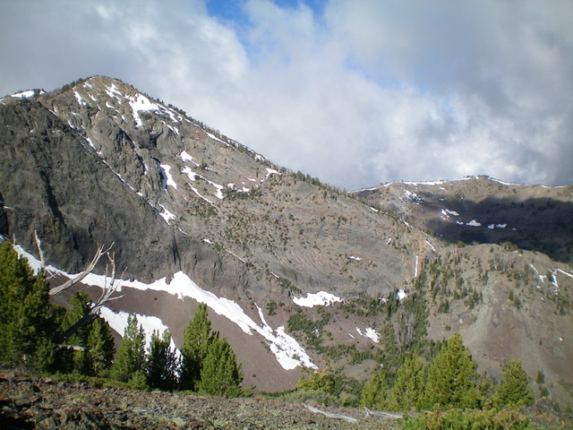
The rugged north aspects of Glide Mountain, as viewed from the White Mountains ridge crest. Livingston Douglas Photo
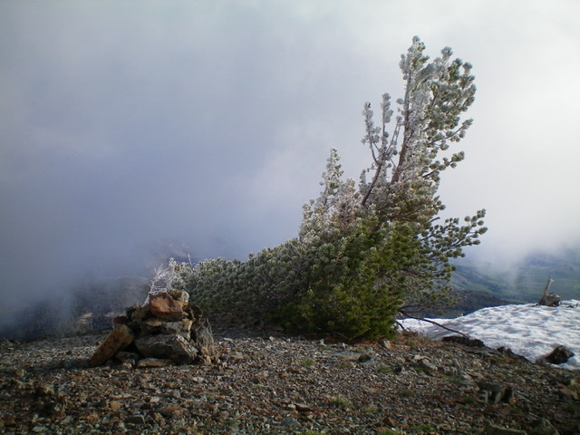
The summit cairn and hoar-frosted pines atop Glide Mountain on a chilly, blustery morning. Livingston Douglas Photo
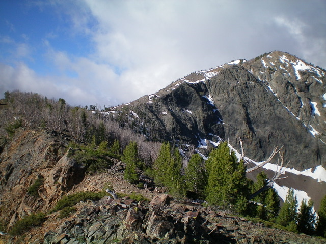
The rugged northeast ridge of Glide Mountain, from the lower left to the upper right hump in the photo. Livingston Douglas Photo
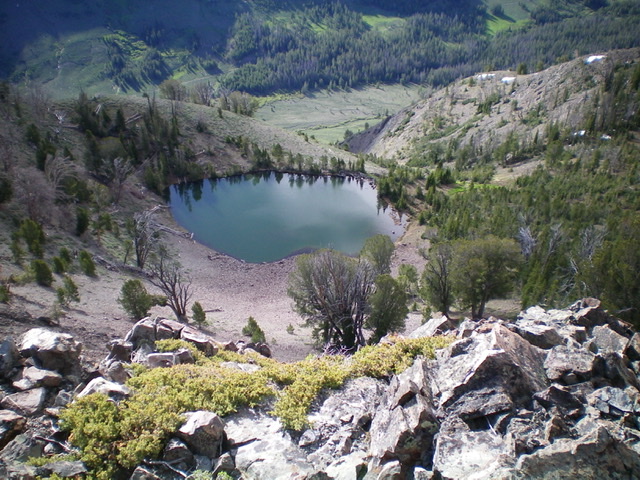
A beautiful tarn below the northeast ridge of Glide Mountain. Livingston Douglas Photo
The rugged upper northeast ridge (center and right of center) and the gentle forested section of the northeast ridge (left of center) as viewed from the juncture at the top of the northwest shoulder. The summit is at far right. Livingston Douglas Photo
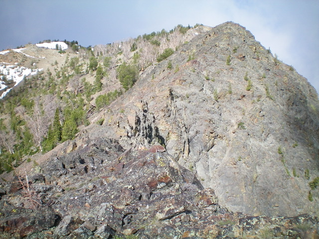
The steep, upper two-thirds of the north ridge/northeast spur route on Glide Mountain (diagonally lower right to upper left in the photo). Livingston Douglas Photo
The lower section of the northeast spur (mid-ground) of Glide Mountain (diagonally upper left to lower right). Livingston Douglas Photo
Additional Resources
Regions: EASTERN IDAHO->Pioneer Mountains
Mountain Range: Pioneer Mountains
First Ascent Information:
- Other First Ascent: Northeast Spur/North Ridge
- Year: 2020
- Season: Summer
- Party: Livingston Douglas
- Other First Ascent: Northeast Ridge/Northwest Spur (DESCENT)
- Year: 2020
- Season: Summer
- Party: Livingston Douglas
Longitude: -113.96259 Latitude: 43.72429