Elevation: 8,166 ft
Prominence: 946
This peak is not in the book. Published May 2019
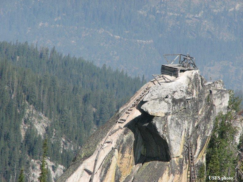
Gold Fork Rock is a former fire lookout site. This impressive peak is located WNW of Warm Lake and north of the Warm Lake Highway. The Forest Service built a series of stairs/ladders to the summit and placed an alidade on top sometime between 1918 and 1920. Living quarters were constructed one and a half miles to the west in a meadow.
By 1933, the Forest Service concluded that the site was not practical, abandoned the lookout, and built a new lookout on the next peak to the west (Gold Fork Lookout on the map). The summit lookout structure and stairway are, for the most part, gone. Without the ladders that lead to the summit, reaching the top requires technical climbing of unknown difficulty. USGS Gold Fork Rock
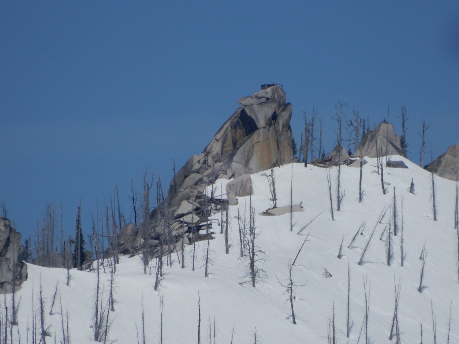
Gold Fork Rock as viewed from the air. USFS Photo
John Platt’s trip report on his journey to the base of the rock is linked below. The report contains additional photos.
Access
Two access options are available. FS-402 was used by Platt and company to reach the trailhead for FST-4113. From this trailhead, they hiked roughly 6.2 miles to reach the peak. Midway they crossed FS-497, a 4WD road that leads to the site of the former Gold Fork Lookout. At this point, the trail designation changes to FST-4115. Until I can visit the area or secure better directions, you are on your own for the FS-402 access route.
FS-497 is accessed from the Warm Lake Highway. From ID-55, follow the Warm Lake Highway east for roughly 12.0 miles to the junction with FS-497 (4WD required). Turn left onto FS-497 and drive 5.4 miles to the [unsigned] trailhead for FST-4115. FST-4115 heads east and then north to Gold Fork Rock. The trail starts out as an old road but quickly deteriorates. It is closed to motorized vehicles. It is 2.0 miles from the trailhead to Gold Fork Rock and 1.0 miles to the Gold Fork Lookout.
Looking north at the stairs. The ladder is on the right. John Platt Photo
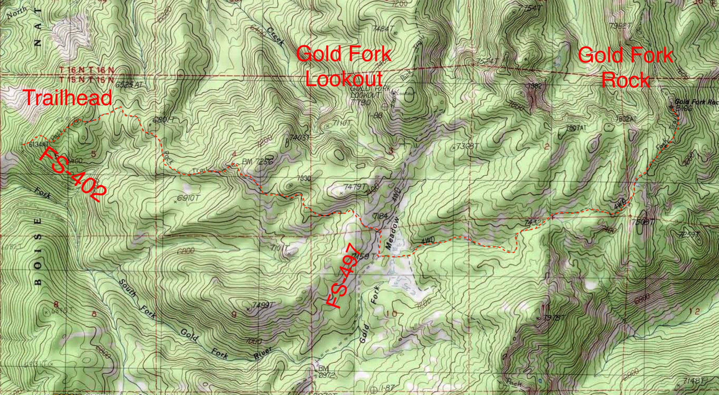
John Platt’s GPS track approaches the peak from FS-402.
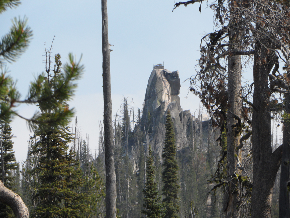
Gold Fork Rock as viewed from Peak 7081. John Platt Photo
Additional Resources
Mountain Range: Western Salmon River Mountains
Longitude: -115.79949 Latitude: 44.67001