Elevation: 7,222 ft
Prominence: 122
This peak is not in the book. Published November 2019
Grand View Peak is a point on the long northern extension of Buckskin Ridge. Buckskin Ridge is, in turn, an extension of the long, dominant north-south ridge that splits the South Hills—Deadline Ridge. Grand View Peak has a tall cairn and a USGS benchmark on its summit. It is guarded on all sides by a patch of thick, almost-impenetrable aspen/pine forest. The easiest ascent route is from the south via Buckskin Road (FSR-617), which passes Mountain View Peak on the way, with a final short ride/hike up FSR-618 to near the summit. USGS Grand View Peak
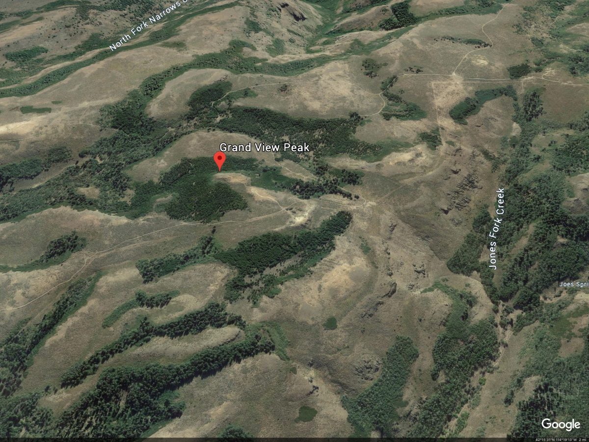
Google Earth Image
North Shoulder/East Face, Class 2
Access
This route is a ridge traverse from Wooden Shoe Butte and, consequently, begins on FSR-617 at the base of the southwest face of Wooden Shoe. Please consult the Steer Basin Route for Wooden Shoe Butte for details on the climb to FSR-617 from Steer Basin.
The Climb
From the base of the southwest ridge of Wooden Shoe Butte, follow rugged FSR-617 southward up the north shoulder of Grand View Peak until it crosses a gulch and reaches an unmarked road junction at a sharp left/west turn in the road. There is an old campsite here. The old spur road goes right/north here but it’s pretty much gone at this point. The USGS map still shows it in existence.
When hiking south up FSR-617 from Wooden Shoe Butte, get a good look at the east face of Grand View Peak. The peak has a tall cairn on top, which is visible from quite a distance. That visual will help you in bushwhacking through terrain that is oftentimes thick and offers minimal, if any, views when you leave the road.
From the old road junction/campsite, bushwhack north-northwest directly at the summit cairn of Grand View Peak. The first short section of forest isn’t too bad and goes quickly. The forest gives way to an open field of sagebrush. At this point, the terrain is open and you have an excellent visual of the final bushwhack to the summit. Crossing the sagebrush field is the easy part. The short, final steep strip of forest will test your willpower. The forest is an almost impenetrable combination of thick pines/aspens with willows mixed in to make your life miserable. It is particularly difficult when heading uphill.
After bashing your way through that mess, emerge at the base of the summit cliff band. Find an easy chute up onto the summit plateau. If your aim/line is good, you’ll pop out very close to the 6-foot tall summit cairn. The USGS benchmark is in a ground boulder about 20 feet to the southwest. The true summit high point is about 50 feet southwest of the tall cairn. There is no road to the top of this peak. No matter how you approach it, you must bash through some wicked trees/bushes/brush to stand on the easy terrain of the summit plateau (short scrub and ground talus).
If you climb Grand View Peak via FSR-617/FSR-618 (plus a short, punishing scramble up through the thick forest guarding the summit block), you can also climb Wooden Shoe Butte by returning to FSR-617 and following it to the base of the southwest face of Wooden Shoe Peak. The Grand View—Wooden Shoe traverse covers about two miles and is mostly a road hike.
Additional Resources
Regions: South Hills->SOUTHERN IDAHO
Mountain Range: South Hills
Longitude: -114.29979 Latitude: 42.25519